
ALASKA HIGHWAY
Dawson Creek, BC
to Delta, Alaska
YUKON
Map with
Hwy links
Kluane Lake area
Campbell Hwy
Dempster Hwy
Dawson City
Klondike Hwy-North
Klondike Hwy-South
Haines Road
Nahanni Range Rd
Silver Trail
South Canol Road
Top of the World
Hwy
BEARS
Grizzly
/ Black
WILDLIFE
BIRDS
NORTHERN LIGHTS
ALASKA
Taylor Hwy
Denali National Park
McCarthy Road
Richardson Hwy
and more
BRITISH COLUMBIA
Cassiar Highway
Liard Hot
Springs
PLAN YOUR TRIP
Planning Links
Campgrounds/POIs
YUKON sights
2020
2019
2017
2016
2015
2014
2013
2012
2011
RV BLOGS
Vancouver Island
to Yukon & Alaska
2010 Aug & Sept
2009 September
2008 June
2007 September
2001 December
2000 August
1998 December
1997 September
1993 September
Stewart to Boya Lake, BC on the Cassiar Highway
4 September 2007
Bear Glacier is between Meziadin Junction and Stewart BC. It was overcast on our way to Stewart and just as overcast on our way out. (see it better at Bear Glacier in 2008)
Bear Glacier
In September the fall colors are nice along the roadside.
Iskut 35km, Dease Lake 118km and the Alaska Highway 354km
This area on the north side of the Stikine River was being rebuilt after a washout in the spring.
We continued north with the goal of overnighting at Boya Lake provincial park.
Gnat Lake on the Cassiar Highway
We arrived at Boya Lake at dusk. The campground was busy and there were only a handful of waterfront sites from which to choose.
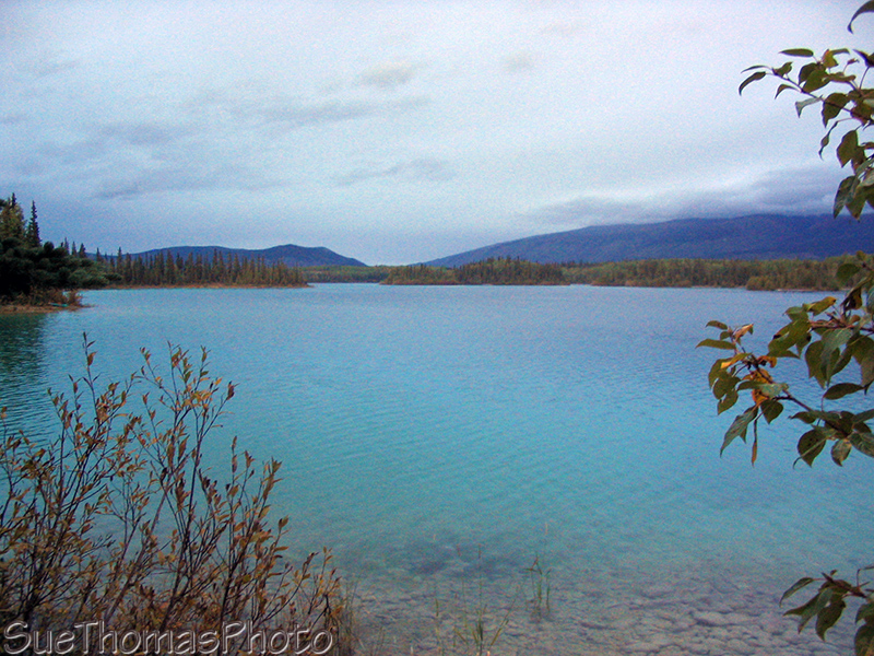
Boya Lake at dusk
To see more pictures of Boya Lake, which is one of our favourite
remote provincial parks in British Columbia, visit my page:
Boya Lake Provincial Park, British
Columbia