
ALASKA HIGHWAY
Dawson Creek, BC
to Delta, Alaska
YUKON
Map with
Hwy links
Kluane Lake area
Campbell Hwy
Dempster Hwy
Dawson City
Klondike Hwy-North
Klondike Hwy-South
Haines Road
Nahanni Range Rd
Silver Trail
South Canol Road
Top of the World
Hwy
BEARS
Grizzly
/ Black
WILDLIFE
BIRDS
NORTHERN LIGHTS
ALASKA
Taylor Hwy
Denali National Park
McCarthy Road
Richardson Hwy
and more
BRITISH COLUMBIA
Cassiar Highway
Liard Hot
Springs
PLAN YOUR TRIP
Planning Links
Campgrounds/POIs
YUKON sights
2020
2019
2017
2016
2015
2014
2013
2012
2011
RV BLOGS
Vancouver Island
to Yukon & Alaska
2010 Aug & Sept
2009 September
2008 June
2007 September
2001 December
2000 August
1998 December
1997 September
1993 September
South Canol Road to Quiet Lake. Yukon
The South Canol meanders 220 km (143 miles) from Johnsons Crossing (Alaska Hwy) to Ross River (Campbell Hwy). There are no services along the road.
There is one territorial
campground and several recreation sites.
For additional information about the South Canol Road (external links):
- South Canol Road (pdf), a brochure published by the Yukon government
- Topographic Map (pdf - 850Kb) posted on my site FYI
6 September 2007
After a quiet night at Squanga Lake Yukon gov't campground (km 1316 Alaska Hwy),
we backtracked 20 km to Johnsons Crossing (km 1296).
There is also a commercial campground at Johnsons Crossing.
I asked about conditions on the South Canol. Turns out a fellow buying coffee was responsible for road maintenance in the area and he told us there was some freshly graded areas, some recent repair of washouts and the road was in reasonable condition.
So we ventured north on the South Canol Road.

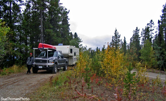
Northbound from the south end of the South Canol Road
at km 13
The road was good gravel and varied from one to two lanes wide. Initially the scenery was not overly spectacular; however the fall colors added emphasis to the sights.

Meadow and creek along South Canol Road at km 14

Northbound on the South Canol Road between the Alaska Highway and
Evelyn Creek
Some of the vistas were very nice. The landscape was expansive.

View from top of hill near km 29 on the South Canol Road, northbound
The bridges were single-lane. Generally the wood decks were in good condition.
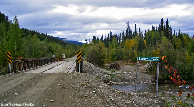
Evelyn Creek at km 43
The road was in better condition than we anticipated. The miles were rolling by quickly. There were few signs along the road and many places to pull over to relax.
Lunch stop at km 50, above the Nisutlin River
Quiet Lake Yukon Government campground (km 76) was quiet. The campsites did not have a view of the lake. We camped at the boat launch. During our two day stay, no one launched a boat.

Quiet Lake boat launch and campsite
Steve decided he wanted to soak in the water. We weren't sure how long it would be before the RV's fresh water tank could be refilled so he took advantage of the water in the lake.

Jake watching Steve take a dip in Quiet Lake
The campground seems to also get use in winter. The picnic shelter had a sign on it.

Sign on the picnic shelter at Quiet Lake campground