
ALASKA HIGHWAY
Dawson Creek, BC
to Delta, Alaska
YUKON
Map with
Hwy links
Kluane Lake area
Campbell Hwy
Dempster Hwy
Dawson City
Klondike Hwy-North
Klondike Hwy-South
Haines Road
Nahanni Range Rd
Silver Trail
South Canol Road
Top of the World
Hwy
BEARS
Grizzly
/ Black
WILDLIFE
BIRDS
NORTHERN LIGHTS
ALASKA
Taylor Hwy
Denali National Park
McCarthy Road
Richardson Hwy
and more
BRITISH COLUMBIA
Cassiar Highway
Liard Hot
Springs
PLAN YOUR TRIP
Planning Links
Campgrounds/POIs
YUKON sights
2020
2019
2017
2016
2015
2014
2013
2012
2011
RV BLOGS
Vancouver Island
to Yukon & Alaska
2010 Aug & Sept
2009 September
2008 June
2007 September
2001 December
2000 August
1998 December
1997 September
1993 September
Dezadeash Lake on the Haines Road to Kusawa Lake near the Alaska Highway in Yukon
25 June 2008
We woke to sunny blue skies once again! The wind continued; however that is normal for Dezadeash Lake.
Leaving the campground we turned north towards Kathleen Lake and Haines Junction with the intention of overnighting in Whitehorse. We stopped at the viewpoint overlooking Kathleen Lake and Kluane National Park to take some pictures.

Viewpoint overlooking Kathleen Lake, looking north
Kathleen Lake, looking west from the viewpoint on the Haines Hwy.
Next stop was Haines Junction. From Haines Junction we headed south towards Whitehorse. The highway is easy driving with nice scenery along the way.
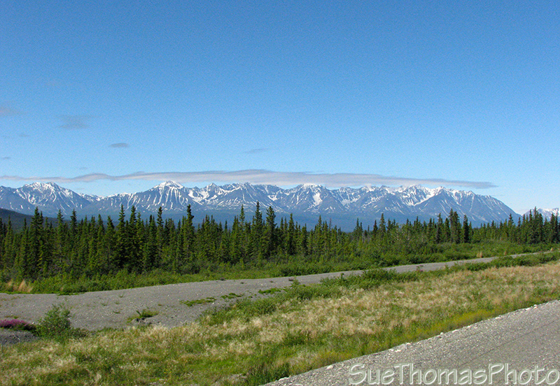
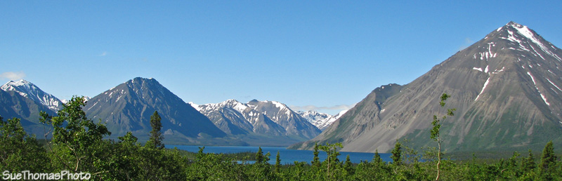
South of Haines Junction, looking west from the Alaska Highway
Nearing Whitehorse, I reviewed our overnight options. Neither of us were looking forward to a commercial campground in a city. Wolf Creek Yukon Government campground is just a bit south of Whitehorse and we have enjoyed staying there before. Then I noticed in the Milepost document that there were two other Yukon gov't campgrounds west of Whitehorse and down a gravel road.
Kusawa Lake Yukon Government Campground - turn off Alaska Hwy at km 1489
The Milepost indicated the 24 km (15 mile) access road to Kusawa Lake is narrow & winding and "not recommended for large RVs or trailers". However, the road was in good condition and we had no problems towing our 25' fifth wheel to Kusawa Lake.
Again, lakeside camping along a scenic lake! The sites were roomy and there were numerous other units our size there too.

Lakeside at Kusawa Lake

From the shore near our campsite, looking east
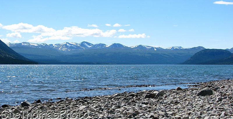
Looking west on Kusawa Lake -- does it get any more blue than this?
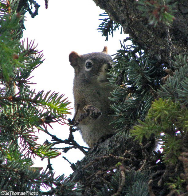
Local resident at Kusawa Lake
Even though a long weekend was soon the campground was very quiet. Again, no bugs, which was nice! The wind blew too much for canoeing but the hiking was fine. We had a nice campfire for the evening and were very happy campers there.