
ALASKA HIGHWAY
Dawson Creek, BC
to Delta, Alaska
YUKON
Map with
Hwy links
Kluane Lake area
Campbell Hwy
Dempster Hwy
Dawson City
Klondike Hwy-North
Klondike Hwy-South
Haines Road
Nahanni Range Rd
Silver Trail
South Canol Road
Top of the World
Hwy
BEARS
Grizzly
/ Black
WILDLIFE
BIRDS
NORTHERN LIGHTS
ALASKA
Taylor Hwy
Denali National Park
McCarthy Road
Richardson Hwy
and more
BRITISH COLUMBIA
Cassiar Highway
Liard Hot
Springs
PLAN YOUR TRIP
Planning Links
Campgrounds/POIs
YUKON sights
2020
2019
2017
2016
2015
2014
2013
2012
2011
RV BLOGS
Vancouver Island
to Yukon & Alaska
2010 Aug & Sept
2009 September
2008 June
2007 September
2001 December
2000 August
1998 December
1997 September
1993 September
Kinaskan Lake Provincial Park to
Boya Lake Provincial Park on the Cassiar Highway
26 August 2009 - Wednesday
There is a good hiking trail from the Kinaskan Lake campground that follows the lake shore. Makes a great dog walking spot!
This morning an eagle watched our progress. He certainly caught our attention! I think he was looking for breakfast and wisely decided the dogs were a bit too big.
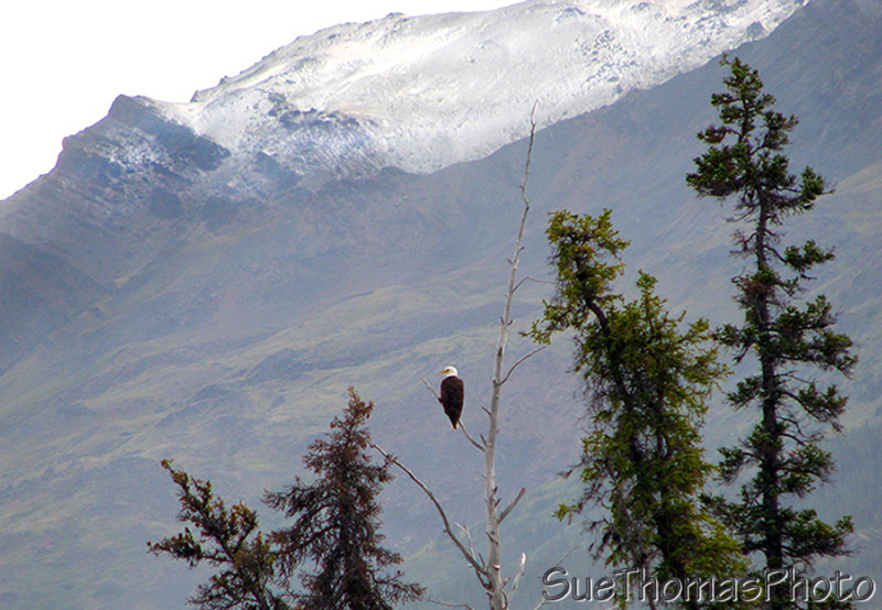
Eagle at Kinaskan Lake, British Columbia
Eagle giving us the evil eye, perched high above Kinaskan Lake along
the Cassiar Highway

Kinaskan Lake in the morning, viewed while on our dog walk
Back on Cassiar Highway heading north, the paint lines disappeared.
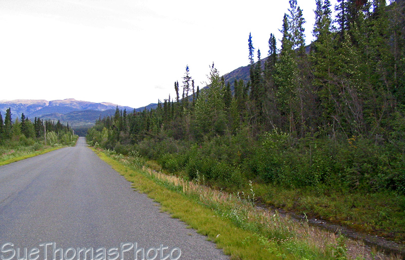
Cassiar northbound between Kinaskan Lake and the Stikine River
The road is steep and winding down to the Stikine River.

Warning of steep grades before descending to the Stikine River
northbound
The asphalt ends and the gravel/dirt started.
The descent to the Stikine River northbound
The Stikine River bridge is narrow, one lane only.

Single-lane bridge crossing over the Stikine River
The climb out is steady and steep. This is the area that washed out a few years ago.
The steady long climb on the north side of the Stikine River
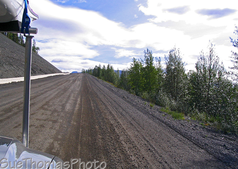
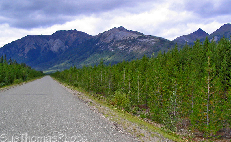
The further north one travels, the more rustic the road becomes. It is good driving, but one must stay alert for the potholes and frost heaves. As well, wildlife can often be seen through this area.
Cassiar Highway northbound

Gnat Lake area

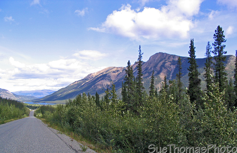
Cassiar Highway northbound before Dease Lake (Dease Lake is visible
left side of the picture)
North of Dease Lake the highway has long been gravel. Nasty stuff when it is wet, too. This year was no exception on our trip north...on our way south we were in for a surprise though (stay tuned!).
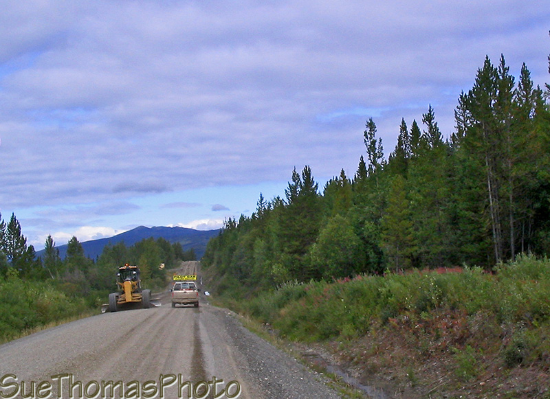
Construction zone north of Dease Lake
Approaching the Dease River Crossing, we spotted the first moose this trip. The commercial campground at Dease River looks fine. Have never stopped to stay so can't comment on the facilities.

Dease River Crossing, a commercial campground along the shores of
the Dease River
Dease River looking north
The scenery improves as the miles continue northward.
Cassiar Highway northbound, north of the Dease River Crossing
We enjoy the Good Hope Lake area.
Approaching Good Hope Lake northbound on the Cassiar Highway
Boya Lake! Our MOST favourite provincial park in British Columbia.
This place has a calm energy that soothes our souls. We couldn't wait to get out in the kayaks!

Kayaking on Boya Lake in the late afternoon
The skies became blue as evening settled in. It was very relaxing, quiet and peaceful.
Kayaking on Boya Lake in the late afternoon
Ahhhh ... time for a great night's sleep!
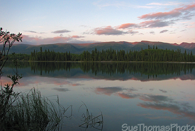
Sun setting at Boya Lake