
ALASKA HIGHWAY
Dawson Creek, BC
to Delta, Alaska
YUKON
Map with
Hwy links
Kluane Lake area
Campbell Hwy
Dempster Hwy
Dawson City
Klondike Hwy-North
Klondike Hwy-South
Haines Road
Nahanni Range Rd
Silver Trail
South Canol Road
Top of the World
Hwy
BEARS
Grizzly
/ Black
WILDLIFE
BIRDS
NORTHERN LIGHTS
ALASKA
Taylor Hwy
Denali National Park
McCarthy Road
Richardson Hwy
and more
BRITISH COLUMBIA
Cassiar Highway
Liard Hot
Springs
PLAN YOUR TRIP
Planning Links
Campgrounds/POIs
YUKON sights
2020
2019
2017
2016
2015
2014
2013
2012
2011
RV BLOGS
Vancouver Island
to Yukon & Alaska
2010 Aug & Sept
2009 September
2008 June
2007 September
2001 December
2000 August
1998 December
1997 September
1993 September
Whitehorse to Watson Lake, Yukon
6 September 2009 - Sunday
The day was overcast again, but not raining as we got underway. However, the forecast was for LOTS of rain in the area.

Near Jakes Corner, a view from the Alaska Highway of the range that
includes Mount White
Near Johnsons Crossing over the Teslin River I remembers a car accident when i was a kid travelling with Mom. She was driving our 1967 Ford Cougar (the first in the Yukon), heading south with her kids and slipped on the bridge.
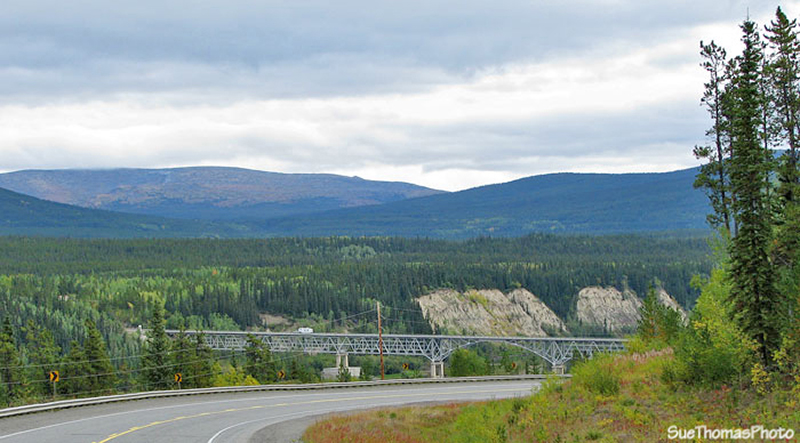
Approaching Johnsons Crossing over the Teslin River
When I was a kid, our 1967 Cougar approached the bridge and started to cross the long span.

Accessing Johnsons Crossing bridge over the Teslin River
Half way across the bridge, the car spun out of control! Mom later said she was sure we were going over the edge but a hard thump and we rebounded back on the roadway. A couple more thumps and the car was under control again!
Mid way on the Johnsons Crossing bridge over the Teslin River,
Yukon
There is no doubt the curb and rail saved our lives! Mom stopped in Teslin and through her open window told a highway maintenance guy about the icy conditions, told him to look at her damaged car. He had an odd look on his face and it wasn't until we got out to look that we realized why; there wasn't a scratch on the car! After arriving in Calgary, mom had the car checked. There was damage to the front end and the mechanic was amazed that mom had driven that distance safely.
Every time we cross that bridge, I remember that accident. I vividly remember being thrown against the interior side of the car when it hit the curb, and I certainly remember my mom's amazing ability to compose herself and carry on. Some things stay with you all your life!
Looking southward on the Teslin River from the Johnsons Crossing
bridge
In 2007, we turned northward at the junction of Highway 6 on the east side of the bridge to explore the South Canol Road. This year we debated making the turn again!
East end of the Johnsons Crossing bridge, approaching the South
Canol Road (Hwy 6)
But we carried on, anxious to visit Liard hotsprings for a few days. If we drove the South Canol we'd have to shorten our time soaking. The Alaska Highway 'dips' into British Columbia at Morley River. The Morley River Lodge has been closed for several years.
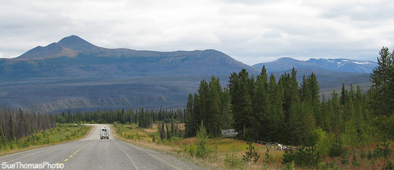
Cassiar Mountains viewed southbound on the Alaska Highway (in BC)
south of Morley River
As the Alaska Highway nears the BC/Yukon border again, travellers get notice that the Swift River lodge is just ahead.
Sign indicating it is 2 km to Swift River, which is on the Yukon
side of the border
There were numerous news reports that Swift River Lodge was closing for good at the end of the season. Apparently the Lodge needs numerous expensive upgrades to water and sewer systems to continue operating as a commercial facility. On this day, it was busy.
Swift River Lodge, on the Alaska Highway in the Yukon
Swift River looks similar to many other highway lodges: dirt yard, assortment of distracting signs, old gas pumps, and natural landscaping.
Diesel $1.06 -- good price compared to others along the highway in
this area
After Swift River, it started to RAIN. We stopped at the Big Creek Yukon Gov't campground (km 1042) at about 5 p.m. with the intentions of staying the night. But it was raining HARD.
Watson Lake was just another hour down the road and we were enticed
by having full-hookup for the night. So carried on to Campground
Services on the south end of town.