
ALASKA HIGHWAY
Dawson Creek, BC
to Delta, Alaska
YUKON
Map with
Hwy links
Kluane Lake area
Campbell Hwy
Dempster Hwy
Dawson City
Klondike Hwy-North
Klondike Hwy-South
Haines Road
Nahanni Range Rd
Silver Trail
South Canol Road
Top of the World
Hwy
BEARS
Grizzly
/ Black
WILDLIFE
BIRDS
NORTHERN LIGHTS
ALASKA
Taylor Hwy
Denali National Park
McCarthy Road
Richardson Hwy
and more
BRITISH COLUMBIA
Cassiar Highway
Liard Hot
Springs
PLAN YOUR TRIP
Planning Links
Campgrounds/POIs
YUKON sights
2020
2019
2017
2016
2015
2014
2013
2012
2011
RV BLOGS
Vancouver Island
to Yukon & Alaska
2010 Aug & Sept
2009 September
2008 June
2007 September
2001 December
2000 August
1998 December
1997 September
1993 September
Keane Lake to Morchuea Lake, Cassiar Highway
10 September 2009 - Thursday
The weather was supposed to be LOTSA rain! Fortunately, it was only a heavy overcast so photos could be taken as we drove south on the Cassiar Highway.
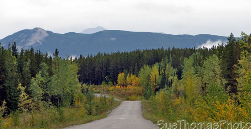
Southbound on the Cassiar Highway, BC
The day was overcast with light rain in some areas.

Southbound on the Cassiar Highway, BC
Fall colours were just starting; seemed to be later this year than in previous years.

Southbound on the Cassiar Highway, BC
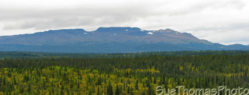
Southbound on the Cassiar Highway, BC
Southbound on the Cassiar Highway, BC

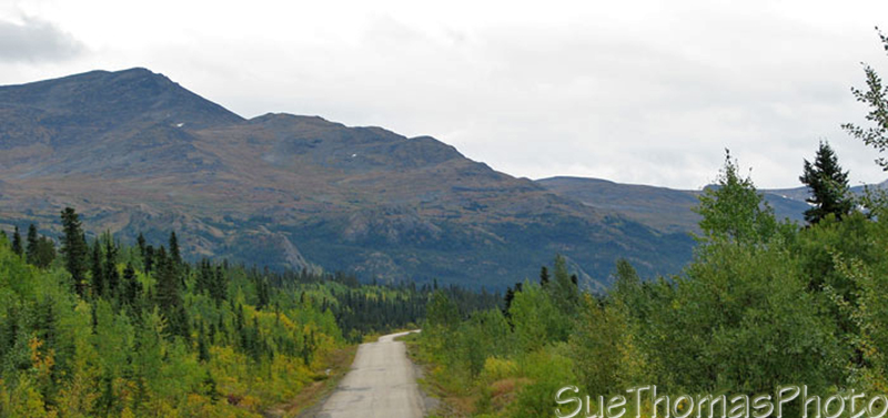
Gnat Pass Summit, southbound on the Cassiar Highway, BC
At Gnat Pass Summit it was COLD. A chilly wind was blowing through and we wondered if snow wasn't far behind.

Rest area near Upper Gnat Lake, on the Cassiar Highway, BC
Upper Gnat Lake would have been a good overnight spot, BUT it was COLD! And windy! We wondered whether the light rain might turn to snow overnight.
The executive decision was made to carry on to another spot - Morchuea Lake, which is about 43 miles south of Dease Lake and south of the Stikine River. The Morchuea Lake Forest Service recreation site borders the Stikine River Provincial Park, a popular wilderness area.
The road into the recreation site is one-lane, downhill and rough. Wouldn't recommend it for any rigs larger than ours. If the weather is wet, 4x4 could be handy if you're towing out of the site.

Mt. Edziza viewed from Morchuea Lake on the Cassiar Highway, BC
There's a handful of camping spots at Morchuea Lake and a boat launch. Facilities are primitive. Usually firewood is not available at recreation sites, but this year the picnic tables had been replaced and the old tables left in the sites for firewood.
We had some neighbours this evening; a couple of hunters. They seemed amazed to see a truck and fifth wheel descend the steep, rough road and came over to introduce themselves. Later in the evening they headed out in hopes of finding a moose.

Tazz puppy digging something or other at the recreation site at Morchuea
Lake, BC