
ALASKA HIGHWAY
Dawson Creek, BC
to Delta, Alaska
YUKON
Map with
Hwy links
Kluane Lake area
Campbell Hwy
Dempster Hwy
Dawson City
Klondike Hwy-North
Klondike Hwy-South
Haines Road
Nahanni Range Rd
Silver Trail
South Canol Road
Top of the World
Hwy
BEARS
Grizzly
/ Black
WILDLIFE
BIRDS
NORTHERN LIGHTS
ALASKA
Taylor Hwy
Denali National Park
McCarthy Road
Richardson Hwy
and more
BRITISH COLUMBIA
Cassiar Highway
Liard Hot
Springs
PLAN YOUR TRIP
Planning Links
Campgrounds/POIs
YUKON sights
2020
2019
2017
2016
2015
2014
2013
2012
2011
RV BLOGS
Vancouver Island
to Yukon & Alaska
2010 Aug & Sept
2009 September
2008 June
2007 September
2001 December
2000 August
1998 December
1997 September
1993 September
Nabesna Road, Alaska
23 August 2010 - Monday
We enjoyed a great evening and slept well even though it rained through the night.
Continuing south along the Nabesna Road the road surface became rough gravel. A grader was maintaining the road and there were numerous hunters out as well.
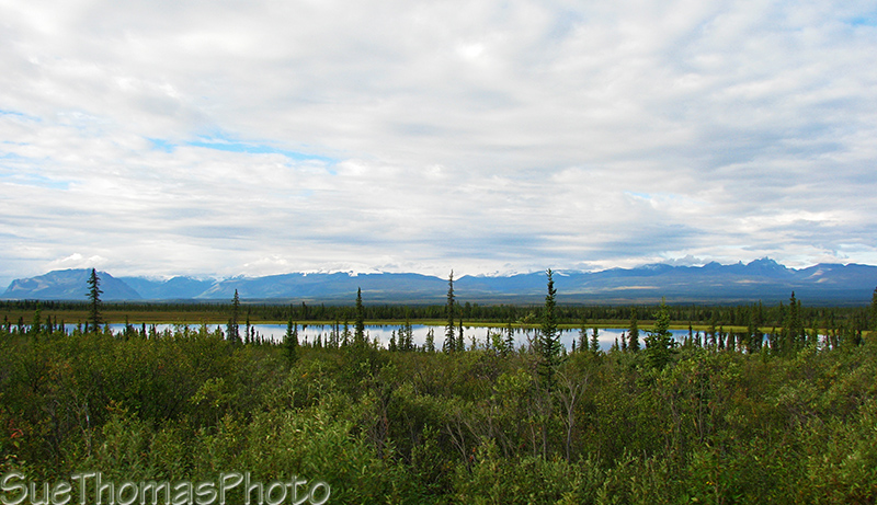
View westward from the Kettle Lake campsite at
Mile 16.5 -
N62 35.069 W143 34.014
There are numerous places to pull-off driving towards Twin Lakes. The ranger at the park entrance told us the campground at Twin Lakes was closed as it was under construction. So we stopped to check out a roadside camping spot by the lake.
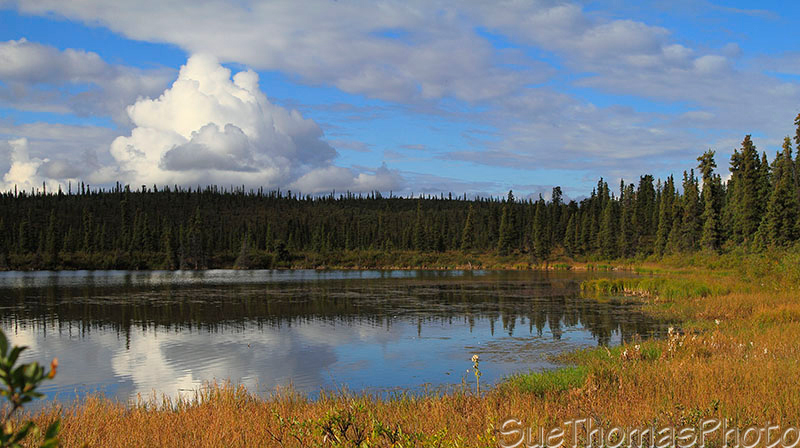
View at Twin Lake from the roadside boondock spot at Mile 27.5 -
N62
31.835 W143 15.844
A park employee stopped and told us to go to the campground and enjoy its amenities. We explained that we'd been told there was no camping there. He advised that the campground was incomplete but no construction was ongoing. He reiterated that we should park there. So we left our roadside spot and pulled into the Twin Lakes recreation site. Found a good spot to leave the fifth wheel, packed a lunch, and headed out with the truck.
The skies were sunny with big cloud banks moving through. It made for interesting lighting.
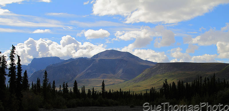
Looking south west from near Mile 32 -
N62 30.776 W143 10.523
The colours on the mountains were striking. And the rocky edges were interesting!

Close-up view of the rock-faced mountains to the west of Nabesna
Road
The mountain below was an amazing red colour. It seemed to be the rock rather than the fauna.
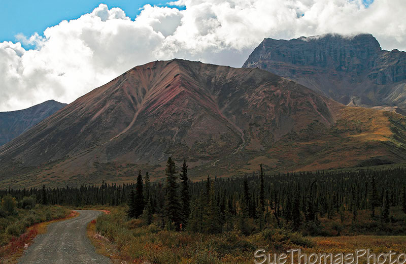
Colourful mountain viewed from Nabesna Road -
N62 27.645 W143 06.010
Despite the odd lighting, I was loving the photo opportunities through this area!

Mountain view to the west -
N62 27.640 W143 06.007
Towards the end of the road, the skies clouded over.
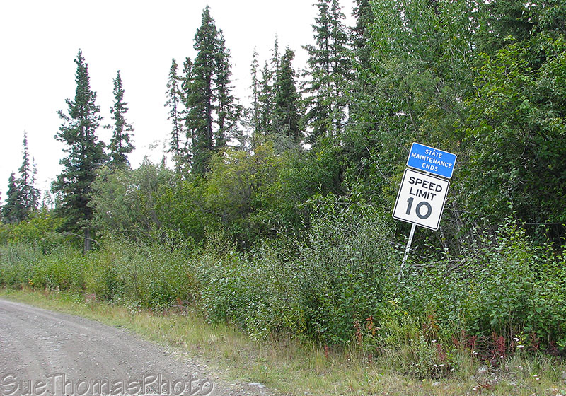
"Maintenance" must not include keeping the signs upright! -
N62 24.233
W142 59.925
We passed by numerous homes, a B&B, and a handful of bush planes. Then reached a sign indicating the road to the historical mine was private with no trespassing. We turned around.
Driving back through "town", I took
pictures of the planes from the truck window. I knew my
former-Alaska-pilot friend Joe would appreciate the diversion from
the scenery usually displayed here! Joe provided the
info about each of these aircraft -- an interesting mix!

This aircraft is a 1968 Piper PA-18-150
See the airfield on Google Maps at N62 23.878 W142 59.709.

A 1951 four-seater Piper PA-18-125 Super Cub, a.k.a. Hulk

Hmmmm - listed as an Ellis Wendell Kirk
Workhorse with a manufacture date of 2007

1946 PA-12
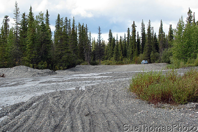
Back near where the State road maintenance ended, there was a nice spot for our lunch break.

Looking north from our lunch stop near the end of Nabesna Road -
N62 24.354 W142 59.899
The peaks surrounding our rest spot were amazing! Even with the misty haze that had settled in, the craggy features created a great lunchroom!

Peaks to the west viewed from our lunch stop

Looking towards the southwest from our lunch stop

Far in the distance to the east were the snow covered Wrangell
Mountains, viewed from our lunch stop
Then back on the road headed north to return to our campsite at Twin Lakes.

View from Mile 35 near the Jack Creek Rest Area
The blue skies returned and the fall colours were highlighted brilliantly.

Looking north near Mile 33.5 on Nabesna Road -
N62 29.279 W143
07.908
Nabesna Road is dirt in some places and gravel in others.

Near Mile 33 on Nabesna Road -
N62 29.434 W143 08.498
South of the Sportsman Lodge, a creek runs across the road. The roadbed was soft but passable when we were there. I was glad we were not towing the trailer!
Trail Creek Crossing near Mile 29 on Nabesna Road -
N62 31.278 W143
12.968
Back at the Twin Lakes recreation site we settled in for the evening.
The parks official who told us we could overnight at the campground came back to let us know he was closing the gate. The decision had been made to close the campground. There was concern that ATV/quad riders would tear up the new gravel base in the campground and destroy the work already completed. We offered to leave but he said we were okay and asked that we let ourselves out in the morning and close the gate when we left. So we had our own little private campground!

Campsite at Twin Lakes on Nabesna Road -
N62 31.785 W143 15.479
Steve went fishing. By 9:30 p.m. he hadn't returned so I headed to the lake to check. Took my camera with me as there was still some light in the sky.
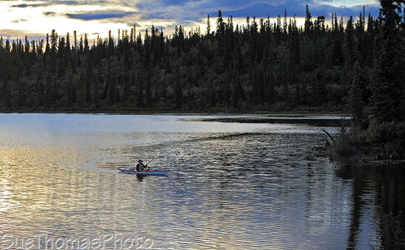
Steve coming to shore with his kayak as the sun set on Twin Lakes
Steve caught some grayling. I continued to take pictures of the setting sun.

Sun setting over Twin Lakes
The sun hit the tree tops and mountains, giving both
red highlights.
With creative use of ISO640 and 1/80 second
shutter speed, I was able to capture a fair bit of detail.

Looking towards the east from Twin Lakes as the sunset
We had a very nice evening. The area was peaceful.