
ALASKA HIGHWAY
Dawson Creek, BC
to Delta, Alaska
YUKON
Map with
Hwy links
Kluane Lake area
Campbell Hwy
Dempster Hwy
Dawson City
Klondike Hwy-North
Klondike Hwy-South
Haines Road
Nahanni Range Rd
Silver Trail
South Canol Road
Top of the World
Hwy
BEARS
Grizzly
/ Black
WILDLIFE
BIRDS
NORTHERN LIGHTS
ALASKA
Taylor Hwy
Denali National Park
McCarthy Road
Richardson Hwy
and more
BRITISH COLUMBIA
Cassiar Highway
Liard Hot
Springs
PLAN YOUR TRIP
Planning Links
Campgrounds/POIs
YUKON sights
2020
2019
2017
2016
2015
2014
2013
2012
2011
RV BLOGS
Vancouver Island
to Yukon & Alaska
2010 Aug & Sept
2009 September
2008 June
2007 September
2001 December
2000 August
1998 December
1997 September
1993 September
Valdez to Chitina on the Richardson Hwy, AK
26 August 2010 - Thursday
It remained busy most of the night so we both slept with our earplugs in. Much too hectic in this town for our liking. Time to move on!
The road out of Valdez goes by the old town of Valdez -- where it was located before the 9.2 magnitude earthquake on 27 March 1964. I remember that earthquake when it happened as our home was affected. Dad took me and my baby brother on a road trip through Valdez in November 1964 on our way to see the Veterans Day parade in Anchorage. The devastation was incredible to see.

Across the port the pipeline terminus is also visible on a clear day.

Pipeline terminus across the bay
Then away from civilization again.

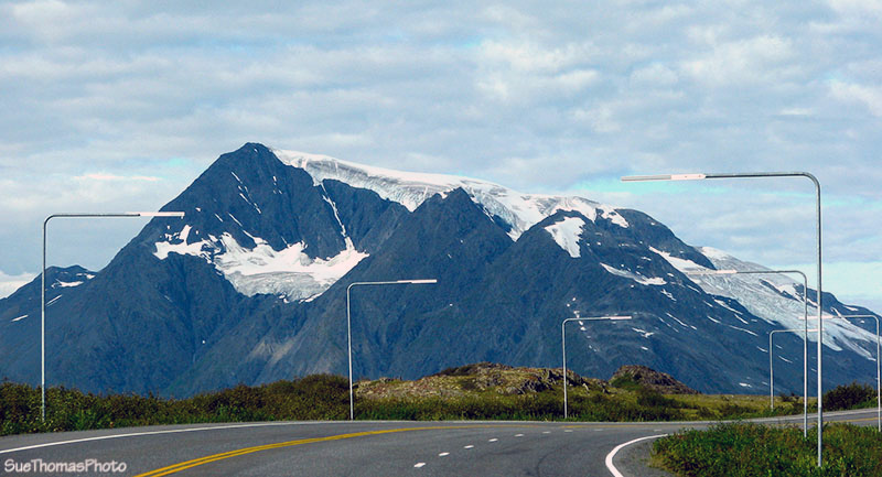
Heading eastward on the Richardson Highway with the Lowe River

Glaciers are visible through the valleys, this looking south from
the highway
In Keystone Canyon, we stopped by the "Old Railroad Tunnel". Apparently this tunnel was hand cut, then there was some sort of gun battle. The tunnel was never finished.
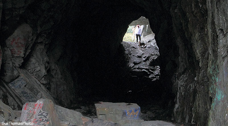
Steve and Tazz standing at the end of this bit of "tunnel"
We had stopped at Bridal Veil Falls and Horsetail Falls on our way into Valdez so didn't stop on the way out. Just as well, both areas were very busy with bus tours.
The climb up to Thompson Pass provides views of more glaciers.
Climbing towards Thompson Pass
And more climbing and more glaciers ...

Keystone Glacier (I think) viewed from the Thompson Pass area on the
Richardson Highway
At the top of the climb there is a large pull off by a small lake. We wondered if this would be a good spot to overnight. It was a lovely spot with some narrow paths down to the lakeshore.

Looking southward over Thompson Pass
The views from the gravel pull off were also stunning.

Looking southwest, back along the Richardson highway with the
highway maintenance camp in the distance
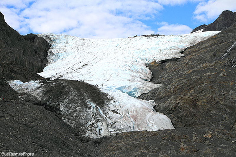
Next stop was Worthington Glacier. Today was a great day to visit the glacier!

Worthington Glacier alongside the Richardson Highway
Worthington Glacier has receded a great deal since our first visit in September 1993.
Close-up shot of Worthington Glacier taken with the zoom lens

Looking northward from near Mile 68 - N61 30.481 W145 12.675
At the junction for the Edgerton Highway we turned east towards Kenny Lake. Kenny Lake has the distinction for having the most expensive fuel of our whole trip.
From Kenny Lake, turned south towards Chitina. Drove through the very small town of Chitina to the Copper River to look for a spot to leave the fifth wheel while we drove to McCarthy tomorrow.
Checked out the recreation site at the river but it wasn't well maintained and none of the sites appealed to us. So crossed the highway to the large open area alongside the river.
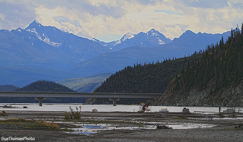
The bridge over the Copper River and a fish wheel alongside the
river -
N61 31.846 W144 24.362
There were numerous folks camped here and also some fisherman. After chatting with a few of the folks who appeared to be "residents", we learned that it is a free-for-all. Park where you wish, but respect the signs marking private lands.
It was VERY windy. The first spot we considered was much too windy; the fifth wheel was swaying! So moved to a spot behind some trees. Despite the wind, Steve still wanted a fire.
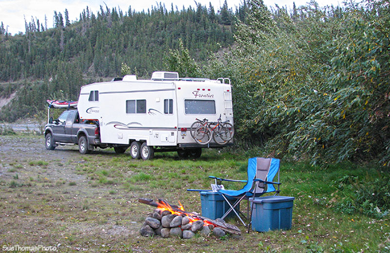
Steve sat by the fire by himself on this night -- too windy for Sue!
The wind meant no bugs though. Several other people pulled in and set up for the night too. It was a good spot even with the trees bending in the wind.