
ALASKA HIGHWAY
Dawson Creek, BC
to Delta, Alaska
YUKON
Map with
Hwy links
Kluane Lake area
Campbell Hwy
Dempster Hwy
Dawson City
Klondike Hwy-North
Klondike Hwy-South
Haines Road
Nahanni Range Rd
Silver Trail
South Canol Road
Top of the World
Hwy
BEARS
Grizzly
/ Black
WILDLIFE
BIRDS
NORTHERN LIGHTS
ALASKA
Taylor Hwy
Denali National Park
McCarthy Road
Richardson Hwy
and more
BRITISH COLUMBIA
Cassiar Highway
Liard Hot
Springs
PLAN YOUR TRIP
Planning Links
Campgrounds/POIs
YUKON sights
2020
2019
2017
2016
2015
2014
2013
2012
2011
RV BLOGS
Vancouver Island
to Yukon & Alaska
2010 Aug & Sept
2009 September
2008 June
2007 September
2001 December
2000 August
1998 December
1997 September
1993 September
McCarthy Road into Kennecott Mine, Alaska
27 August 2010 - Friday
The morning dawned quietly. We were a bit late getting up and most of the other folks who had planned to drive into McCarthy were already gone! By the time our dog walk was done, it was 10 a.m. when we hit the road.
Immediately the road climbed from the Copper River. At the top, the view was very nice.
The National Park Service has an informative guide about McCarthy Road (pdf file).
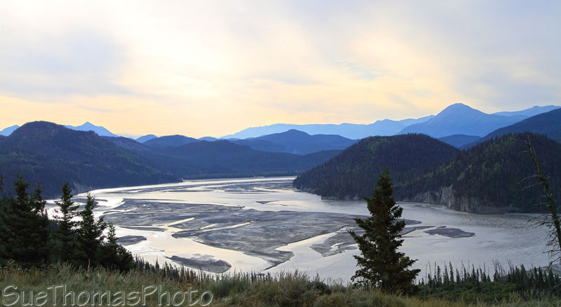
View northward of the Copper River from McCarthy Road, just west of Chitina
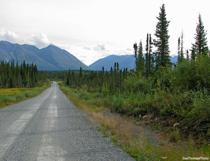
The first 10 miles were rough. Big rocks on the road, very rough road in spots, so we just slowed it down and enjoyed the scenery.
Rough McCarthy Road westbound at
N61 31.352 W144 13.472
Things got pretty exciting when I spotted some wildlife!
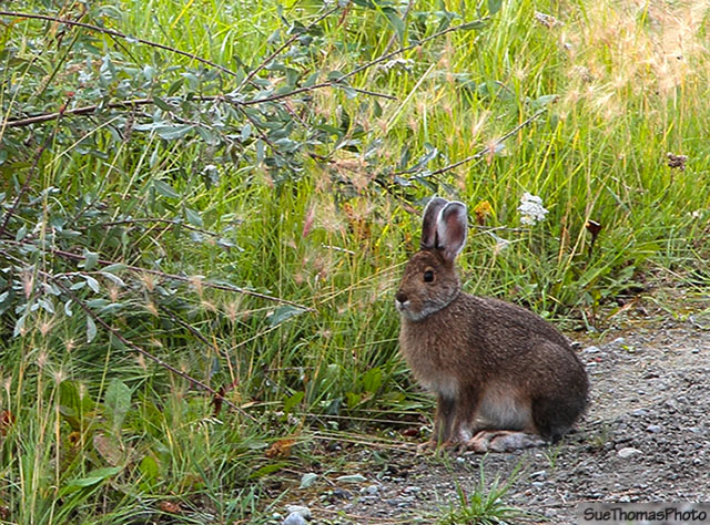
Rabbit alongside McCarthy Road
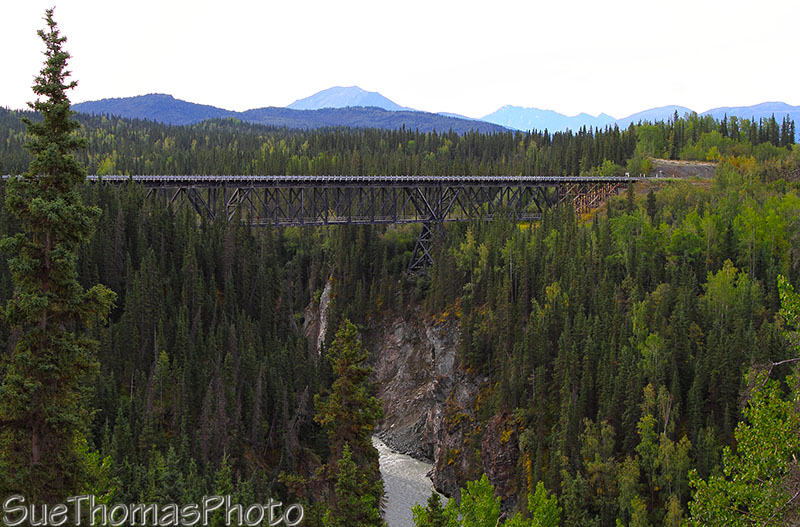
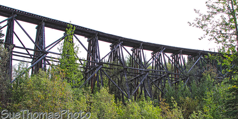
I looked forward to seeing the Kuskulana Bridge at Mile 17.
The trestle was constructed in 1910.
Kuskulana Trestle - view point approaching
eastbound -
N61 29.505 W144 01.143
This was originally a train trestle now converted to a passenger vehicle crossing.
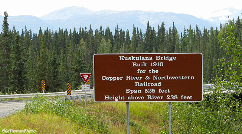
Sign at the west end of the Kuskulana Bridge
One lane only - fortunately visibility is not a problem from abutment to abutment.
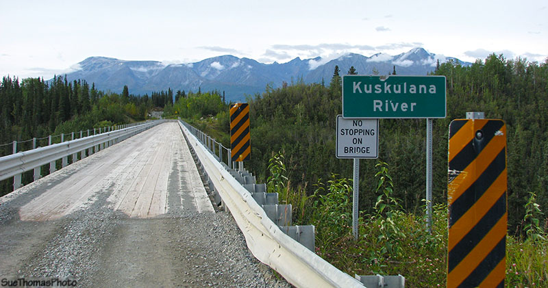
Approach to the Kuskulana Bridge -
N61 29.441 W144 00.891
The east side of the bridge has a good rest area with information signs about the bridge and its history. There are also some walking paths to the underside of the bridge for those that like to explore.
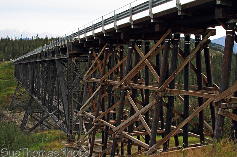
Kuskulana Bridge viewed from the east abutment
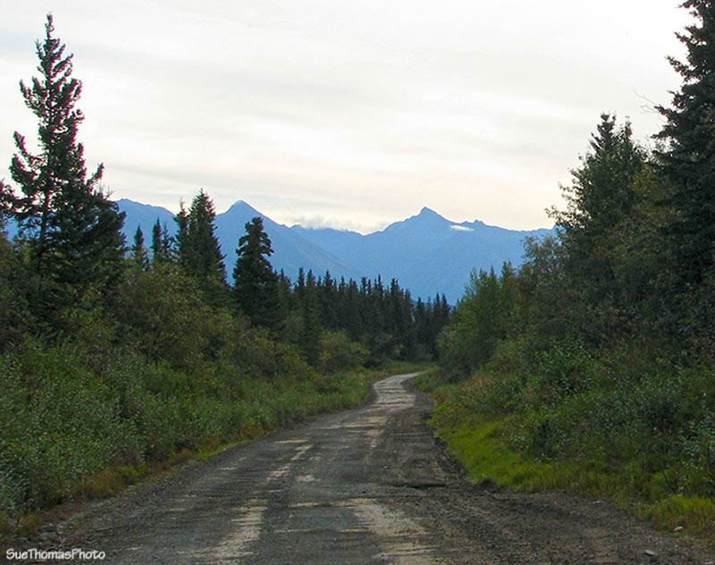
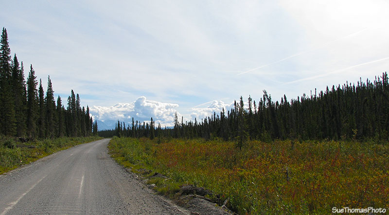
Carrying on the road eastbound was in good condition. Not very wide, but good gravel.
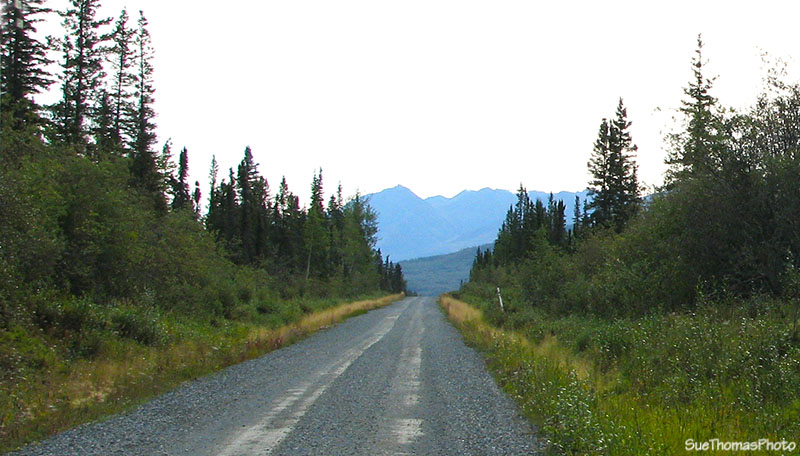
East bound on the McCarthy Road in Alaska
Still eastbound, this picture just east of Mile 20 -
N61 28.086 W143
56.990
Through this area the road shown on the GPS map did not match the route. The electronic mapping for roads in Alaska seems to not be accurate. In this instance, the GPS indicated the road was a few hundred yards to the south.
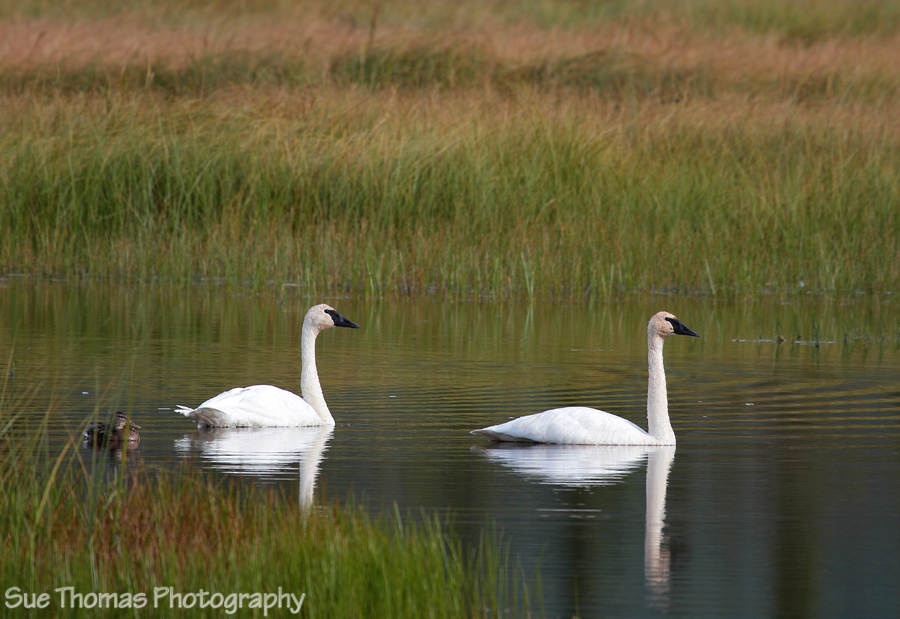
A bit east of Chokosna Lake there were a couple of Trumpeter swans in a wetland area.
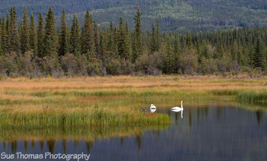
Trumpeter swans alongside McCarthy Road -
N61 27.379 W143 47.898
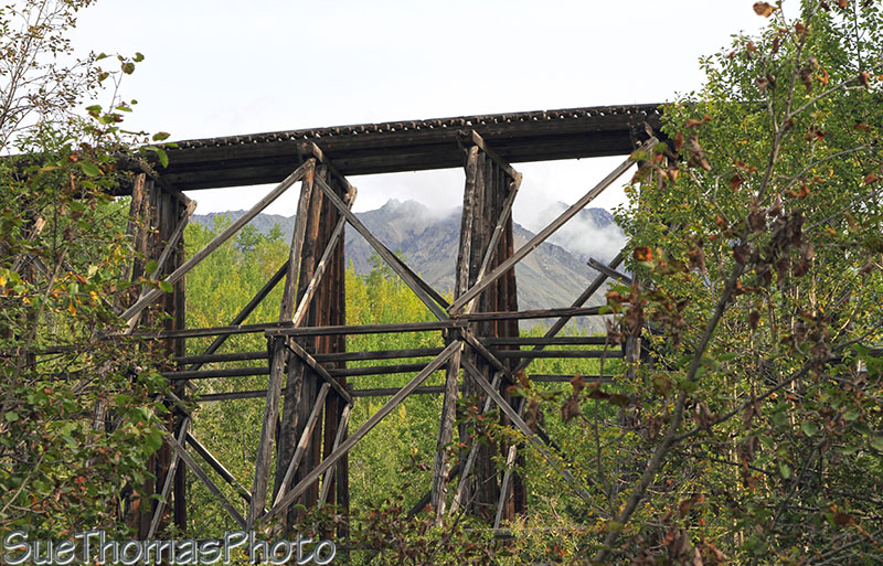
Next was at the historical Gilahina Trestle at Mile 29.
There were spots to park
and paths to explore.
Gilahina Trestle viewed from the parking area at Mile 29 -
N61 26.291 W143
43.171
The trestle is constructed from a combination of logs and timbers.
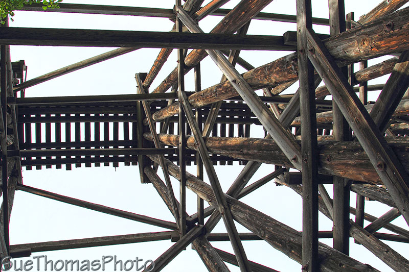
Looking up from underneath the Gilahina Trestle
It was interesting poking around the trestle.
Hard to imagine
the ore-laden trains that crossed this bridge decades ago!
Looking north through the Gilahina Trestle on McCarthy Road
Next stop was prompted by the flag person at the Lakina River. The bridge had been damaged months before and it had a load limit of 6,000 lbs. The crews were driving trucks similar to ours, so obviously knew we were over the limit. The flag person poked around, then asked about the 160 lb. motorcycle in the truck box, then snickered when he said, "You're obviously under the limit" (wink). Then told us to take it slow and easy.
The bridge was slated for replacement in October 2010.
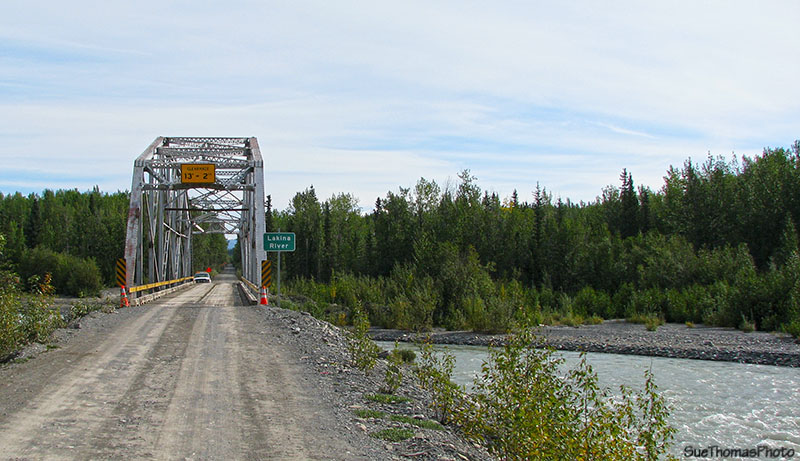
Approaching the damaged Lakina River bridge eastbound -
N61 22.452 W143 21.105
As we crossed I took a picture southward out the truck window.
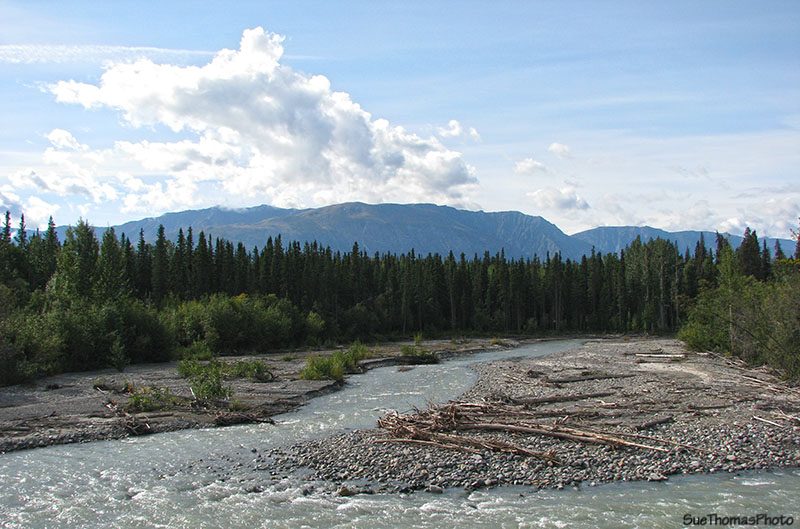
View south from the Lakina River bridge
Not too many miles until the "end of the road". There wasn't much to indicate that the road was nearing the end.
Eastbound near Mile 50 of the McCarthy Road
Saw a parking lot by a tour operator's building so went in to ask where we could park. He said we could park in their lot for no cost and gave us a tag to put in the window. He said it was used to make sure they knew if a car was in the lot too many days, possibly indicating someone was lost in the bush.
We loaded our day packs with food and water for humans and dog. The sky was starting to clear of clouds and it was getting warm.
It was a 500m (third of a mile) walk to the bridge. In the image below, the Kennecott mine buildings are on the left side just above the tree line.
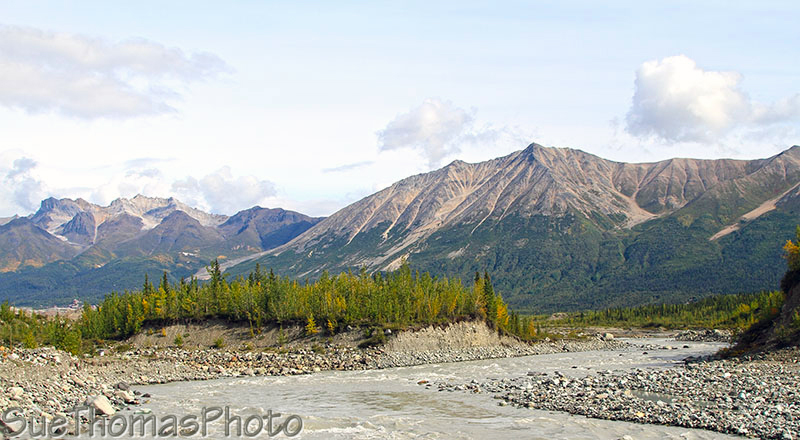
Looking north on the Kennicott River at the pedestrian bridge into
McCarthy.
The setting for the mine is awe-inspiring!
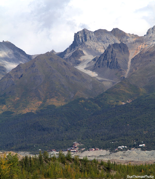
The Kennecott mine viewed from McCarthy Road
And finally, a picture of the pedestrian bridge. Looks wide enough for an ATV to cross.
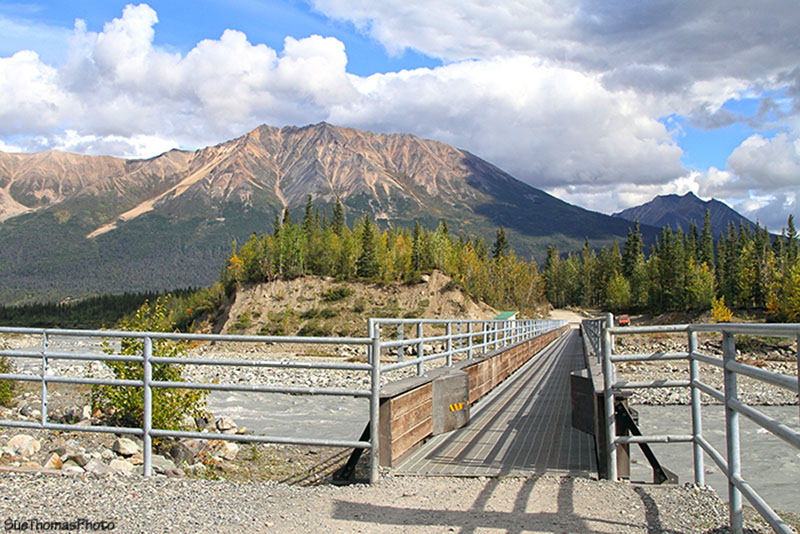
The pedestrian bridge across the Kennicott
River -
N61 26.032 W142 56.627
It was about 12:30 p.m. We had just enough time to walk into McCarthy to catch the shuttle to the mine. Pictures of the mine site on the next page...