
ALASKA HIGHWAY
Dawson Creek, BC
to Delta, Alaska
YUKON
Map with
Hwy links
Kluane Lake area
Campbell Hwy
Dempster Hwy
Dawson City
Klondike Hwy-North
Klondike Hwy-South
Haines Road
Nahanni Range Rd
Silver Trail
South Canol Road
Top of the World
Hwy
BEARS
Grizzly
/ Black
WILDLIFE
BIRDS
NORTHERN LIGHTS
ALASKA
Taylor Hwy
Denali National Park
McCarthy Road
Richardson Hwy
and more
BRITISH COLUMBIA
Cassiar Highway
Liard Hot
Springs
PLAN YOUR TRIP
Planning Links
Campgrounds/POIs
YUKON sights
2020
2019
2017
2016
2015
2014
2013
2012
2011
RV BLOGS
Vancouver Island
to Yukon & Alaska
2010 Aug & Sept
2009 September
2008 June
2007 September
2001 December
2000 August
1998 December
1997 September
1993 September
Dempster to Klondike Highway, Yukon
25 July 2011 - Monday
Woke to a drizzly damp morning, with a good wind blowing through the area. Even so, the dog walk must go on. The North Klondike River hiking trail access is on the north side of the Tombstone campground.
The start of the North Klondike River hiking trail
Despite the wind and chill, and occasionally muddy ground, the
trail was a nice hike.
A little further along, it is possible
to get down to the North Klondike River.
North Klondike River in Tombstone Park
It was unfortunate to discover evidence of days gone by. Came across this oil drum.
I wondered if the "6-21-34" was a date? June 21, 1934?
Oil drum in a pile of old stuff near the North Klondike River in
Tombstone Park
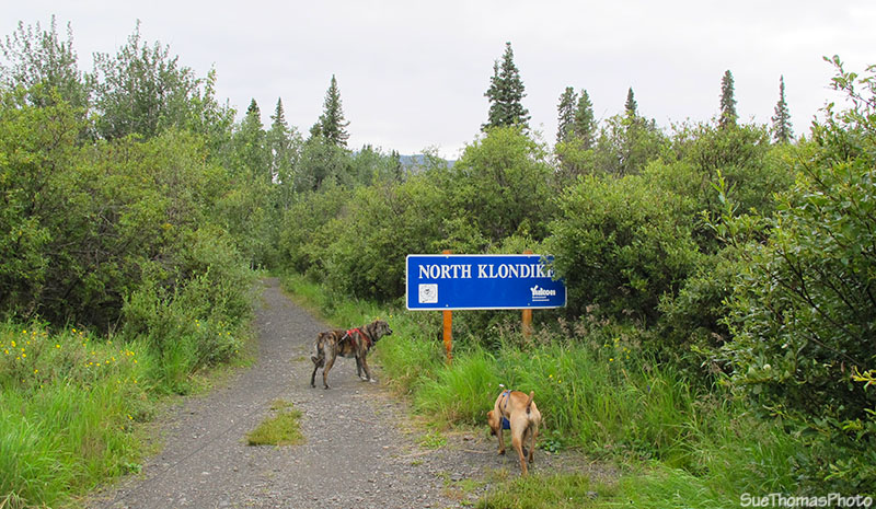
Back at the campsite, we decided to hit the road southbound back to the North Klondike Highway. For the most part the weather was WET, so few pictures were taken. However, as we neared the junction with the North Klondike Highway, the sky was again bright.
Approaching the North Klondike Highway, southbound on the Dempster
Highway
We took a quick break at the pull-off by the signage for the Dempster Highway.
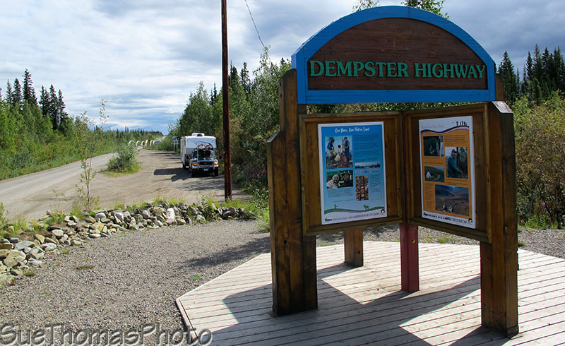
Dempster Highway sign, and looking northward on the highway
Looking southward at the junction of the Dempster and North Klondike
Highway
At the rest area, there are numerous signs. The Dempster Highway is officially part of the TransCanada Trail although the sign is a little worn.
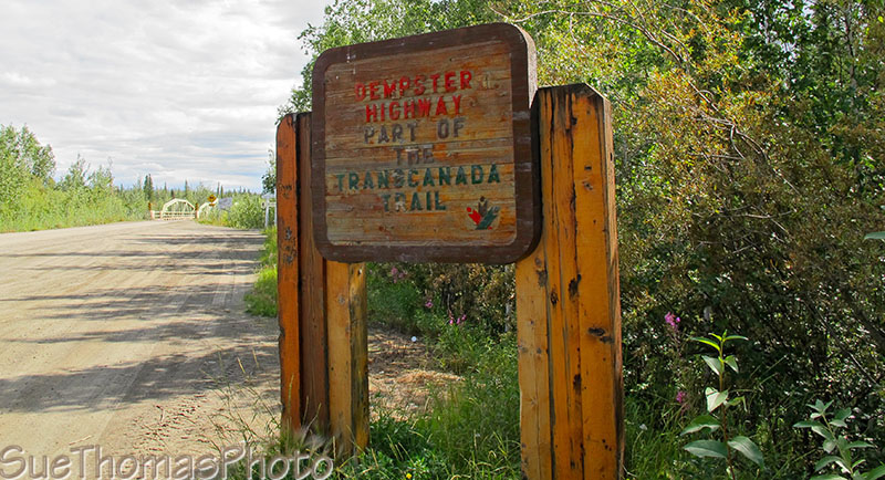
TransCanada Trail sign at the junction of the Dempster & North
Klondike Highways
Then it was time to turn southward on the North Klondike Highway. I don't find this route to be overly scenic, compared to other routes in Yukon.
The Tintina Trench is an area of interest though.
The Tintina Trench is a linear valley, extending into Alaska and south across the Yukon. It was first recorded as a geological feature in the early 1900s by R.G. McConnel, a geologist with the Geological Survey of Canada. The GSC named it the "Tintina (meaning Chief) Trench"
Beneath the Tintina Trench is a fault line along which the bedrock has shifted a minimum of 450 km laterally. Some 65 million years ago, the rocks presently beneath Dawson City were adjacent to those of Ross River! About 8 million years ago, the earth's crust separated along the fault, creating a wide valley or trench.
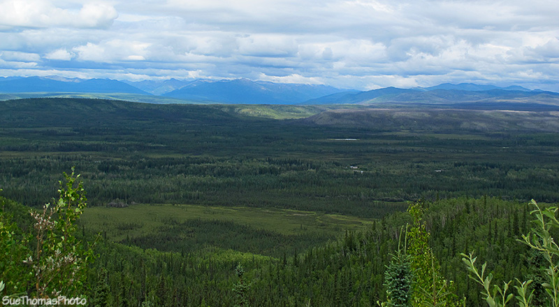
View of the Tintina Trench from the scenic viewpoint along the North
Klondike Highway
For bird watchers, May & September are the months to visit this
area!
We've lunched at Moose Creek campground, but not overnighted. Too many mosquitos!
Further along, Stewart Crossing ...
Approaching Stewart Crossing on the North Klondike Highway
Be sure to turn to the right, or you'll find yourself on the way to Mayo & Keno!
Sign for Mayo, Pelly Crossing & Whitehorse
We like the backroads so thought we'd head into Ethel Lake, a 24-km drive. The campground sounded intriguing and the lake is supposed to be good for fishing! We've see seen signs like this before, at the start of the Nahanni Range Road for instance. So we continued along the road.
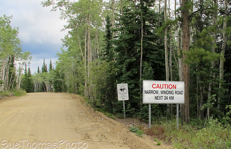
Sign at the start of the road into Ethel Lake Yukon Gov't Campground
The road was in good driving condition but it had numerous steep ascents and descents. About half way in the truck was starting to overheat with the slow driving, warm temperatures and steep climbs. On the descents, the brakes would overheat.
At a slight widening in the road we took a break. While walking the dogs, the executive decision was made; it was time to turn around. We were only half way in and didn't know what was ahead other than more hills!
Back on the Klondike Highway, it was getting late. So found a nice spot to park for the night.