
ALASKA HIGHWAY
Dawson Creek, BC
to Delta, Alaska
YUKON
Map with
Hwy links
Kluane Lake area
Campbell Hwy
Dempster Hwy
Dawson City
Klondike Hwy-North
Klondike Hwy-South
Haines Road
Nahanni Range Rd
Silver Trail
South Canol Road
Top of the World
Hwy
BEARS
Grizzly
/ Black
WILDLIFE
BIRDS
NORTHERN LIGHTS
ALASKA
Taylor Hwy
Denali National Park
McCarthy Road
Richardson Hwy
and more
BRITISH COLUMBIA
Cassiar Highway
Liard Hot
Springs
PLAN YOUR TRIP
Planning Links
Campgrounds/POIs
YUKON sights
2020
2019
2017
2016
2015
2014
2013
2012
2011
RV BLOGS
Vancouver Island
to Yukon & Alaska
2010 Aug & Sept
2009 September
2008 June
2007 September
2001 December
2000 August
1998 December
1997 September
1993 September
Yarger Lake AK to Lake Creek YT - Alaska Highway
7 September 2012 - Friday
The Tetlin National Wildlife Refuge is a large area. Wonderful spot for birders! There is an information center that is worthwhile visiting.
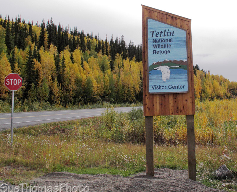
Much of the area is wetland, perfect for birds & moose.

Near the Alaska border there is a sign that lets you know it is another 20 miles to Canada Customs. Note the drunken telephone poles in the ditch/wetland!

20 miles to Canada Customs, sign at the border

Port Alcan, the US side of the border crossing
It is another 20 miles or so to Canada Customs near Beaver Creek.
Meanwhile, welcome to Yukon!

Welcome to Yukon sign at the Yukon-Alaska border
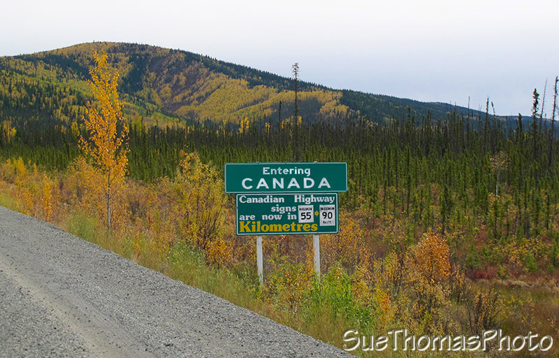
Now in Canada with speeds and distance in metric
The section of Alaska Highway between the Alaska border and Beaver Creek is notoriously bad. Always has been.

Heading to Beaver Creek from the Alaska/Yukon border
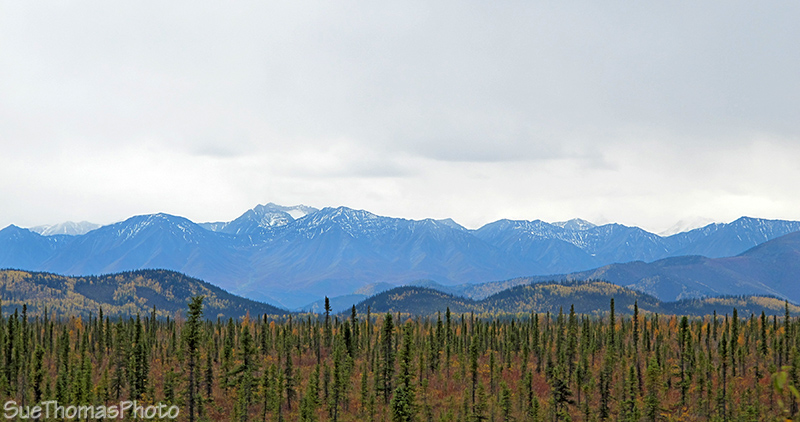
The scenery is nice, these the Wrangell-St. Elias mountains
Beaver Creek, my home town. We didn't plan to visit this trip,
instead just passing through.
Beaver Creek is the most westerly
community in Canada, as the sign says.

Welcome to Beaver Creek, the most westerly community in Canada
South of Beaver Creek there is a test section to learn how best to reduce the effects of the annual freeze/thaw. This section of highway is rough each spring. Frost heaves and pot holes. We think the test section is about the worst of the section too, likely meaning it isn't working!
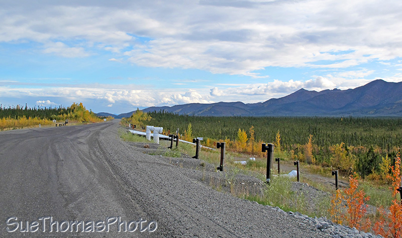
Test section along the Alaska Highway

Fall colours on Dead Man's Hill
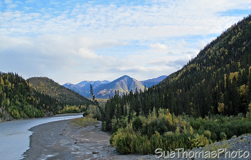
Looking west on the White River

Pickhandle Lake is a great spot to stop and watch birds
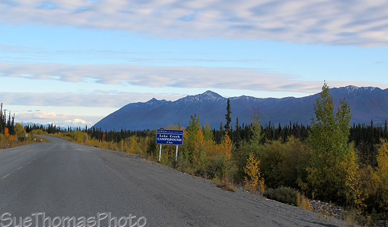
Lake Creek Yukon gov't campground ... a quiet spot to stop for the night