
ALASKA HIGHWAY
Dawson Creek, BC
to Delta, Alaska
YUKON
Map with
Hwy links
Kluane Lake area
Campbell Hwy
Dempster Hwy
Dawson City
Klondike Hwy-North
Klondike Hwy-South
Haines Road
Nahanni Range Rd
Silver Trail
South Canol Road
Top of the World
Hwy
BEARS
Grizzly
/ Black
WILDLIFE
BIRDS
NORTHERN LIGHTS
ALASKA
Taylor Hwy
Denali National Park
McCarthy Road
Richardson Hwy
and more
BRITISH COLUMBIA
Cassiar Highway
Liard Hot
Springs
PLAN YOUR TRIP
Planning Links
Campgrounds/POIs
YUKON sights
2020
2019
2017
2016
2015
2014
2013
2012
2011
RV BLOGS
Vancouver Island
to Yukon & Alaska
2010 Aug & Sept
2009 September
2008 June
2007 September
2001 December
2000 August
1998 December
1997 September
1993 September
West Fork CG to Top of the World Hwy, Yukon
22 July 2011 - Friday
Woke to another brilliant day! After breakfast and cleanup, time to walk the dogs.
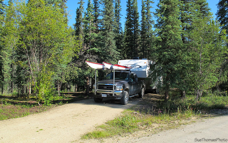
Campsite at West Fork Campground on the Taylor Highway
At the entrance to the campground, there is a sign that made me
go, "Hmmmm..."
When we passed through here in
September 2010, the campground was full of hunters. I hope
the sign was for them!
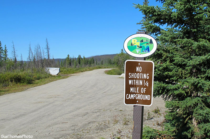
Sign at the entrance to the West Fork Campground on the Taylor
Highway
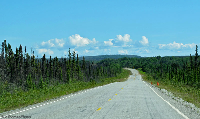
Back on the road, heading east to Dawson City. The plan was to cross into the Yukon and drycamp the night away at a quiet pulloff alongside the Top of the World Highway.
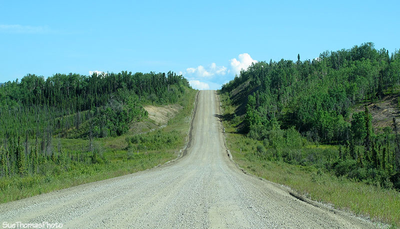
Taylor Highway eastbound towards Dawson City - N63 54.659 W142
12.845
These frost heaves were here in 2010 too -- just before Mile 53.
Frost heaves ... looks like some took a sheet and tossed it wrong! -
N63 55.790 W142 11.677
Some areas of the road had been repaired, leaving long gravel sections.
Gravel section of repaired road near Mile 53 - N63 56.457 W142
11.175
Very long sections of gravel! Below the transition to pavement can be seen in the distance.
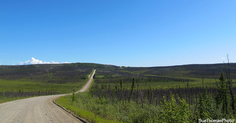
Near Mile 56 eastbound - N63 58.841 W142 09.201
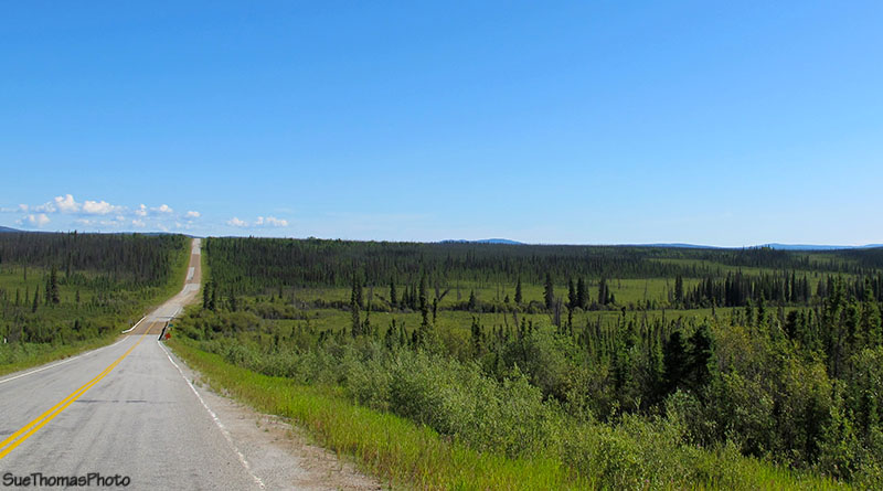
The Taylor Highway meanders between hilltops and valley bottoms. Often the highway is visible in the distance. Mosquito Fork Wayside is the valley below...
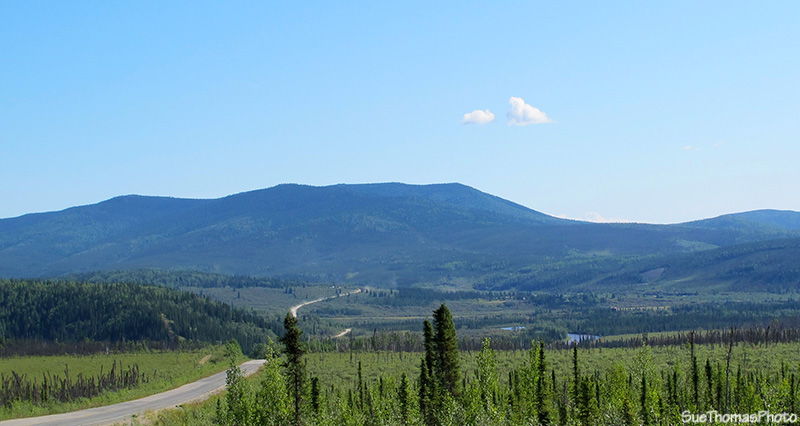
Taylor Highway disappearing into the east - N64 03.732 W142 00.538
The sign below was amusing. Was it for the damage being repaired? Or for the disarray being caused by the grader? The road was still soft; the shoulders extremely soft.
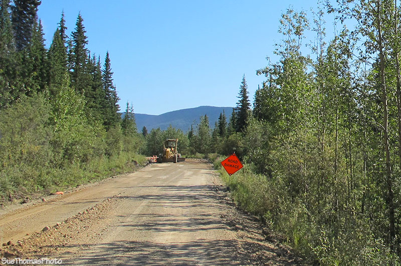
Road repair underway, although the grader operator was not in the
grader as we went by
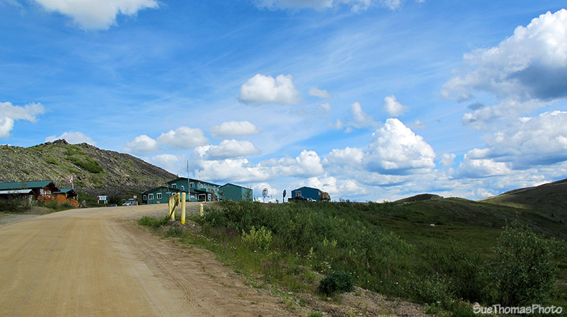
The community of Chicken ahead ...
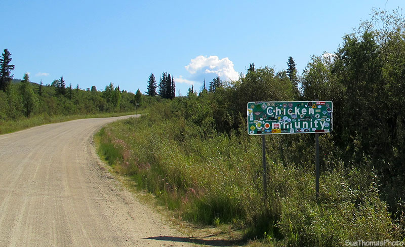
Sign approaching Chicken Community on the Taylor Highway
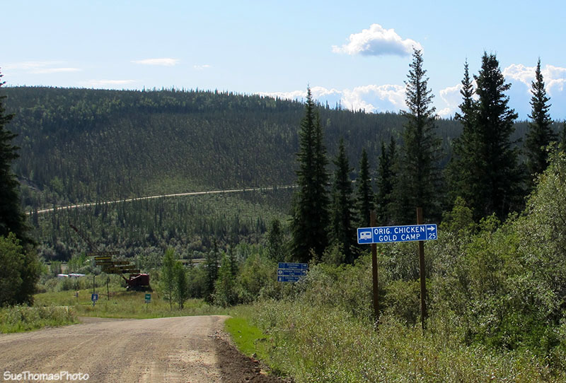
Around the corner and down the hill to Chicken ...
This year we stopped to fill the truck with diesel. Usually we simply pass on by. Many folks enjoy the stay here but it has never appealed to us. I also used the last of our American money to buy Steve a Chicken t-shirt; it remains one of his favourites!
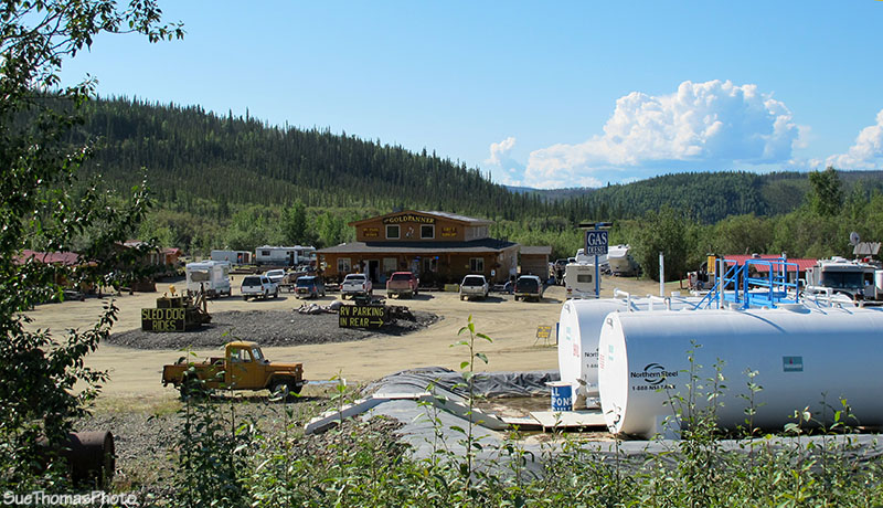
Facilities at Chicken - N64 04.303 W141 55.766
In September 2010 this area was reconstructed due to flooding and washouts. This year, it was fine. All gravel, but in good shape. Just past the South Fork River Wayside, we crossed over the bridge.
- N64 03.642 W141 45.604
At about Mile 82 we drove into the Walker Fork Recreation Site. It wasn't too our liking...small campsites with limited privacy. So we carried on.
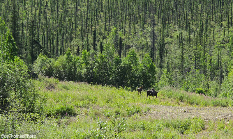
Passing by one spot near Wade Creek, about Mile 88, I saw movement to the right. Steve stopped and backed up. There was a moose calf. Then mom popped her head out of the bush. She didn't appreciate us being near her young one. Cow moose can be very dangerous and have killed people while protecting their calves.
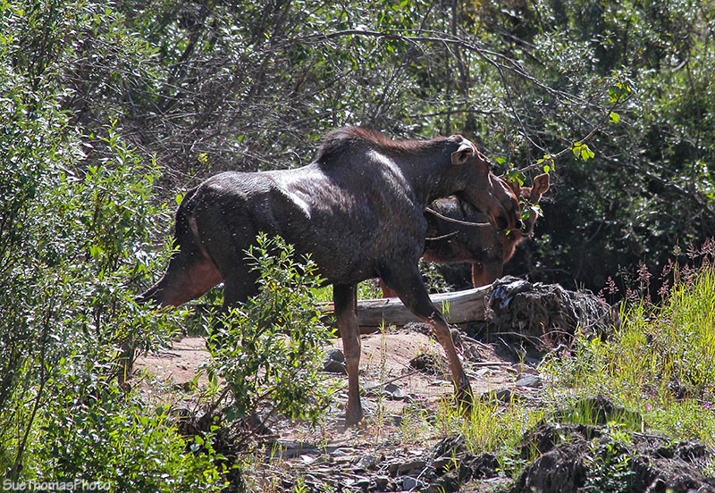
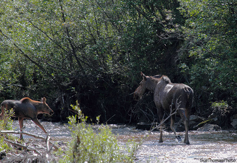
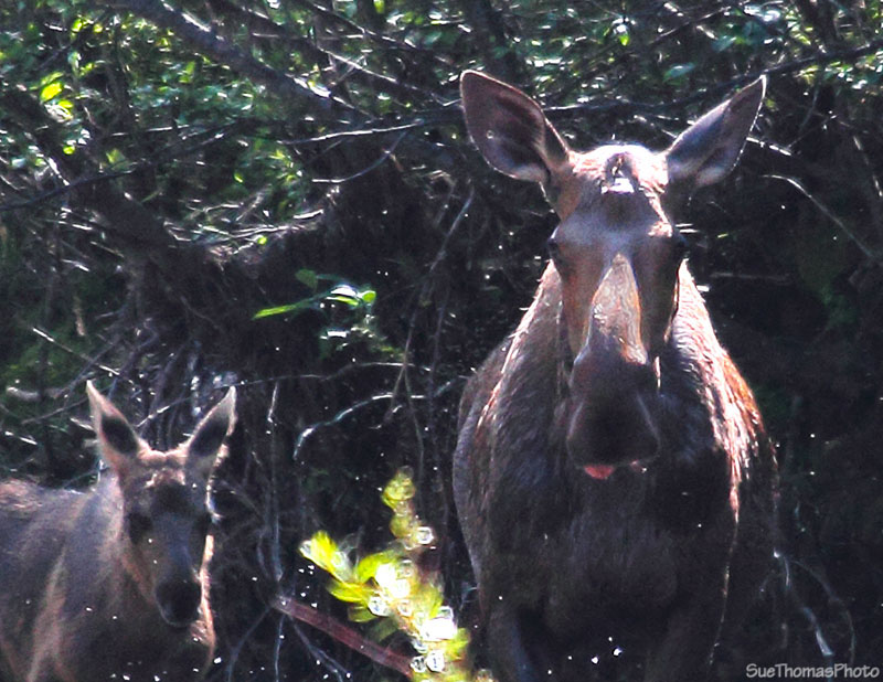
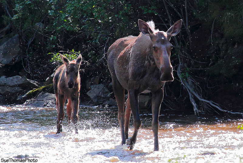
Cow moose and her calf
The cow followed the creek then turned into the bush and headed into the hills.
The highway gets narrow through this area. With many turns.
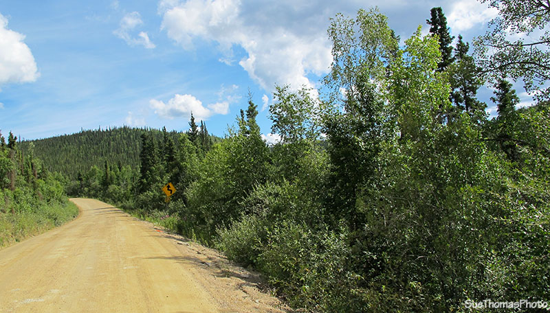
Taylor Highway eastbound at about Mile 93 - N64 09.842 W141 22.862
At the Jack Wade Junction, you can turn north to Eagle, or carry on to the Yukon border. The highway to Eagle was in rough shape due to last year's washouts so we continued by.
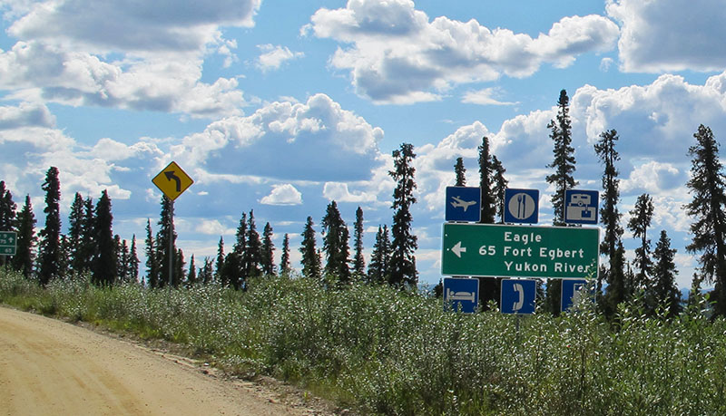
Sign marking the Jack Wade Junction and the Taylor
Highway to Eagle - N64 08.264 W141 20.168
Between the Jack Wade Junction and Yukon border is the very small community of Boundary. There is also an airstrip at Boundary.
Approaching Boundary on the Taylor Highway - N64 04.680 W141 06.471
Between Boundary and the border we meet two Holland America buses. The dirt road was very narrow. Not too many options available so Steve pulled onto the soft shoulder and stopped. The bus inched by.
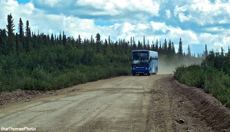
Holland America bus full of tourists
The Davis Dome Wayside is a good spot to pull in and collect your paperwork for the border crossing. I imagine a few folks overnight here when the border crossing is closed for the night.
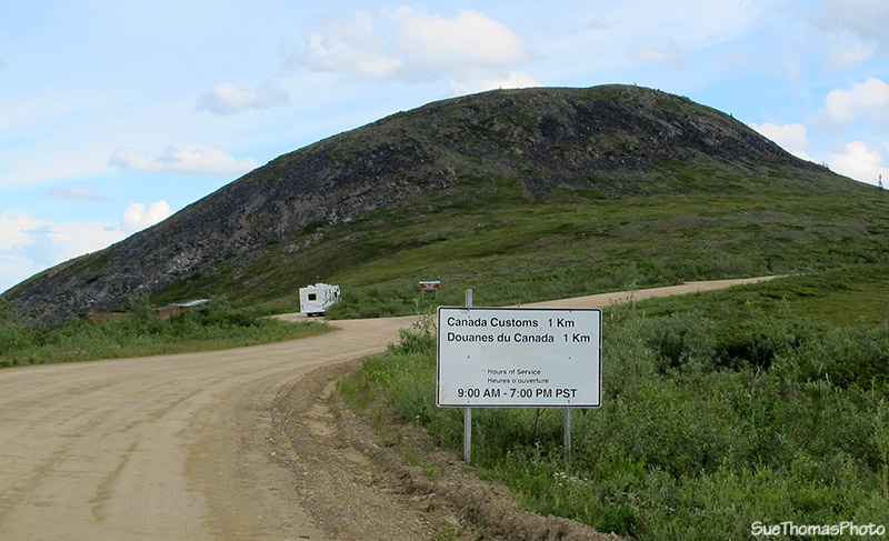
Canada Customs open from 9 a.m. to 7 p.m. Pacific Standard Time
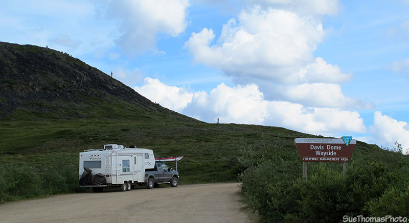
Truck, fifth wheel, motorcycle and kayaks at the Davis Dome Wayside!
From this viewpoint, on a clear day one can see for miles, literally!
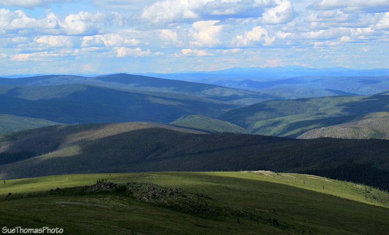
View from the Davis Dome Wayside viewpoint
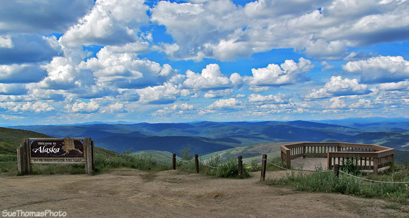
Welcome to Alaska sign and viewpoint - N64 05.085 W141 01.040
Then on to the border ...
Canada and US Customs ahead
It took only a few minutes to answer the questions. Then we were on our way.

Love arriving home to Yukon! - N64 05.076 W140 59.409
Just east of the border crossing there is a good spot to pull in and look over the scenery. I sometimes wonder how cold and miserable this spot would be in winter!
Looking back at the buildings at the border crossing - N64 05.076
W140 59.409
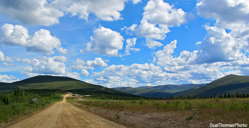
From the same spot, look east and see the highway climbing even higher!
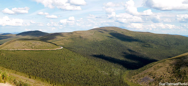
Top of the World highway eastbound from the Yukon/Alaska border
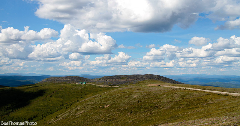
It wasn't long before we arrived at our camp spot. I had waypointed the location in the GPS last year so it was easy to find again. Last year it was very windy and cold in September so we didn't overnight. This spot is off the highway a bit and very private.

Overnight boondock spot on the Top of the World
About an hour after we set up camp, a couple of cyclists pulled in. They asked if we minded sharing the landscape. Not at all. They also asked if we could share some water. Then I realized there was no water up on top of the ridges. No creeks from which they could re-supply their water! They said they had to ask RVers for water the night before too. They also said they were fatigued from the hill climbs. No doubt!
We enjoyed a campfire later in the evening. And hiked across the hills too. The highway gets very quiet at night because the border crossing is closed. Before bedtime we went for a walk on the highway with the dogs. There was no traffic to worry about because it was after 9 p.m. and the border was closed. It was also warm!

Dog walk on Top of the World