
ALASKA HIGHWAY
Dawson Creek, BC
to Delta, Alaska
YUKON
Map with
Hwy links
Kluane Lake area
Campbell Hwy
Dempster Hwy
Dawson City
Klondike Hwy-North
Klondike Hwy-South
Haines Road
Nahanni Range Rd
Silver Trail
South Canol Road
Top of the World
Hwy
BEARS
Grizzly
/ Black
WILDLIFE
BIRDS
NORTHERN LIGHTS
ALASKA
Taylor Hwy
Denali National Park
McCarthy Road
Richardson Hwy
and more
BRITISH COLUMBIA
Cassiar Highway
Liard Hot
Springs
PLAN YOUR TRIP
Planning Links
Campgrounds/POIs
YUKON sights
2020
2019
2017
2016
2015
2014
2013
2012
2011
RV BLOGS
Vancouver Island
to Yukon & Alaska
2010 Aug & Sept
2009 September
2008 June
2007 September
2001 December
2000 August
1998 December
1997 September
1993 September
North Klondike Highway, Whitehorse to Dawson City
 |
For more images of this route, visit pages with details of the day: Also see my page dedicated to |
Just a bit north of Whitehorse is the turn to the right to head to Dawson
City.
From Lake Laberge to Braeburn be alert for the Braeburn elk herd.

Elk don't mind being on the highway even with traffic close by
- May 2013
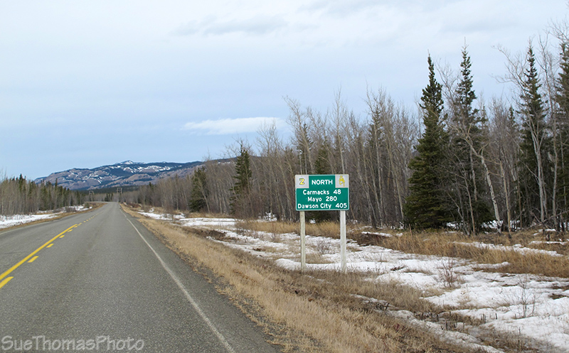
Kilometres on the distance sign beside the North Klondike Highway -
May 2013
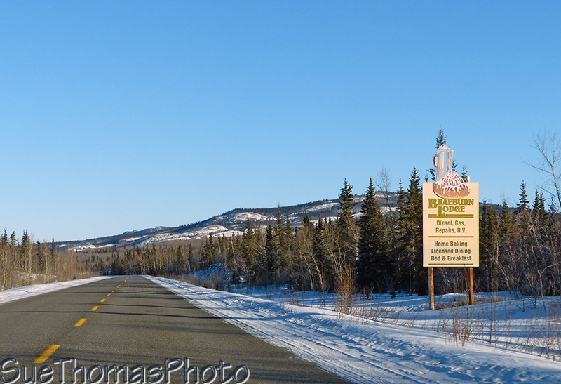
Braeburn Lodge has very good cinnamon buns
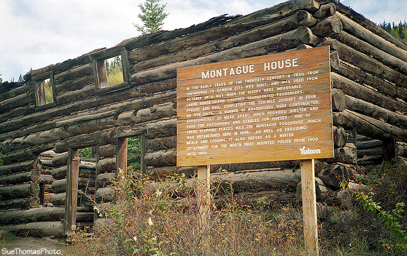
Montague Roadhouse at km 322 was built in 1900 but burned down. This replacement was built in 1915 and was a roadhouse until the 1950s. Some preservation work has been done.
September 1996
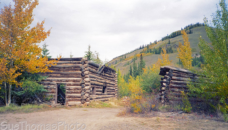
September 1996
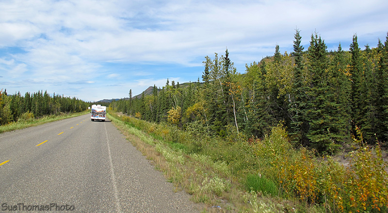
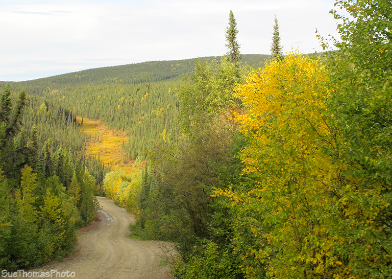
Northbound near km 334 - September 2012

Sign at the edge of Carmacks - May 2013
The Klondike and Campbell Highway junction is north of "downtown" Carmacks
and the
Yukon River. The Coal Mine
RV Park is located at this junction, seen below on the right.
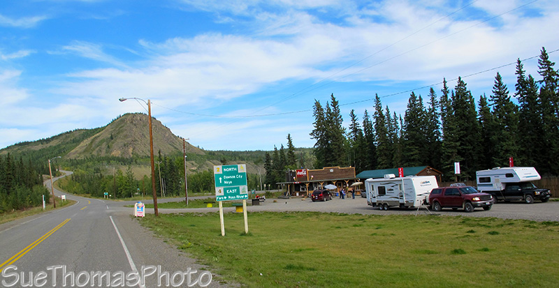
Turn right to take the Campbell Highway to Faro, Ross River & Watson
Lake - September 2012
Five Finger Rapids on the Yukon River is about 40 km north of Carmacks. The river is split by four small rocky islands. There is a large rest area by the highway above the rapids at km 380. If you feel ambitious, take the stairs down and hike to the viewing platform near the islands.
The two pictures below were taken from the same location: one in fall and one in spring.
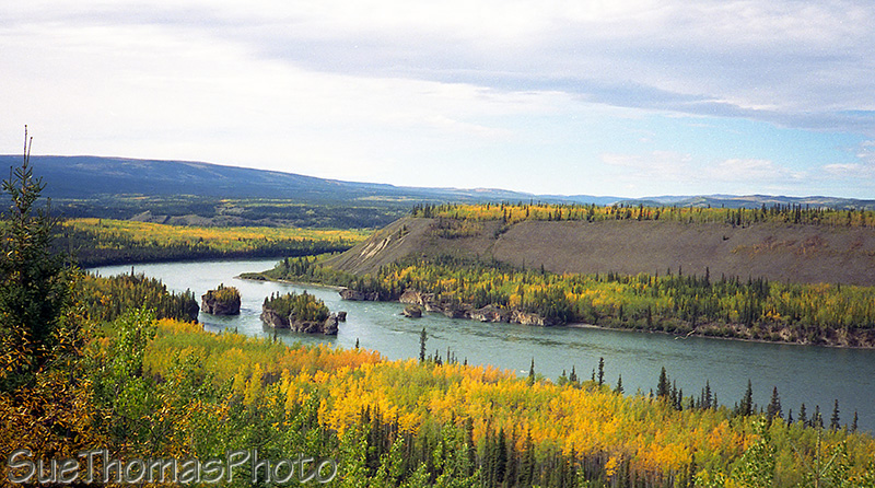
Five Finger Rapids - September 1993
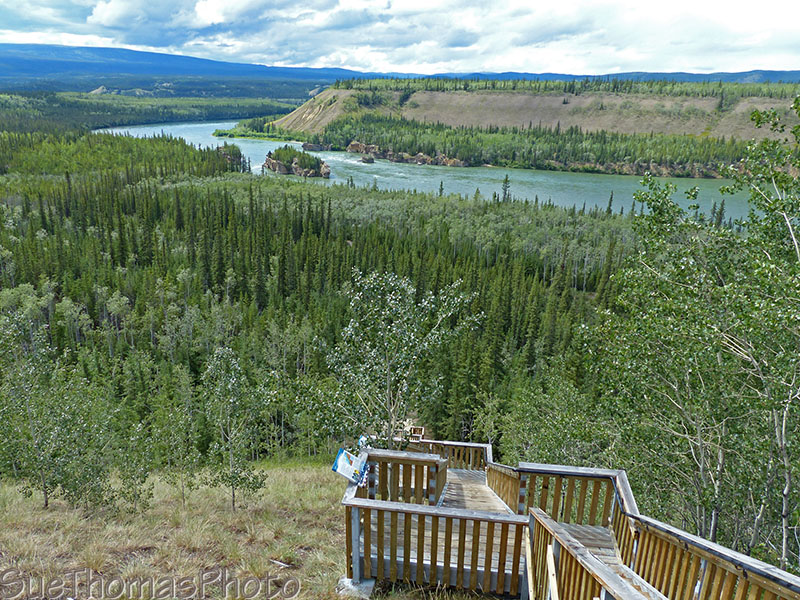
Showing the stairs down for the trail to Five Finger Rapids -
June 2015
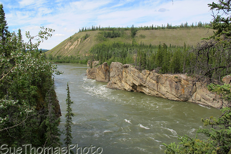
View of Five Finger Rapids from near the lookout platform -
July 2012
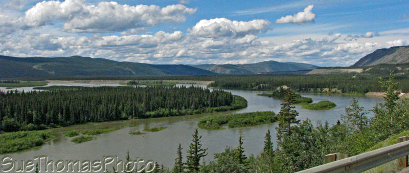
The Pelly River flows 530 kilometres through south central Yukon to join the Yukon River.

Pelly River at Pelly Crossing - September 1993
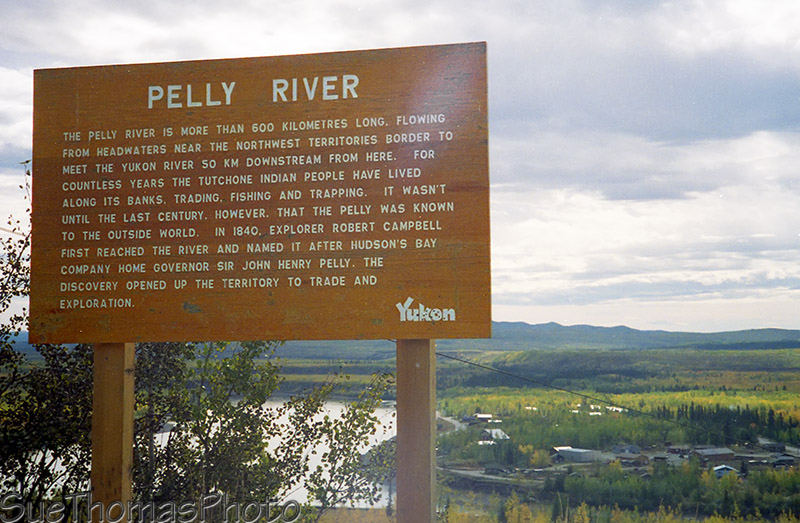
Roadside sign at Pelly River - September 1993
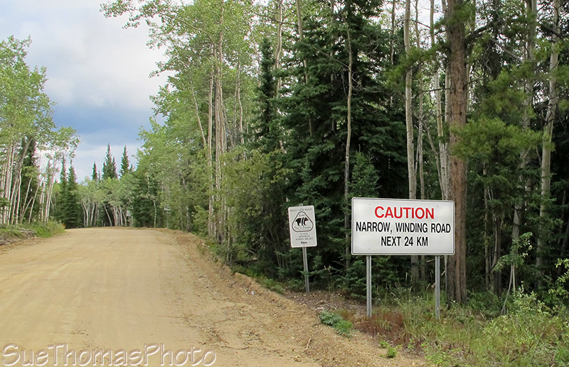
Ethel Lake Yukon Gov't campground is a long drive on a rough road. We tried to make it in with the fifth wheel in 2011. In 2012 we got there. The road was slippy when it was wet. Drive carefully!
Sign at the start of the Ethel Lake Road -
July 2011
The road into Ethel Lake Yukon Gov't campground -
September 2012
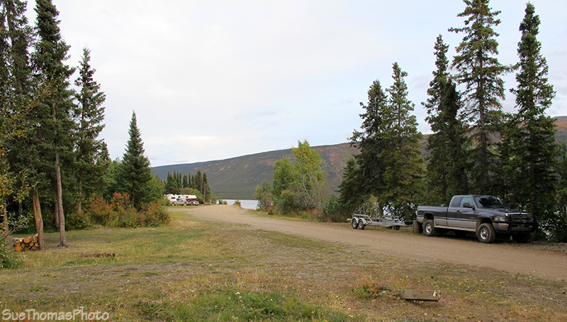
Ethel Lake Yukon Gov't campground - September 2012
For more images of the Ethel Lake area, see my 3 September 2012 page.
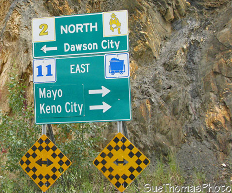
Just north of the Ethel Lake turn-off is the small community of Stewart. After crossing the Stewart River bridge northbound, you can choose to turn left for Dawson City or turn right towards May and Keno City on the Silver Trail.
The Silver Trail is a nice drive. Keno City is an interesting historical location. It would take a day to drive in and another to drive out. We stayed two nights at the Five Mile Lake Yukon Gov't campground near Mayo and drove without the fifth wheel to Keno.
Sign at the north end of the Stewart River bridge
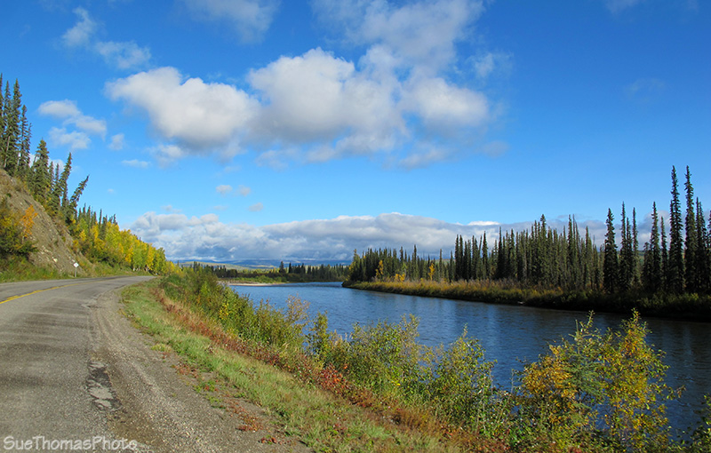
Continuing northwest towards Dawson City, the highway is beside the Stewart River.
The Stewart River north of Stewart Crossing - June 2008

North Klondike Highway between Stewart and Dawson City - June 2008
Northbound on the North Klondike Highway -
September 2012
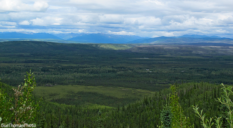
There is a rest area by the Tintina Trench. This linear valley extends into Alaska and south across
the Yukon.
Beneath the Tintina Trench is a fault line along which the bedrock has shifted a
minimum of 450 km laterally. It is a popular route with migrating birds
too.
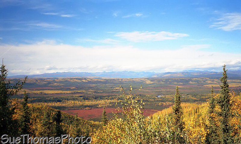
Tintina Trench - September 1993
Tintina Trench - July 2011
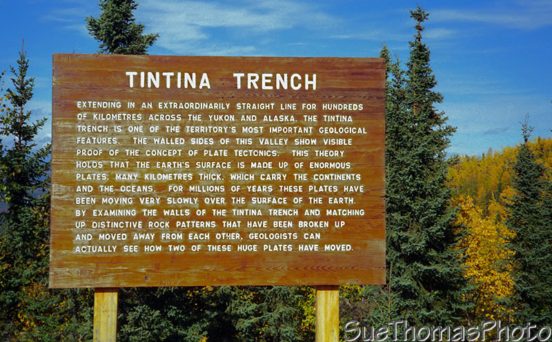
Roadside sign at Tintina Trench - September 1993
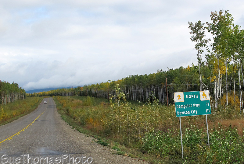
The Klondike Highway is beside the Klondike River near the Dempster Highway junction.
Klondike River on the right approaching the Dempster Highway
junction - September 2012

Approaching the Dempster Highway - June 2008
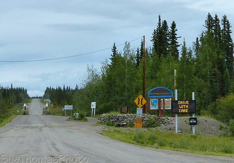
The junction of the North Klondike and Dempster Highways - June 2015
Please visit my Dawson City page for more info about this grand historical town!