
ALASKA HIGHWAY
Dawson Creek, BC
to Delta, Alaska
YUKON
Map with
Hwy links
Kluane Lake area
Campbell Hwy
Dempster Hwy
Dawson City
Klondike Hwy-North
Klondike Hwy-South
Haines Road
Nahanni Range Rd
Silver Trail
South Canol Road
Top of the World
Hwy
BEARS
Grizzly
/ Black
WILDLIFE
BIRDS
NORTHERN LIGHTS
ALASKA
Taylor Hwy
Denali National Park
McCarthy Road
Richardson Hwy
and more
BRITISH COLUMBIA
Cassiar Highway
Liard Hot
Springs
PLAN YOUR TRIP
Planning Links
Campgrounds/POIs
YUKON sights
2020
2019
2017
2016
2015
2014
2013
2012
2011
RV BLOGS
Vancouver Island
to Yukon & Alaska
2010 Aug & Sept
2009 September
2008 June
2007 September
2001 December
2000 August
1998 December
1997 September
1993 September
Top of the World Highway, Yukon
Alaska/Yukon Border to Dawson City, Yukon
The Top of the World Highway, also called the 60 Mile, traverses the mountains between the Alaska/Yukon border and Dawson City.
The Taylor Highway is the route's title in Alaska, between Tetlin Junction (Alaska Highway) and the Jack Wade Junction where the Taylor Highway turns northward to Eagle. Between the Jack Wade Junction and the Alaska/Yukon border there is a 13 mile (21 km) connector called the Boundary Spur Road.
For more images of this route, see each day's photologue:
- September 2010 - includes some moose photos
- July 2011
- September 2012
This page starts at the Alaska/Yukon border and moves east to Dawson
City.
On a sunny
September day, it is lovely!
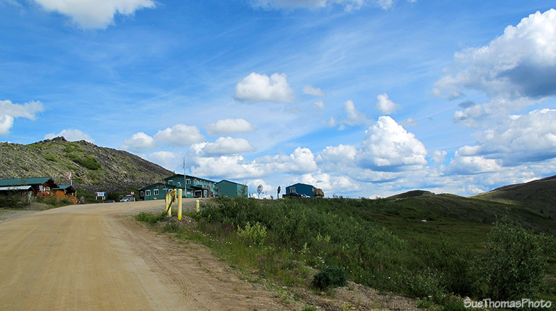
Canada and US Customs
- border crossing ahead -
July 2011

Love arriving home to Yukon! - July 2011
East of the border crossing there is a good spot to pull in and look over the scenery.
Looking back at the buildings at the border crossing -
September
2010
Look east and see the Top of the World Highway twist its way across the mountain ridges.

Top of the World highway eastbound from the Yukon/Alaska border -
September
2010
Further east there is a good spot off the highway to park on overnight.

Overnight
camp spot beside the Top of the World highway-
July 2011

Evening walk with the dogs, no
traffic because Customs was closed!
Back on the road heading east to Dawson City.

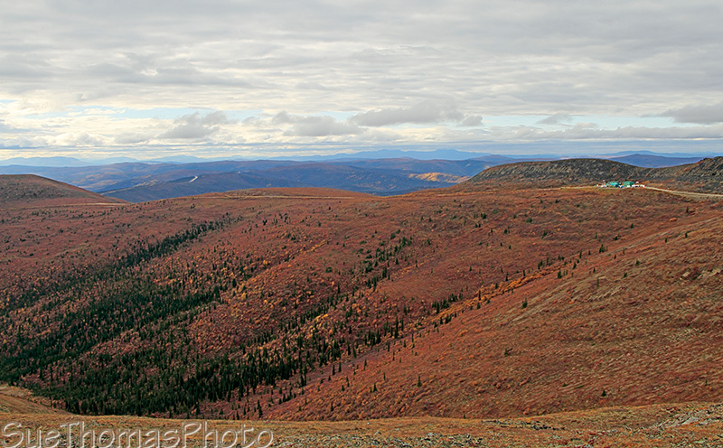
Looking to the north approaching Swede Dome eastbound - September
2010

Trucks exiting from the mining road near Swede Dome - September 2010
A few kilometres later is the road to Clinton, a closed mining town and Forty Mile, a historical site in Yukon. Historically, Clinton was an active asbestos mine. I remember visiting as a kid and being astounded by the huge trucks moving about the mine.
We visited Clinton Creek and overnighted near Forty Mile in 2012.

Rustic road into Clinton Creek and Forty Mile -
September 2012
Back onto the Top of World highway heading towards Dawson City.

Top of the World Highway is gravel -
September 2010
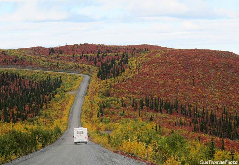
RV headed towards Alaska on the Top of the World Highway -
September
2012

View northward from the Top of the World Highway - September 2010
The mountains go on forever.

View from Top of the World Highway - September 2010
Before the long descent to the Yukon River there is a rest area announcing that Dawson City is near. There are also some trails in the area for stretching the legs.

View from the rest area at the top of the hill approaching Dawson
City - September 2010
Then onward and downward to Dawson City!

View from the highway, looking southward on the Yukon River -
September 2010
During 2010 the highway wasn't busy due to the construction on the Alaska side of this route so I was able to stop on the highway and take pictures of the Yukon River and Dawson City.

View of Dawson City from the west side of the Yukon River -
September 2010
The highway continues downhill to the Yukon River and its ferry crossing.

Signs for the Yukon River campground and Dawson City, just
2 km - September 2010

The highway is paved approaching Dawson City - September 2010
At last! The Yukon River and signs indicating the ferry crossing is just ahead.

Approaching the ferry landing to cross the Yukon River into Dawson
City -
N64 04.616 W139 26.685
The ferry continuously toils across the river. When tourist season is at its peak, there can be waits of up to three hours, especially when there are RV caravans waiting to cross.
However, there were few in line in 2010 because
of the road troubles on the Taylor Highway.
Mid-September is too late in the season for many so there were no
waits on this day.

Sign on the west side of the Yukon River, at the ferry landing -
September 2010
The "landings" are nothing more than dirt ramps leading down to the river's edge. The ferry drifts a bit downriver then approaches the landings under power, ramming the ramp up onto the dirt. The crossing takes only a few minutes.
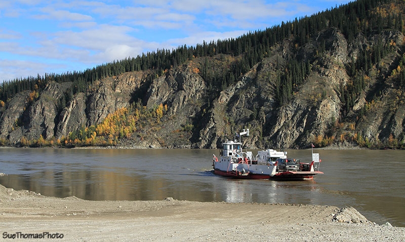
George Black ferry on the west side of the Yukon River
To see more of Dawson, visit my page of the historical buildings in the city.