
ALASKA HIGHWAY
Dawson Creek, BC
to Delta, Alaska
YUKON
Map with
Hwy links
Kluane Lake area
Campbell Hwy
Dempster Hwy
Dawson City
Klondike Hwy-North
Klondike Hwy-South
Haines Road
Nahanni Range Rd
Silver Trail
South Canol Road
Top of the World
Hwy
BEARS
Grizzly
/ Black
WILDLIFE
BIRDS
NORTHERN LIGHTS
ALASKA
Taylor Hwy
Denali National Park
McCarthy Road
Richardson Hwy
and more
BRITISH COLUMBIA
Cassiar Highway
Liard Hot
Springs
PLAN YOUR TRIP
Planning Links
Campgrounds/POIs
YUKON sights
2020
2019
2017
2016
2015
2014
2013
2012
2011
RV BLOGS
Vancouver Island
to Yukon & Alaska
2010 Aug & Sept
2009 September
2008 June
2007 September
2001 December
2000 August
1998 December
1997 September
1993 September
Cassiar Highway, Hwy 37 in Northern British Columbia
starting at Highway 16 (Yellowhead Highway)
The Cassiar Highway is about 450 miles long. The Cassiar route from Prince George to Whitehorse is about 210 km (130 miles) shorter than the Alaska Highway route from Prince George to Whitehorse.
In 2007, we drove north on the Cassiar and returned on the Alaska Highway. While overnighting south of Fort Nelson we decided the Cassiar Highway would be our preferred route on future trips.
In 2008 and 2009, we travelled north and south on the Cassiar. The scenery is better southbound, even though it is all the same trees and mountains.
In 2010 we went north on the Alaska Highway and returned south on the Cassiar.
See my page Highway 37A for pictures from Meziadin Junction to Stewart, Hyder, Fish Creek and Salmon Glacier.

Northbound on the Cassiar Highway, south of Meziadin
Junction - June 2008
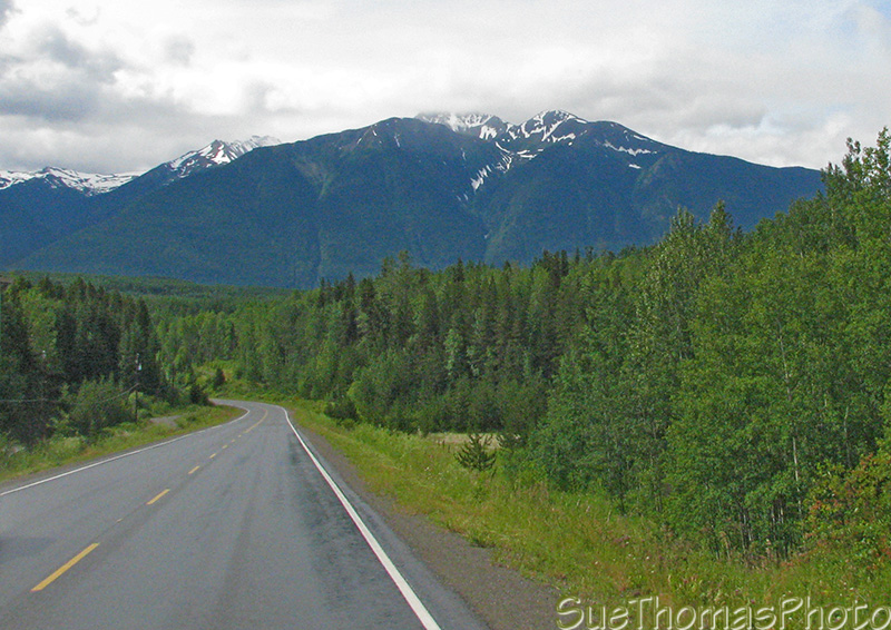
Southbound on the Cassiar Highway, south of Meziadin
Junction - July 2008
Meziadin Lake provincial park is near where Hwy 37 and Hwy 37A meet.
Highway 37A is a very scenic route that leads to
Stewart, B.C. and Hyder, Alaska.
Salmon Glacier
is beyond Hyder and worth the drive to see it.
The campground at Meziadin Lake Provincial Park has many waterfront spots as well as numerous sites with water views.

Meziadin Lake Provincial Park and campground, near
Meziadin Junction - June 2008
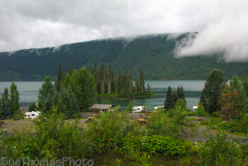
View of Meziadin Lake Provincial Park and campground - August 2009
North of Meziadin Junction the paved highway continues.

Cassiar Highway north of Meziadin Lake, northbound - August 2009

Northbound between Meziadin Junction
and Kinaskan Lake provincial park - June 2008

Northbound between Meziadin Junction
and Kinaskan Lake provincial park - June 2008

Northbound between Meziadin Junction
and Kinaskan Lake provincial park - June 2008

Northbound on the Cassiar Hwy, Meziadin Junction
to Kinaskan Lake - June 2008
Kinaskan Lake Provincial Park
has a small campground.
Most of the sites are waterfront with
varying amounts of privacy.

Campsite at Kinaskan Lake Provincial Park and campground - June 2008
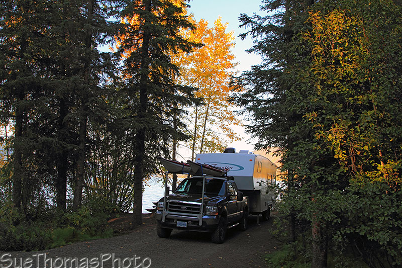
Campsite at Kinaskan Lake Provincial Park - September 2010

Shoreline along Kinaskan Lake, a short hike from the
campground - June 2008

Fall colours on Kinaskan Lake - September 2010

Looking west from the campground at Kinaskan Lake - September 2010

Sun setting on Kinaskan Lake on the Cassiar Highway - September 2010
Now on to the
north end of the Cassiar Highway