
ALASKA HIGHWAY
Dawson Creek, BC
to Delta, Alaska
YUKON
Map with
Hwy links
Kluane Lake area
Campbell Hwy
Dempster Hwy
Dawson City
Klondike Hwy-North
Klondike Hwy-South
Haines Road
Nahanni Range Rd
Silver Trail
South Canol Road
Top of the World
Hwy
BEARS
Grizzly
/ Black
WILDLIFE
BIRDS
NORTHERN LIGHTS
ALASKA
Taylor Hwy
Denali National Park
McCarthy Road
Richardson Hwy
and more
BRITISH COLUMBIA
Cassiar Highway
Liard Hot
Springs
PLAN YOUR TRIP
Planning Links
Campgrounds/POIs
YUKON sights
2020
2019
2017
2016
2015
2014
2013
2012
2011
RV BLOGS
Vancouver Island
to Yukon & Alaska
2010 Aug & Sept
2009 September
2008 June
2007 September
2001 December
2000 August
1998 December
1997 September
1993 September
Whitehorse YT to Anchorage AK
22 March 2014 - Saturday
Had a reason to go to Anchorage, Alaska. Decided to make the
drive in a single day.
On the road at 7 a.m. headed north.

Moon over the Alaska Highway
Approaching Haines Junction, the sun started to ease over the mountain ridges.

Sunrise on the Kluane Ranges / St. Elias Mountains from the rest
area east of Haines Junction
Approaching Kluane Lake the light was still dull, especially with the overcast clouds. When I saw a moose munching alongside the highway, had to stop and try some pictures. She cooperated nicely...

Cow Moose near Kluane Lake

Cow moose near Kluane Lake
Carrying on around Kluane Lake, the view of Sheep Mountain deserved some photos too. I might compile a page of the many images I have of the mountain during different seasons and conditions.

Heading towards Sheep Mountain beside Kluane Lake
The mountain is called Sheep Mountain for a reason; many Dall Sheep
thrive on it.
On occasion, the sheep are on the road...
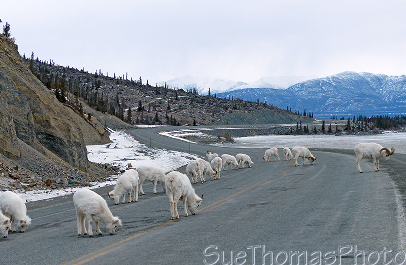
Dall Sheep on the Alaska Highway beside Kluane Lake

Ram flirting with me
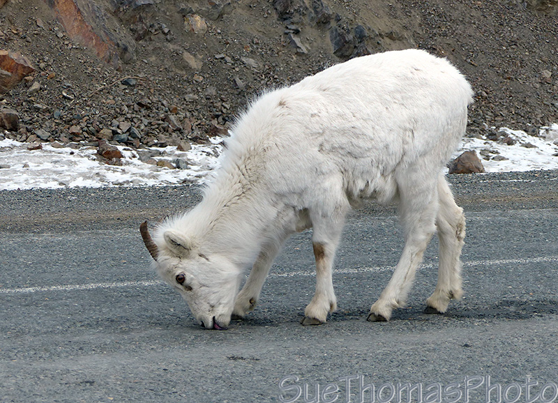
Licking at the cracks in the Alaska Highway

Looking west over the Donjek River from the Donjek bridge
At the Donjek River, there was an electronic sign with a message from the highway maintenance crews: UNEVEN ROAD SURFACE

Approaching Pickhandle Lake
Carrying on, I encountered some of the uneven road surfaces...

The freeze thaw cycle wreaks havoc on the highway in this area

Northbound through Beaver Creek
I grew up in Beaver Creek and was tempted to stop.
Needed to make time though; Anchorage was still hours and hours
away.

Beaver Creek customs
The Alaska Highway between Beaver Creek and the border has been upgraded many times. There is a long stretch of good gravel now.

Gravel highway between Beaver Creek and the border
At the Alaska border crossing, I was asked where I was going, for what reason and for how long. Was also asked if I would be leaving anything in Alaska. Then I was on my way again.

Caribou (reindeer) getting off the highway

Caribou carrying on over the hill

Crossing the newer Tanana River bridge heading towards Tok

Tok - Mile 1313, Alaska Highway
Weather was spectacular and road was in great condition.

The view about 15 miles from the junction in Tok
Southwest bound out of Tok the highway is straight and the mountains lovely.

Near the Tok River

Nelchina Glacier and Nelchina River in the distance, south of the
highway
Highway elevation about 3,300 feet.

Popular area for snowmobiling

Not a cloud in sight! Coordinates N61.90994 W147.28338

Matanuska River in the distance - N61.83076 W147.41242

Lions Head is the darker blue hump - N61.80783 W147.51987

Matanuska Glacier - N61.79737 W147.74604
It was nearly 5 p.m. my time (4 p.m. Alaska time). I'd been on the road for 10 hours, stopping only for fuel and a few minutes at the border crossing.

Long Lake and Kings Mountain
- N61.81045 W148.18696
Arrived at my Anchorage hotel at 6:30 p.m. after 11.5 hours on
the road. According to the GPS,
11 hours was moving time at
an average speed of 97 km/h (60 mph) over 1,074 km (667 miles).
While visiting Anchorage, I took a quick drive out Turnagain Arm...

Turnagain Arm - 6:30 p.m.
Later in the week I needed some fresh air so headed out for an evening walk along the walking trail around Cook Inlet.

Looking westward across Cook Inlet
The evening was beautiful, these images were taken at 6:00 p.m. Alaska time.

No mud flats now
On March 28, I drove home, again in a single day. Stopped for many more pictures though, so the drive took an hour longer!
Previous page - 2 March 2014
Next page - 28 March 2014