
ALASKA HIGHWAY
Dawson Creek, BC
to Delta, Alaska
YUKON
Map with
Hwy links
Kluane Lake area
Campbell Hwy
Dempster Hwy
Dawson City
Klondike Hwy-North
Klondike Hwy-South
Haines Road
Nahanni Range Rd
Silver Trail
South Canol Road
Top of the World
Hwy
BEARS
Grizzly
/ Black
WILDLIFE
BIRDS
NORTHERN LIGHTS
ALASKA
Taylor Hwy
Denali National Park
McCarthy Road
Richardson Hwy
and more
BRITISH COLUMBIA
Cassiar Highway
Liard Hot
Springs
PLAN YOUR TRIP
Planning Links
Campgrounds/POIs
YUKON sights
2020
2019
2017
2016
2015
2014
2013
2012
2011
RV BLOGS
Vancouver Island
to Yukon & Alaska
2010 Aug & Sept
2009 September
2008 June
2007 September
2001 December
2000 August
1998 December
1997 September
1993 September
Cassiar Highway, Hwy 37 in Northern British Columbia
Kinaskan Lake to the Alaska Highway in Yukon
See south end of the Cassiar
Highway for pictures south of Kinaskan Lake.
The south end page also
includes links for additional info about the Cassiar Hwy.
The paint lines used to end near Kinaskan Lake. In 2010 there were improvements to this route and the paint lines now go further northward.

Driving southbound near Kinaskan Lake, approaching the beginning of
the paint lines - Sept 2009
The Cassiar Hwy continues northward with 2 lanes of asphalt with minimal shoulders.
Travelling southbound on the Cassiar Highway approaching Kinaskan
Lake - September 2009
In some spots the asphalt is rough. Some folks expressed concern regarding the roughness and narrowness of the north end of the Cassiar. It is not uncommon to hear tall tales of the horror of the highway. We think it is fine. We meander along this route at an easy pace.
This picture accurately reflects the road width and conditions ...
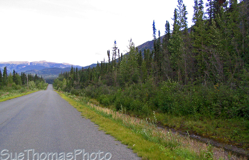
Northbound on the
Cassiar Highway north of Kinaskan Lake - August 2009

View of glacier on the west side of Eddontenajon Lake - September
2009

Southbound north of Eddontenajon - Kluachon & Eddontenajon Lakes on
the right - Sept 2010
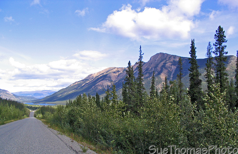
North of Iskut and south of the Stikine River is the Morchuea Lake Recreation Site. There is a stunning view of Mt. Edziza within the Mount Edziza Provincial Park.

Mount Edziza south of Morchuea Lake - September 2009
To see wildlife requires looking all around while touring. Movement in a distant marsh area got my attention. The reward was nice pictures of a cow moose even though she was far away.

Cow moose south of Dease Lake, in a
marshy area on the east side of the highway - June 2008
Dease Lake is a good community for replenishing fuel and groceries.
The Cassiar Highway north of Dease Lake is paved now but wasn't in
the past.
However, in spring there can be numerous potholes and
pavement breaks requiring repair.

North end of Dease Lake from the Cassiar Hwy - September 2010 -- N58
47.868 W130 04.996

Dease River Crossing, a commercial campground on the Cassiar Highway
- August 2009
We enjoy the drive through this area. It is scenic and wildlife abundant.
Approaching Good Hope Lake on the Cassiar Highway northbound -
August 2009
We enjoy staying at Boya Lake Provincial Park (link to BC Parks) and have stayed during three different seasons. The lake is unique and always lovely, regardless of season or weather.

Boya Lake on a September morning - September 2007
In 2009 we explored the lake with kayaks. It is much larger than it appears from the campground and has numerous islands. Visit Google Maps here to see the layout of the lake.
The white lake bottom reflects the light through the crystal clear waters.
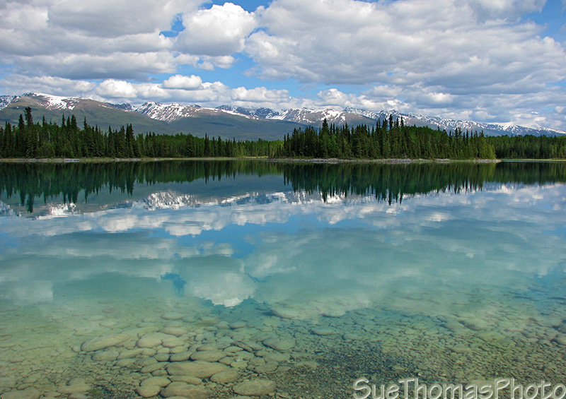
Boya Lake Provincial Park and campground, along the
lakeshore near a campsite - June 2008
Visit my page dedicated to this special park.
There is a stretch of about 30 km on the north end of the Cassiar where forest fires burned during the summer of 2010. The highway was closed for several weeks.

2010 forest fire damage at Blue Lakes on the Cassiar Hwy - Sept
2010 -- N59 49.914 W129 07.985
The north end of the Cassiar has been improved in recent years. Even so, it is narrow and there are rough spots. Take your time. Enjoy the sights.
If you are northbound, the Alaska Highway is near. The solitude of the Cassiar will be left behind.
North of Boya Lake, northbound on the Cassiar Highway at km 665 -
August 2009

Southbound from Yukon into B.C., Cassiar Highway - Sept 2011 - N60
00.169 W129 03.096

Leaving BC on the Cassiar Highway northbound at km 720 - August 2009

Yukon sign at the border between British
Columbia and Yukon, looking north - July 2008
In 1993 the sign was different, but note the same fir tree with the hook in it ...
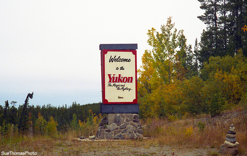
The sign in 1993 ...
The Alaska Highway is a very short drive from the border, about 3 km.
Sign at the north end of the Cassiar Highway - August 2009
Now on to the Alaska Highway,
northbound to Whitehorse.