
ALASKA HIGHWAY
Dawson Creek, BC
to Delta, Alaska
YUKON
Map with
Hwy links
Kluane Lake area
Campbell Hwy
Dempster Hwy
Dawson City
Klondike Hwy-North
Klondike Hwy-South
Haines Road
Nahanni Range Rd
Silver Trail
South Canol Road
Top of the World
Hwy
BEARS
Grizzly
/ Black
WILDLIFE
BIRDS
NORTHERN LIGHTS
ALASKA
Taylor Hwy
Denali National Park
McCarthy Road
Richardson Hwy
and more
BRITISH COLUMBIA
Cassiar Highway
Liard Hot
Springs
PLAN YOUR TRIP
Planning Links
Campgrounds/POIs
YUKON sights
2020
2019
2017
2016
2015
2014
2013
2012
2011
RV BLOGS
Vancouver Island
to Yukon & Alaska
2010 Aug & Sept
2009 September
2008 June
2007 September
2001 December
2000 August
1998 December
1997 September
1993 September
Alaska Highway - B.C. border to Whitehorse, Yukon
|
Page contents: More of this portion of the Alaska Hwy: |
 |
We're always happy to return to Yukon! The Alaska Highway dips into British Columbia and into Yukon several times while heading to Watson Lake.

Contact Creek Lodge - August 2010

Sign at Watson Lake - August 2010
Watson Lake - km 980 (historical mile 635)

Arriving at Watson Lake - September 2015

Heading west through Watson Lake -
September 2015
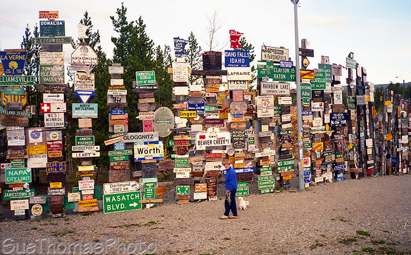
Sign forest at Watson Lake, historical milepost 635 -
September 1993
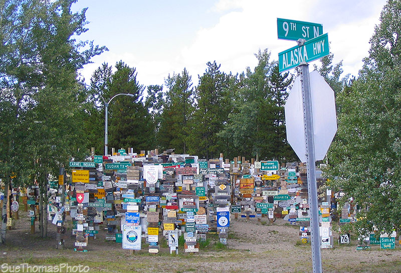
Sign forest in Watson Lake - July 2009

Sign marking the Watson Lake Yukon government campground -
Sept
2017

Walking the dogs at the Watson Lake campground in the evening-
Sept 2017
After you leave Watson Lake heading to Whitehorse, there's a large rest area north of the Highway 37 (Cassiar Hwy) junction. It was good information signs.

Information sign at a rest stop near the AK Hwy junction with Hwy 37
(Cassiar Hwy) - Sept 2015

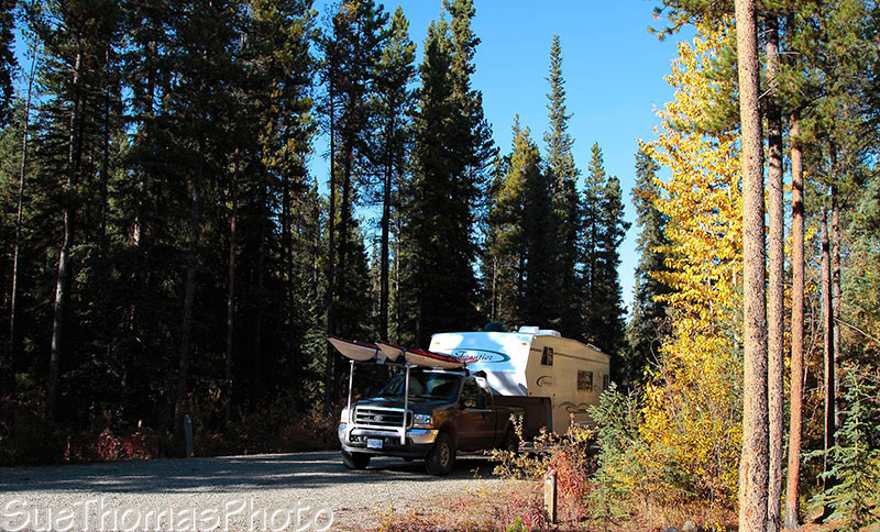
Camped at a lake alongside the Alaska Highway -
August 2010
Big Creek Yukon government campground, about km 1043 -
September 2010
The fall colours can be brilliant in the sunshine!

Fall colours near Big Creek -
September 2010

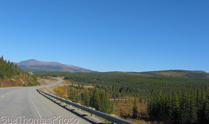
Northbound on the Alaska Highway, north of Junction 37 -
July 2009

Northbound on the Alaska Highway km 1074 -
August 2010
 Southbound near the Swift River Rest
Area - September 2010
Southbound near the Swift River Rest
Area - September 2010
Southbound on the Alaska Highway -
September 2010
Rancheria Falls Recreation Site - km 1084
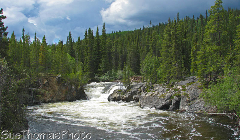
Rancheria Falls Recreation Site, km 1084 (mile 677) -
June 2008

Nearing Teslin on the Alaska Highway northbound -
September 2015

Bridge at Teslin in August 2010
Squanga Lake Yukon government campground - km 1316

Squanga Lake Yukon government campground -
September 2007

Squanga Lake Yukon government campground -
September 2007
 Descending the hill southbound to Johnson's Crossing -
September
2009
Descending the hill southbound to Johnson's Crossing -
September
2009

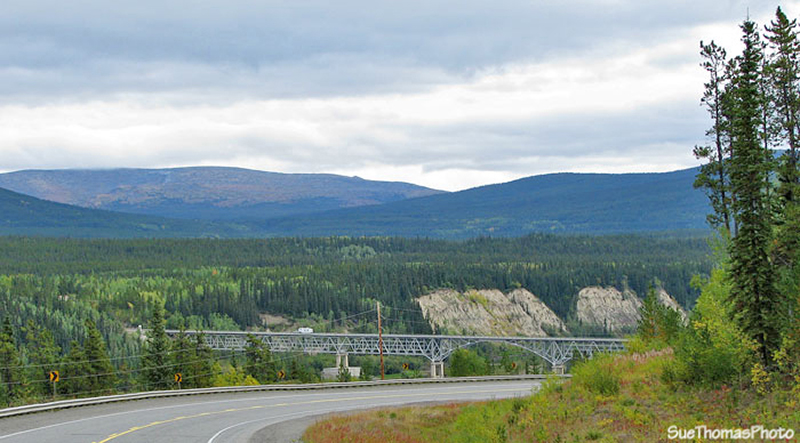
Johnson's Crossing - southbound on the bridge over the Teslin River -
September 2009

View to the south near Jake's Corner - September 2009

Arriving in Whitehorse, northbound on the Alaska Highway - September
2015

Driving into Whitehorse on the Robert Service Boulevard, also called
the south access - August 2010

Historic
SS Klondike in Whitehorse in winter -
January 2014
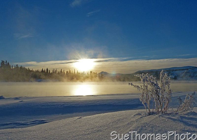
Yukon River running through Whitehorse -
January 2014