
ALASKA HIGHWAY
Dawson Creek, BC
to Delta, Alaska
YUKON
Map with
Hwy links
Kluane Lake area
Campbell Hwy
Dempster Hwy
Dawson City
Klondike Hwy-North
Klondike Hwy-South
Haines Road
Nahanni Range Rd
Silver Trail
South Canol Road
Top of the World
Hwy
BEARS
Grizzly
/ Black
WILDLIFE
BIRDS
NORTHERN LIGHTS
ALASKA
Taylor Hwy
Denali National Park
McCarthy Road
Richardson Hwy
and more
BRITISH COLUMBIA
Cassiar Highway
Liard Hot
Springs
PLAN YOUR TRIP
Planning Links
Campgrounds/POIs
YUKON sights
2020
2019
2017
2016
2015
2014
2013
2012
2011
RV BLOGS
Vancouver Island
to Yukon & Alaska
2010 Aug & Sept
2009 September
2008 June
2007 September
2001 December
2000 August
1998 December
1997 September
1993 September
Whitehorse to Big Creek near Hwy 37 on the Alaska Hwy
15 September 2010 - Wednesday
This morning Tazz was much worse. No pain was apparent but she could not hold herself upright. Laying down seemed to be the best and her preferred position. We set up the back of the supercab so she was laying on a thick foamy. Nestled her into some blankets then departed Whitehorse southbound at about 10:30 a.m., headed towards Vancouver and an appointment with a neurologist on Monday.
With Tazz resting quietly, I felt a bit better. I was fretting though.
As we passed by the junction of the South Canol Road at Johnson's Crossing north of Teslin, there is no doubt we would have turned north to enjoy the drive if Tazz had not been sick. However, it was essential to make miles southward.
At 1 p.m. we stopped for lunch at the Morley River Recreation Site on the Yukon side of the B.C./Yukon border. Tazz didn't want to get out of the truck but we lifted her out so she could pee.
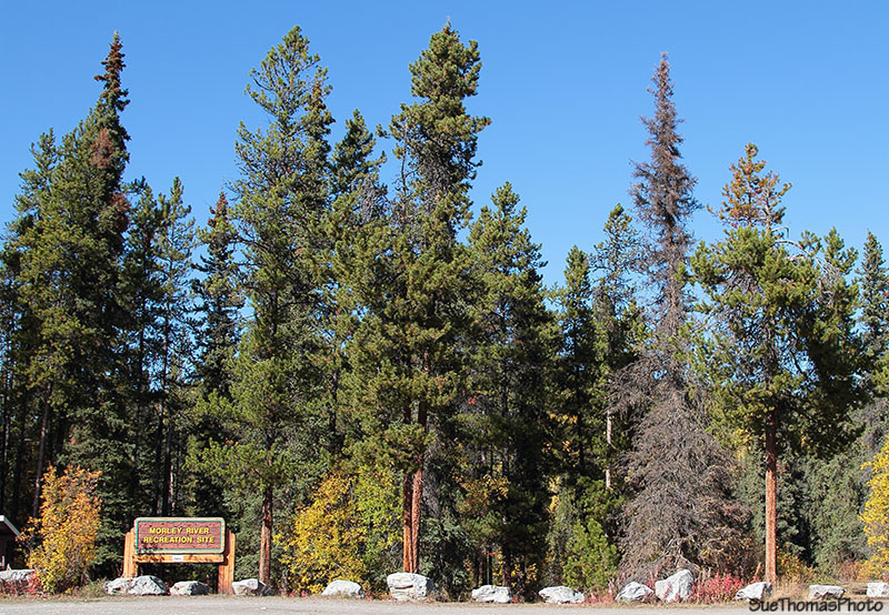
Morley River Recreation Site on the Alaska Highway in Yukon -
N60 00.428 W132 08.145
After lunch, I felt the need to stroll away on my own with the camera. The day was clear, the air was sweet, and it helped ease the stress I was feeling.

Fireweed gone to seed in the autumn
Below the recreation site, the Morley River flows to Morley Lake. There are several paths down to the river.
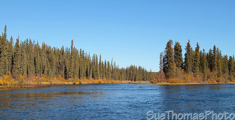
Looking eastward on the Morley River

Looking west on the Morley River
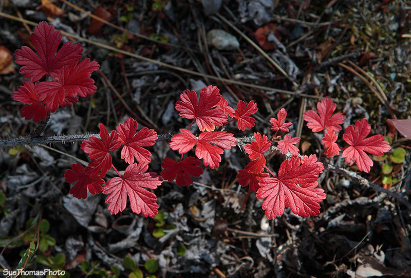
Walking back up to the parking area, I kept
my eyes open for some autumn leaves.
I wasn't disappointed.
The brightness from the trees was distracting. The golden yellow is brilliant in the sunshine.
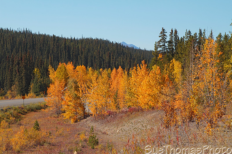
Fall colours along the Alaska Highway near Morley River
The afternoon was lovely. Even so, my mind was on Tazz and her comfort. She didn't move in the back of the truck. Eyes closed. Not at all the high-energy girl we had lived with for 14 months!
On the road again, the sky remained clear and blue as the Alaska Highway dipped into British Columbia. Then back again into the Yukon ...
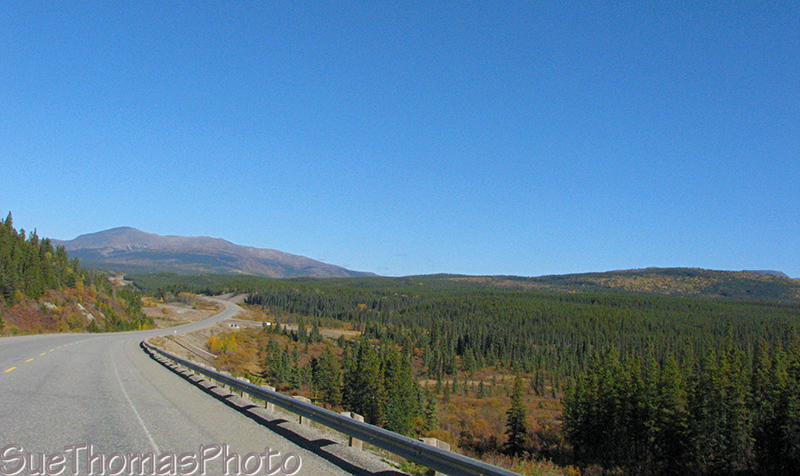
Southbound on the Alaska Highway -
N60 02.562 W131 00.956

Continuing southbound -
N60 02.635 W131 00.736

Southbound on the Alaska Highway just south of the Swift River Rest
Area -
N60 03.076 W130 59.526
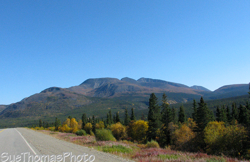
South of the Continental Divide Lodge looking east on the Alaska
Highway -
N60 04.516 W130 53.099
I was worried about Tazz becoming fatigued. We didn't know what was wrong. It was a delicate balancing act -- trying to get to Vancouver without impacting Tazz's well-being.
It was about 4 p.m. when we stopped at the Big Creek Gov't Campground, about 40 km north of the junction of the Cassiar Highway. We felt it important to stop for Tazz to rest.
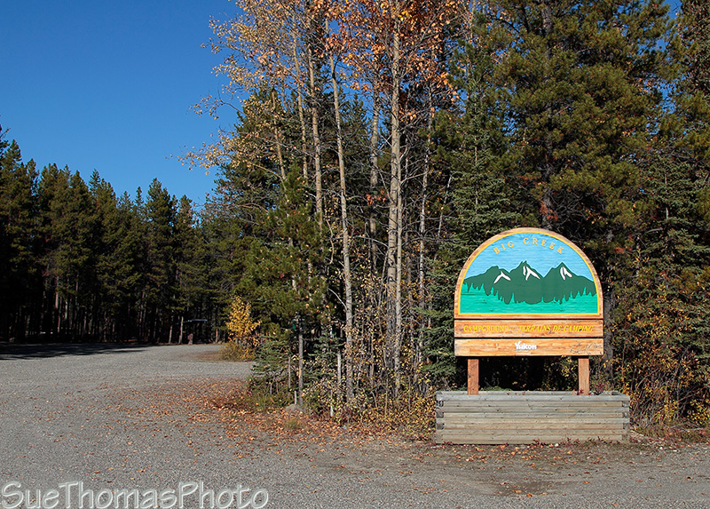
Sign at the entrance to Big Creek Yukon Gov't campground -
N60
09.502 W129 42.424
I took some pictures of the area, looking each way along the Alaska Highway.
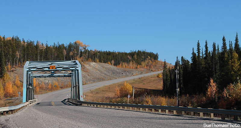
Looking towards the east on the Alaska Highway and the bridge over
Big Creek

Looking westward, again with brilliant hues from the fall colours
This campground, similar to others in the Yukon, has numerous signs.

Sign at Big Creek Yukon gov't campground in Yukon
Eyes are always open for these critters!

Bear warning sign at Big Creek Yukon gov't campground
Then back to the campsite for a quiet evening. Steve checked the creek and tried some fishing with no success. There was lots of moose sign around but we didn't see any of the big brown beasts.
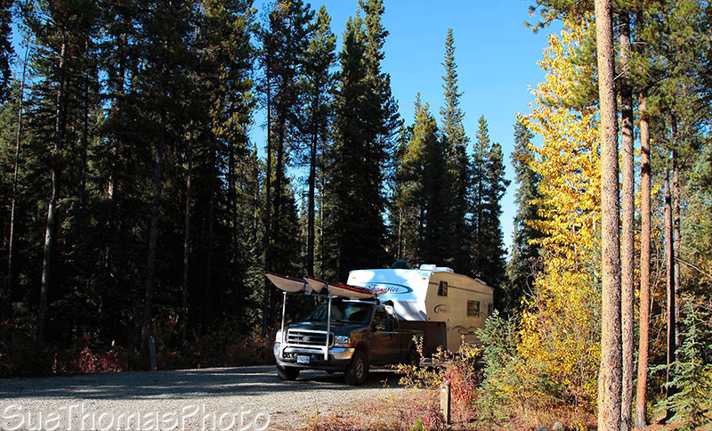
Campsite at Big Creek Yukon gov't campground
Tazz continued to rest throughout the evening. She ate some supper. Then we hobbled her around the campground with our custom sling so she could take care of business. Tazz wanted to keep going. She wanted to walk & stumble along. She also wanted to get to the creek so we took her over there too. It was almost as if movement was soothing for her.
After three circuits around the campground with Tazz, we settled into bed as darkness settled in.