
ALASKA HIGHWAY
Dawson Creek, BC
to Delta, Alaska
YUKON
Map with
Hwy links
Kluane Lake area
Campbell Hwy
Dempster Hwy
Dawson City
Klondike Hwy-North
Klondike Hwy-South
Haines Road
Nahanni Range Rd
Silver Trail
South Canol Road
Top of the World
Hwy
BEARS
Grizzly
/ Black
WILDLIFE
BIRDS
NORTHERN LIGHTS
ALASKA
Taylor Hwy
Denali National Park
McCarthy Road
Richardson Hwy
and more
BRITISH COLUMBIA
Cassiar Highway
Liard Hot
Springs
PLAN YOUR TRIP
Planning Links
Campgrounds/POIs
YUKON sights
2020
2019
2017
2016
2015
2014
2013
2012
2011
RV BLOGS
Vancouver Island
to Yukon & Alaska
2010 Aug & Sept
2009 September
2008 June
2007 September
2001 December
2000 August
1998 December
1997 September
1993 September
Alaska Highway - British Columbia
Page contents:
Our most recent trip along this section was in September 2015
Dawson Creek Mile 0 to Fort St John
Entering Dawson Creek on Highway 2 (from Alberta).
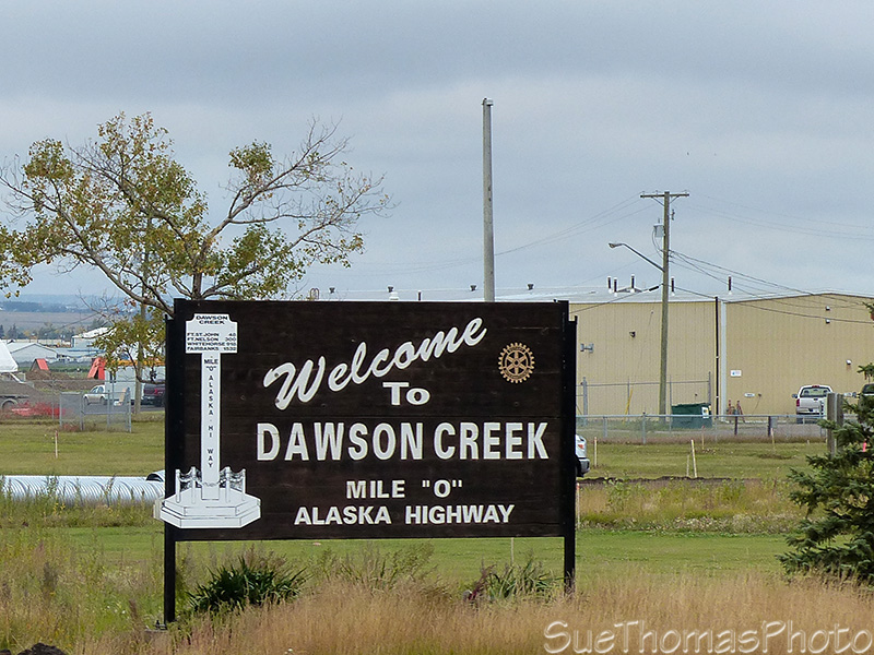
Welcome to Dawson Creek sign -
September 2015

The sign at the start of the Alaska Highway -
September 2015
The Alaska Highway north of Dawson Creek looks similar to other highways.

Northbound on the Alaska Highway just north of Dawson Creek -
September 2015
Twenty-eight kilometres (17 miles) north of Dawson Creek there is an interesting side trip along the old Alaska Highway that leads to the Kiskatinaw Curved Bridge. Also a nice provincial park campground at the Kiskatinaw bridge so you can camp and explore the area.
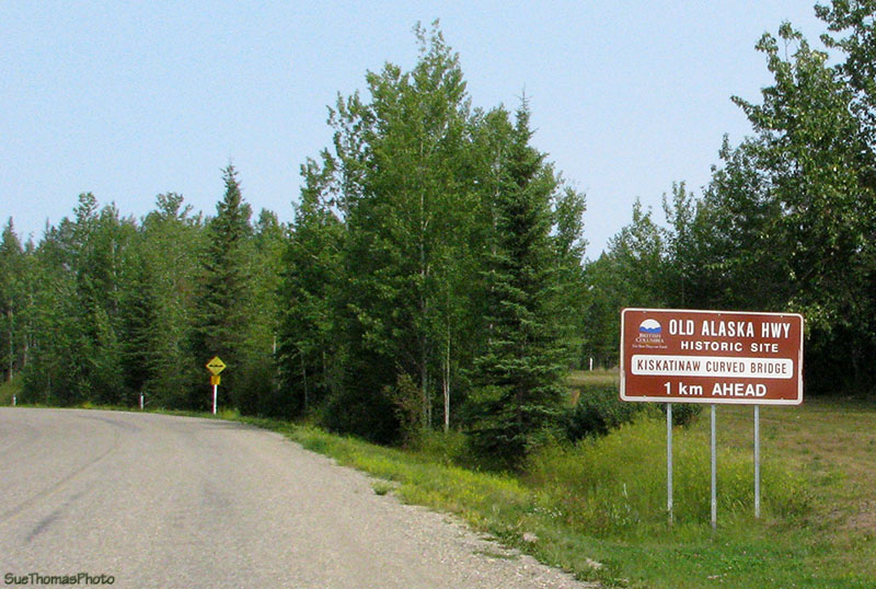
Sign indicating the Kiskatinaw bridge is just ahead -
August 2010
Kiskatinaw Provincial Park includes a provincial campground near the Kiskatinaw bridge. This historical timber bridge is a curved bridge that is interesting to see and hike around.
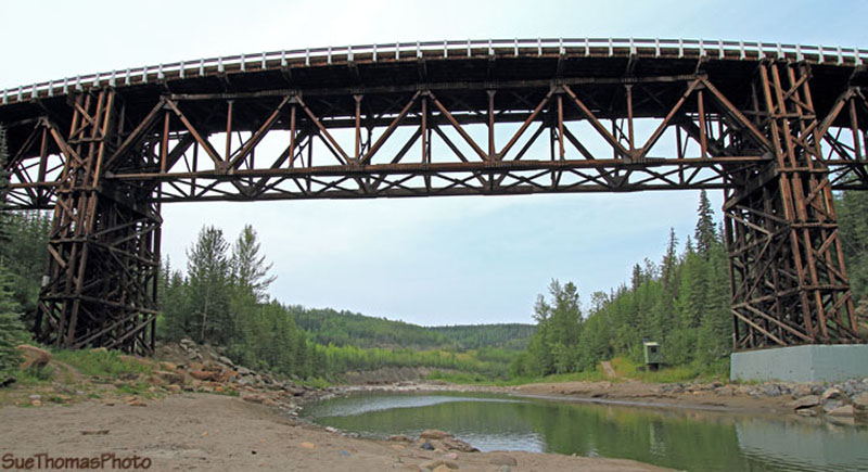
Kiskatinaw Bridge on the old Alaska Highway route viewed
from the south side - August 2010
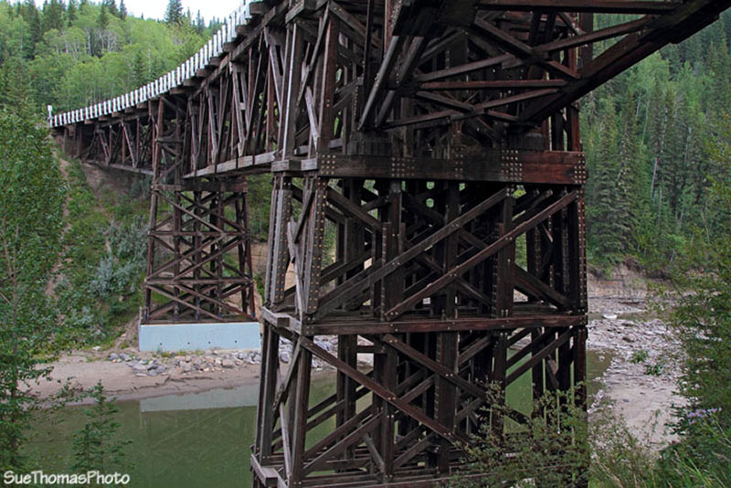
Kiskatinaw Bridge on the old Alaska Highway route -
August
2010
Driving across the bridge in a large RV is also interesting ...
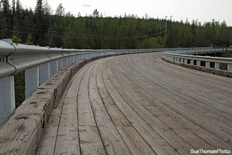
The plank deck on the Kiskatinaw bridge is unique - August 2010
If you continue on the main Alaska Highway you will cross over the new Kiskatinaw River bridge rather than visit the historical Kiskatinaw bridge on the old AK Hwy.

Kiskatinaw River Bridge, Alaska Highway -
September 2015

In 2015 the Alaska Highway was under construction northbound
approaching Taylor - Sept 2015
Approaching Wonowon (1-oh-1), there are numerous open camps along the highway. These provide accommodation to gas field workers. It can be difficult to find campsites as many of the workers have their own accommodation and camp in the campsites so they can be full.
These camps are for the gas field workers
- Sept 2015
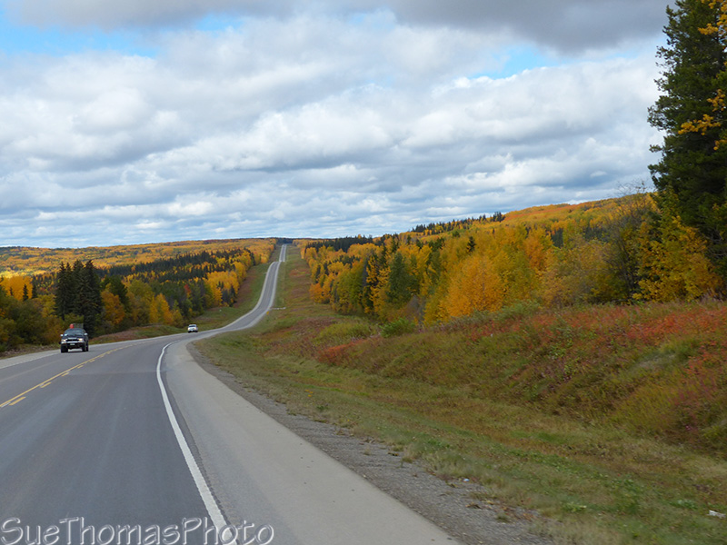
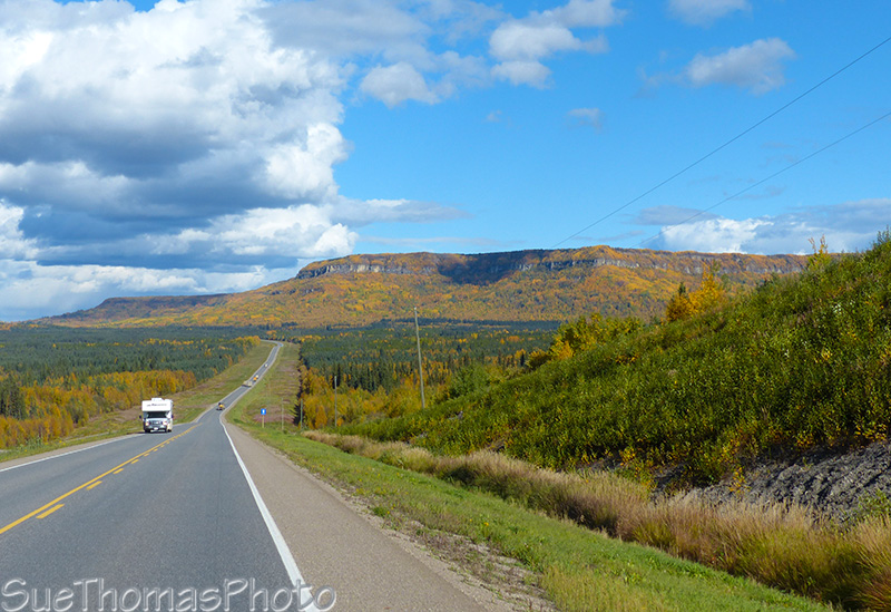
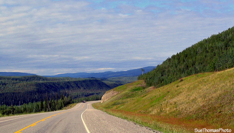
Love the fall colours this time of year! This is near km 175 of the
Alaska Highway - Sept 2015
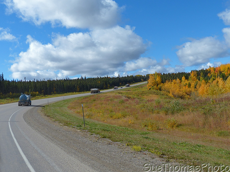
The semi-trucks are working with the gas fields - there are lots of
them on the highway, near km 207
Nearing Pink Mountain, there are more Open Camps.

Another open camp for the workers - km 226
Not too far past Pink Mountain, the Rocky Mountain Foothills become visible in the distance.

The Rocky Mountain Foothills ahead
- Sept 2015
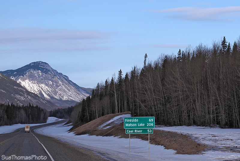
Another distance sign near km 228 on the Alaska Highway -
September 2015

Sikanni Chief River and campground to the left
- Sept 2015

Ranchland near Prophet River, km 360 - Sept 2015
Northbound on the Alaska Highway at km 372 - Sept 2015

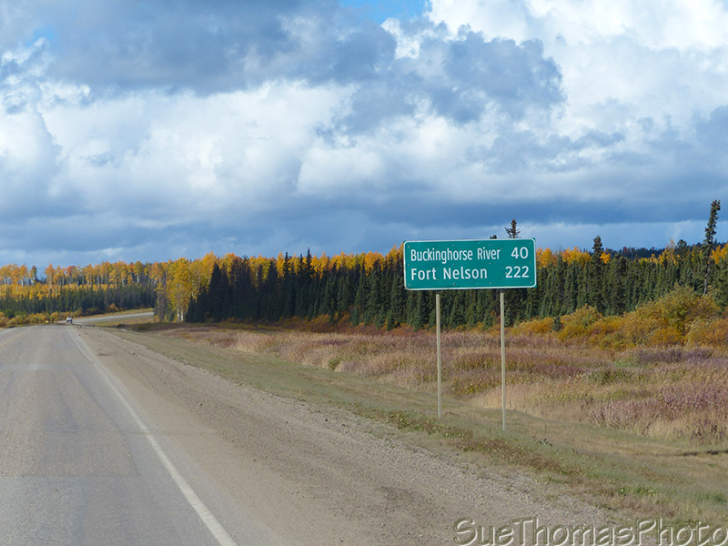
Distance sign, almost at Fort Nelson but another 600 km to Watson
Lake YT - Sept 2015
Fort Nelson to Liard Hotsprings

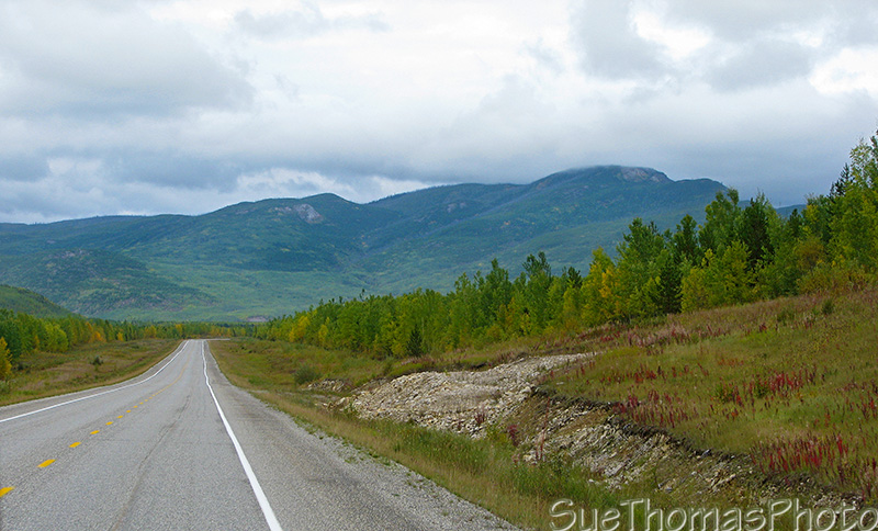
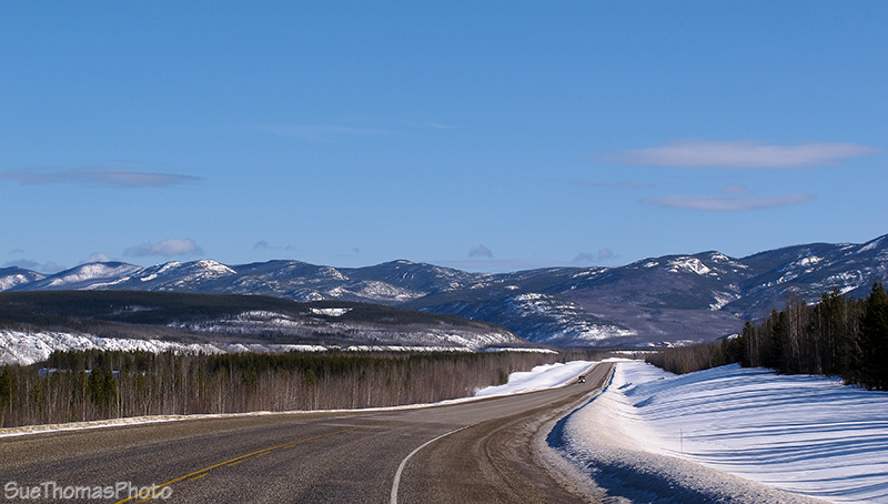
Mountain silhouettes at km 536 - Sept 2015

Fall colours southbound on the Alaska Highway -
Sept 2007

Entrance to Summit Lake Campground within Stone Mountain Provincial Park
- Aug 2010
Summit Lake (historical milepost 392) - Aug 2010
Summit Lake Campground - Sept 2015
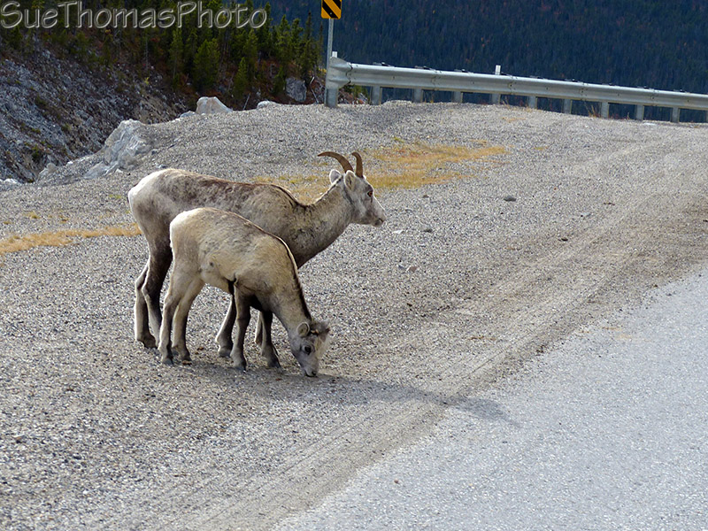
A mom and baby Stone Sheep beside the AK Hwy -
Sept 2015

Macdonald Creek heading south in Stone Mountain Park - km 604 -
Sept 2015
The area between Stone Mountain and Liard Hot Springs has an abundance of wildlife. We have seen caribou, elk, moose, buffalo, wolves. black bears and more.

Wildlife along Alaska Highway - Sept 2007

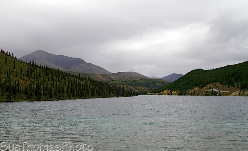
Muncho Lake - Sept 2015

Kayaking on Muncho Lake - Sept 2017

Campsite at MacDonald campground at Muncho Lake -
Sept 2017
 Looking northward from MacDonald campground at Muncho Lake -
August 2010
Looking northward from MacDonald campground at Muncho Lake -
August 2010
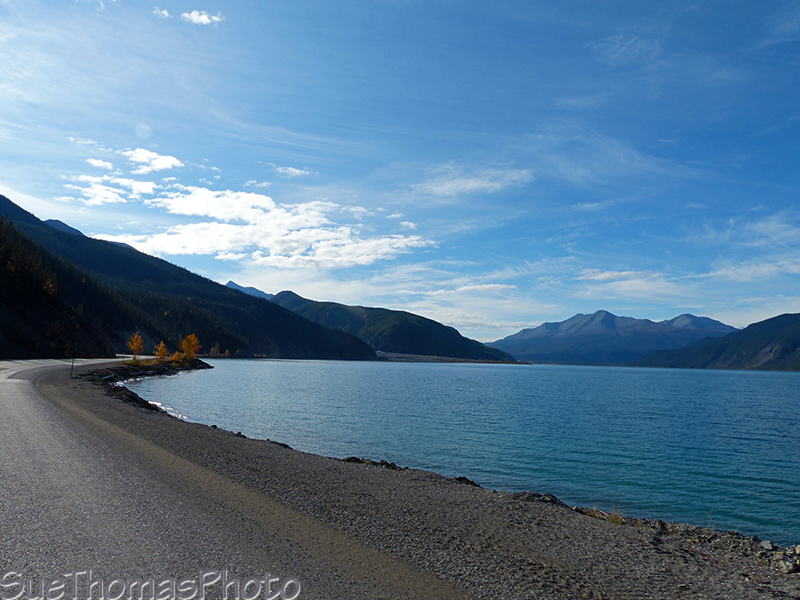
Southbound on the Alaska Highway along Muncho Lake -
Sept 2015
Liard Hot Springs (Historical Milepost 497)
Visit my Liard Hot Springs page to see our
favourite hot spring in BC, Alberta and Yukon.
We have visited in all
seasons and have soaked at minus 40 temperatures in December.

At Liard in December 2001

Alpha pool at Liard Hot Springs -
March 2013
North of Liard Hotsprings
See more of this section at:
- 10 August 2010 - Liard to Watson Lake YT
- 29 March 2013 - Rancheria to Liard BC
- 31 March 2013 - Liard to Whitehorse
- 7 September 2015 - Whitehorse to Liard Hotsprings
Departing Liard Hotsprings northbound towards Yukon -
March 2013
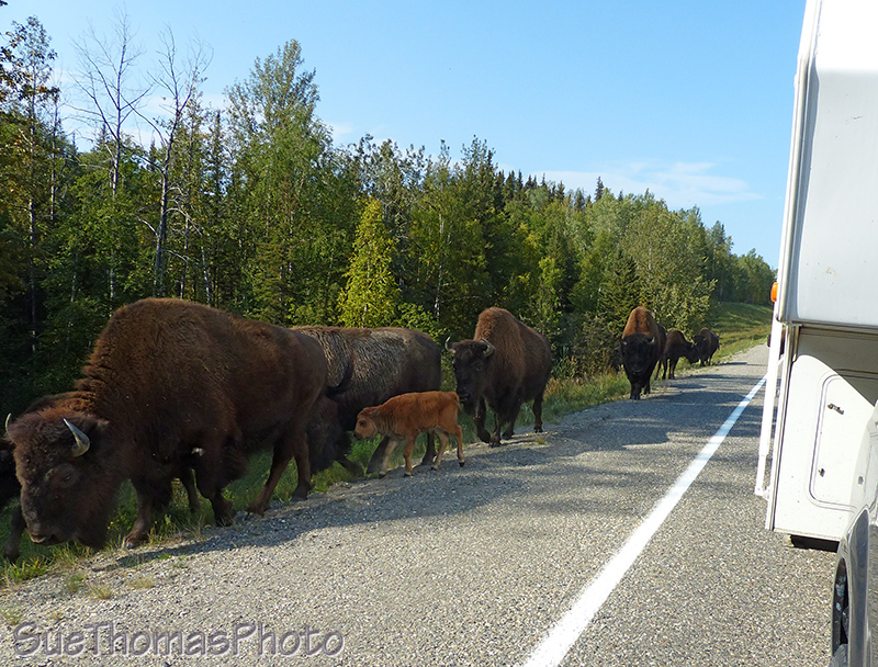
Bison alongside the Alaska Highway -
Sept 2017
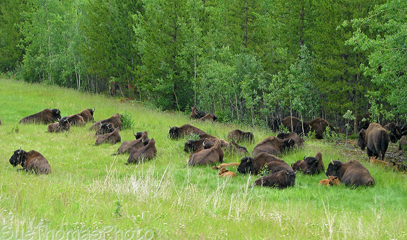
Bison resting alongside the highway, north of Liard Hot Springs -
July 2008

Caribou beside the Alaska Highway -
Sept 2017
Nouthbound on the Alaska Highway -
September 2009
Northbound on the Alaska Highway north of Cranberry Rapids -
August 2010
More bison along the Alaska Highway south of the Yukon border near Watson Lake.

Bison connecting alongside the Alaska Highway -
August 2010

Bison on the Alaska Highway between Watson Lake and Liard
Hotsprings - Sept 2015
Into the Yukon again!

Sign near Watson Lake welcoming you to Yukon -
August 2010