
ALASKA HIGHWAY
Dawson Creek, BC
to Delta, Alaska
YUKON
Map with
Hwy links
Kluane Lake area
Campbell Hwy
Dempster Hwy
Dawson City
Klondike Hwy-North
Klondike Hwy-South
Haines Road
Nahanni Range Rd
Silver Trail
South Canol Road
Top of the World
Hwy
BEARS
Grizzly
/ Black
WILDLIFE
BIRDS
NORTHERN LIGHTS
ALASKA
Taylor Hwy
Denali National Park
McCarthy Road
Richardson Hwy
and more
BRITISH COLUMBIA
Cassiar Highway
Liard Hot
Springs
PLAN YOUR TRIP
Planning Links
Campgrounds/POIs
YUKON sights
2020
2019
2017
2016
2015
2014
2013
2012
2011
RV BLOGS
Vancouver Island
to Yukon & Alaska
2010 Aug & Sept
2009 September
2008 June
2007 September
2001 December
2000 August
1998 December
1997 September
1993 September
Ross River to Quiet Lake on the South Canol Rd, Yukon
Note: also see my South Canol Road page
03 July 2008
Woke to good weather this morning! Even though we knew the road was closed at Quiet lake we decided to turn south on the South Canol Road and drive to Lapie Lake, a spot we enjoyed very much last year.
With the bridge closed, we did not expect to see much traffic on the South Canol. This is a good thing on the north end of the South Canol, which can be narrow and winding. In some places, there is enough room for only one vehicle.
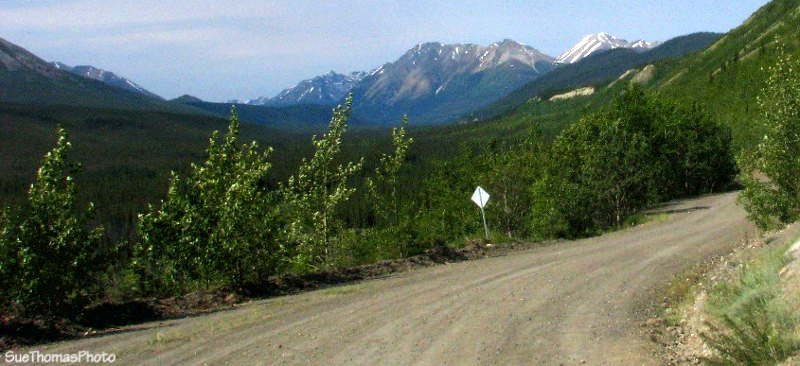
Heading south on the South Canol Road
Even though the South Canol is more remote, it is well-signed.
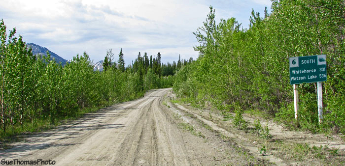
Whitehorse 331 km and Watson Lake 536 km

The South Canol is a good gravel road, one lane in many places

The colours in the mountains were very different from our
September 2007 trip


In some places the road was very narrow
The Lapie Lakes area is very nice. Meadows, marshy lakes and mountains. Very peaceful.

The Lapie Lake area
We stopped at Lapie Lake for lunch. Last year we camped overnight at this spot.
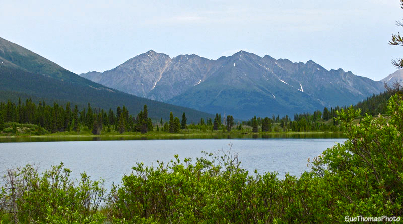
View northward from Lapie Lake

View south from Lapie Lake

Local wildlife at Lapie Lake
After lunch, we continued south from Lapie Lake, more out of curiosity than an expectation we would be able to continue past the Rose River No. 1 bridge, which was supposed to be closed.

Southbound on the South Canol Road, between Quiet Lake and Lapie Lake

Approaching Upper Sheep Creek southbound

Whitehorse 281 km, Watson Lake 476 km

Just south of Rose River No. 2 crossing, southbound
Crews were working on the bridge at Rose River No. 1. A crane and pile driver were set up so we knew there was no chance of crossing to continue south to Quiet Lake. With some careful maneuvering we were able to turn the truck and fifth wheel around and head back to Lapie Lake.
Our campsite at Lapie Lake was beautiful!

Overnight camp spot at Lapie Lake
Steve went fishing on the calm waters. The evening was very pleasant and we enjoyed a good dinner of fresh grayling. We also enjoyed solitude surrounded by incredible colours and silence.
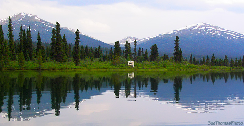
Campsite at Lapie Lake
We looked forward to a very restful sleep, absolutely in the middle of nowhere.