
ALASKA HIGHWAY
Dawson Creek, BC
to Delta, Alaska
YUKON
Map with
Hwy links
Kluane Lake area
Campbell Hwy
Dempster Hwy
Dawson City
Klondike Hwy-North
Klondike Hwy-South
Haines Road
Nahanni Range Rd
Silver Trail
South Canol Road
Top of the World
Hwy
BEARS
Grizzly
/ Black
WILDLIFE
BIRDS
NORTHERN LIGHTS
ALASKA
Taylor Hwy
Denali National Park
McCarthy Road
Richardson Hwy
and more
BRITISH COLUMBIA
Cassiar Highway
Liard Hot
Springs
PLAN YOUR TRIP
Planning Links
Campgrounds/POIs
YUKON sights
2020
2019
2017
2016
2015
2014
2013
2012
2011
RV BLOGS
Vancouver Island
to Yukon & Alaska
2010 Aug & Sept
2009 September
2008 June
2007 September
2001 December
2000 August
1998 December
1997 September
1993 September
South Canol Road and Campbell Highway, Yukon
Note: see my other page for pictures of the entire South Canol Road
04 July 2008
South Canol Road
After a very quiet night and restful sleep at Lapie Lake, we were on the road again, retracing yesterday's drive back to the Campbell Highway and Ross River.
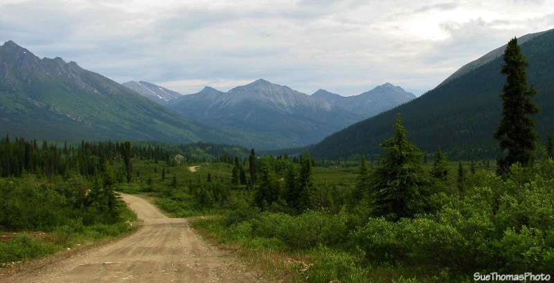
Northbound on the South Canol

Lapie River
South of the Lapie Canyon bridge, the road traverses a hillside above the valley. In places it is very narrow; only one-lane. Note the front edge of the fifth wheel on the right side of the picture below.
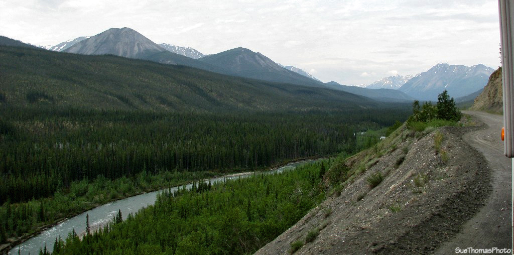
South Canol Road on the hill alongside the Lapie River - note the front of the
fifth wheel on the right
Fortunately, we did not meet an oncoming vehicle through this section.

Southbound on the South Canol, just north of Lapie Canyon bridge
We met a truck & camper at the junction of the South Canol and Campbell Highway. During the exchange of pleasantries, we learned the couple was from Germany and they wished to drive the South Canol. They understood the bridge was out near Quiet Lake and seemed assured to see a truck and fifth wheel exiting the road. They were looking forward to camping at Lapie Lake.
Ross River
We needed fuel so headed into Ross River. The station had diesel but was out of unleaded gasoline. This was the second station that trip that had diesel but no unleaded gas.
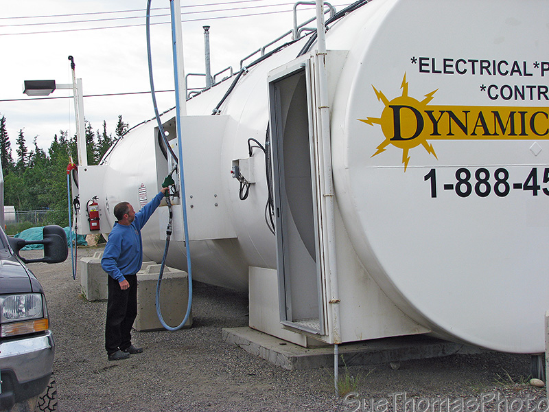
Filling up with diesel at Ross River
The gas station is also the local store, post office and bank.
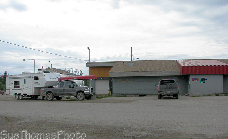
Ross River gas station, store, post office and bank
We scooted out of town and enjoyed lunch along the Campbell Highway.
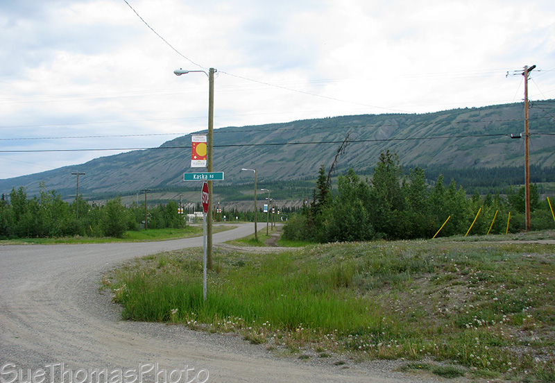
Looking northward along the main street through Ross River
Campbell Highway

Dust from an oncoming vehicle, looking south on the Campbell Highway south of Ross River
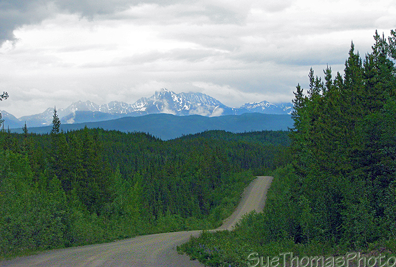
Southbound on the Campbell Highway, south of Ross River
The highway was in much better condition in September 2007. It took four hours to drive from Ross River to Frances Lake Yukon Gov't campground.

Cleaning some mud off the truck at the campground
The bugs were very bad. We had to keep on the move to keep the mosquitoes out of our hair and off our faces. While we sat inside the fifth wheel, the mosquitoes lined themselves up on the screen windows looking for any opportunity to get inside.

Campsite at Frances Lake - mosquito haven