
ALASKA HIGHWAY
Dawson Creek, BC
to Delta, Alaska
YUKON
Map with
Hwy links
Kluane Lake area
Campbell Hwy
Dempster Hwy
Dawson City
Klondike Hwy-North
Klondike Hwy-South
Haines Road
Nahanni Range Rd
Silver Trail
South Canol Road
Top of the World
Hwy
BEARS
Grizzly
/ Black
WILDLIFE
BIRDS
NORTHERN LIGHTS
ALASKA
Taylor Hwy
Denali National Park
McCarthy Road
Richardson Hwy
and more
BRITISH COLUMBIA
Cassiar Highway
Liard Hot
Springs
PLAN YOUR TRIP
Planning Links
Campgrounds/POIs
YUKON sights
2020
2019
2017
2016
2015
2014
2013
2012
2011
RV BLOGS
Vancouver Island
to Yukon & Alaska
2010 Aug & Sept
2009 September
2008 June
2007 September
2001 December
2000 August
1998 December
1997 September
1993 September
km 1048.5 Alaska Hwy thru Teslin to the South Canol Road
12 August 2010 - Thursday morning
The barometer was rising this morning. There were a few rain showers last night though. The sun was shining as we optimistically hit the road at 8:30 a.m.

View northbound at km 1074 on the Alaska Highway, with the Rancheria
River to the left side of image
The sunny skies were refreshing and rejuvenating! Approaching the Continental Divide, the blue skies were endless!

Northbound near km 1115 on the Alaska Highway, nearing the
Continental Divide
At 11 a.m. we crossed the bridge over the Nisutlin Bay Inlet to arrive at Teslin.

The Nisutlin Bay Bridge crosses over the Nisutlin Bay Inlet -
also referred to as the Teslin Bridge
Filled with diesel at the Yukon Motel & RV Park in Teslin.
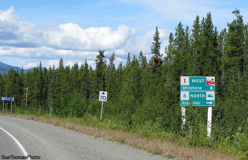
Sign on the Alaska Highway indicating the South Canol Road is just
ahead
The weather was great and Steve thought it would be nice to drive the South Canol Road. We topped up with fuel at Johnson's Crossing because there are no services along the route. Ross River at the end of the road is sometimes out of fuel, so a couple of 5-gallon fuel cans were also filled with diesel. We backtracked the single kilometre to the turn-off northbound on the South Canol.

Looking southward on the Teslin River from the Teslin River bridge
at Johnson's Crossing
After turning on to the South Canol there was an important sign!
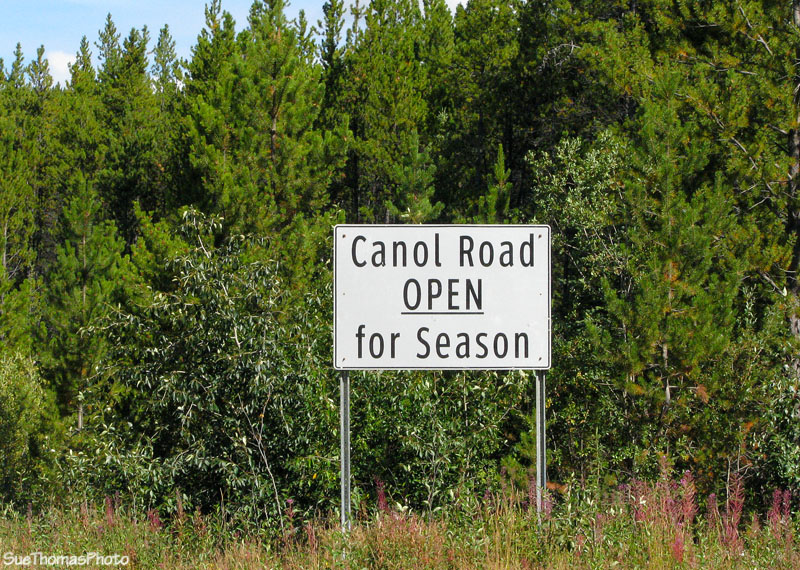
Make sure the snow is off the South Canol before driving north!
There is a rest area with historical information about the South Canol just a few hundred metres from the Alaska Highway. It is a nice spot and easy to pull in to. If you prefer, you can return to the Alaska Highway to continue on towards Whitehorse.

The rest area on the South Canol Road very near the Alaska Highway -
good spot for a break!
Please go to my next page to see more pictures of the artefacts at this rest area and to continue the journey north on the South Canol.