
ALASKA HIGHWAY
Dawson Creek, BC
to Delta, Alaska
YUKON
Map with
Hwy links
Kluane Lake area
Campbell Hwy
Dempster Hwy
Dawson City
Klondike Hwy-North
Klondike Hwy-South
Haines Road
Nahanni Range Rd
Silver Trail
South Canol Road
Top of the World
Hwy
BEARS
Grizzly
/ Black
WILDLIFE
BIRDS
NORTHERN LIGHTS
ALASKA
Taylor Hwy
Denali National Park
McCarthy Road
Richardson Hwy
and more
BRITISH COLUMBIA
Cassiar Highway
Liard Hot
Springs
PLAN YOUR TRIP
Planning Links
Campgrounds/POIs
YUKON sights
2020
2019
2017
2016
2015
2014
2013
2012
2011
RV BLOGS
Vancouver Island
to Yukon & Alaska
2010 Aug & Sept
2009 September
2008 June
2007 September
2001 December
2000 August
1998 December
1997 September
1993 September
Lapie Lake on the South Canol Road to
Little Salmon Lake on the Robert Campbell Highway
17 August 2010 - Tuesday
Usually we pack stuff away the night before a departure. Today we had hoped to get on the lake with the kayaks but the water was very choppy. So we had to load the bike, kayaks and other gear and prepared to depart.
This morning we also caught scent of the forest fire smoke again; likely the wind change blowing it in.

Northbound on the South Canol Road
The road was in good condition for a gravel/dirt road.

View northbound on the South Canol Road in Yukon
The signage along the South Canol is usually visible, although often difficult to see.

26 kms to Ross River on the Campbell Highway
There is a good view of the Lapie River from the road above.
Lapie River, looking south from the South Canol Road
Note the lack of roadside barriers through this area.
In the image below, the signs read, "Keep Right", "Hill" and
"Trucks Gear Down".

View south from the South Canol Road above the Lapie River
The road is narrow along this hillside. There are some spots to pull over so an oncoming vehicle can pass. Fortunately, the road is not well-travelled and we have never met an oncoming vehicle so have never had the debate about who will back up to the nearest pull-off.

The South Canol is narrow above the Lapie Canyon with an occasional
pull-off
At the Lapie River bridge there is a short hiking trail along the Lapie Canyon on the west side of the bridge. It is marked, but the sign is hard to see.

The Lapie River bridge over the Lapie Canyon, just a few miles south
of the Campbell Highway
At the north end of the South Canol, travellers can choose to turn east to Watson Lake or west towards Ross River, Faro and Carmacks. Many will have to take the drive to Ross River to get fuel to continue their journey either direction.

The sign at the north end of the South Canol Road
Folks wishing to continue northbound on the North Canol need to go to Ross River to take the ferry across the Pelly River.
Sign indicating the 10 km drive to Ross River
We had diesel with us so bypassed the turnoff to Ross River. Further along is the turn off to Faro. There is also a community managed full-service campground that is very nice.
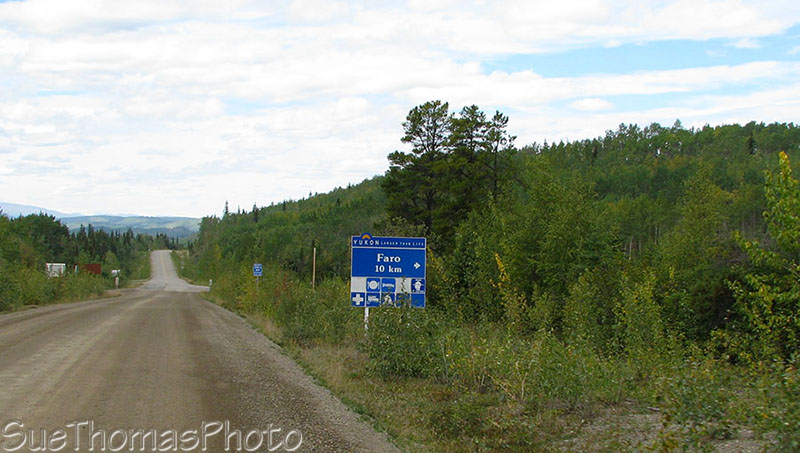
Sign indicating turn off to Faro, Yukon
We headed west on the Campbell Highway, planning to stay at one of the two Yukon gov't campgrounds on Little Salmon Lake. The first one is Drury Creek campground.
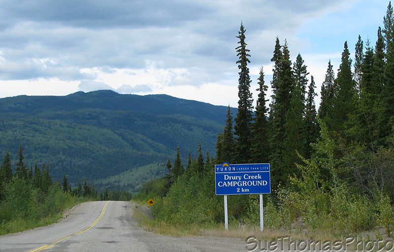
Sign indicating the turn-off to Drury Creek Yukon gov't campground
There are no services at Yukon gov't campgrounds. Usually the campgrounds aren't too busy and the firewood is free. While checking out the Drury Creek campground, Steve decided to give Tazz dancing lessons ...
Put your right foot in and shake it all about!
Drury Creek was nice but we decided to carry on to Little Salmon Lake Yukon gov't campground, where we parked in a nice waterside spot.

Campsite at Little Salmon Lake Yukon gov't campground
Later in the evening some dramatic clouds blew over us. An advantage of the wind was there were no bugs to bother me while I photographed the clouds!
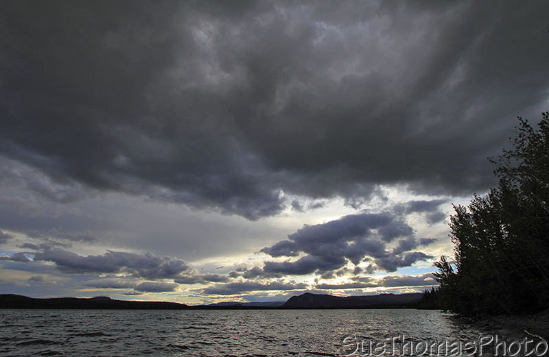
Looking west over Little Salmon Lake
While watching the clouds and water, I saw some water splashing near the end of the lake. With binoculars we saw a cow moose and her calf crossing the creek!
There were some other folks camped at the campground with rental RVs.
Rental RVs camped at Little Salmon Lake in Yukon
The barometer continued to drop. We expected to wake to rain in the morning.