
ALASKA HIGHWAY
Dawson Creek, BC
to Delta, Alaska
YUKON
Map with
Hwy links
Kluane Lake area
Campbell Hwy
Dempster Hwy
Dawson City
Klondike Hwy-North
Klondike Hwy-South
Haines Road
Nahanni Range Rd
Silver Trail
South Canol Road
Top of the World
Hwy
BEARS
Grizzly
/ Black
WILDLIFE
BIRDS
NORTHERN LIGHTS
ALASKA
Taylor Hwy
Denali National Park
McCarthy Road
Richardson Hwy
and more
BRITISH COLUMBIA
Cassiar Highway
Liard Hot
Springs
PLAN YOUR TRIP
Planning Links
Campgrounds/POIs
YUKON sights
2020
2019
2017
2016
2015
2014
2013
2012
2011
RV BLOGS
Vancouver Island
to Yukon & Alaska
2010 Aug & Sept
2009 September
2008 June
2007 September
2001 December
2000 August
1998 December
1997 September
1993 September
Silver City and Kluane Lake area in Yukon
23 June 2008 - continued
See my other pictures of Silver City, including pictures from winter and fall.
Silver City - access road at km 1636 (historical mile 1053)
Silver City was a trading post & roadhouse that included North West Mounted Police barracks in the early 1900s. When I was a kid we often stopped to look at the ruins on our way home from Whitehorse. This historical community captures my imagination each time I am there now.

Cabin at Silver City

Backside of the largest log structure at Silver City

And the front side of the building pictured above

Log building with dirt roof
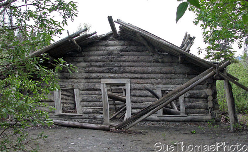
Another log building at Silver City

Interior of one of the log structures
Jake, our big dog, looked into one of the windows to check out a scent.

Jake, the dog, and Steve check inside one of the cabins
The scent was a rabbit, who patiently posed for a few pictures!

Inside one of the buildings there was a large rabbit
Near Silver City there is a road that heads north along the east side of
Kluane Lake.
This was our first time exploring this route. We encountered several creek crossings.
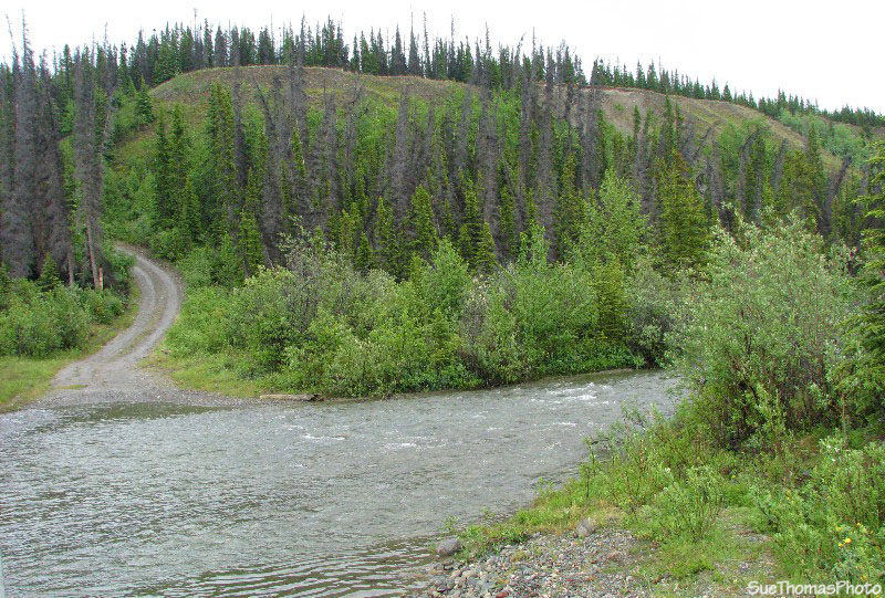
Creek crossing on the east side of Kluane Lake

Looking west across Kluane Lake as we continued to head north
After about 30 km (19 miles) there was a wide creek that was too risky to cross. It had been a wet spring and this creek was running high. Steve wondered if I wanted to wade barefoot to test the waters; however I politely declined and so we turned around.

Creek crossing that resulted in our turning back
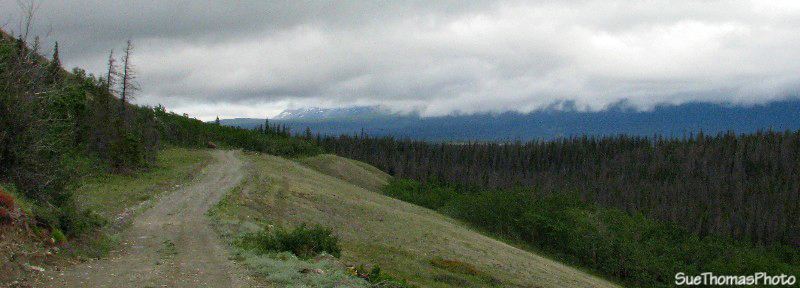
Heading south on the east side of Kluane Lake

Westward view across two lakes (the far lake is Kluane Lake)
We collected a great deal of mud on today's adventure.

Muddy truck and big red dog, Jake
A quiet night at Congdon Creek. No insects made for a pleasant evening by the campfire.