
ALASKA HIGHWAY
Dawson Creek, BC
to Delta, Alaska
YUKON
Map with
Hwy links
Kluane Lake area
Campbell Hwy
Dempster Hwy
Dawson City
Klondike Hwy-North
Klondike Hwy-South
Haines Road
Nahanni Range Rd
Silver Trail
South Canol Road
Top of the World
Hwy
BEARS
Grizzly
/ Black
WILDLIFE
BIRDS
NORTHERN LIGHTS
ALASKA
Taylor Hwy
Denali National Park
McCarthy Road
Richardson Hwy
and more
BRITISH COLUMBIA
Cassiar Highway
Liard Hot
Springs
PLAN YOUR TRIP
Planning Links
Campgrounds/POIs
YUKON sights
2020
2019
2017
2016
2015
2014
2013
2012
2011
RV BLOGS
Vancouver Island
to Yukon & Alaska
2010 Aug & Sept
2009 September
2008 June
2007 September
2001 December
2000 August
1998 December
1997 September
1993 September
Alaska Highway - Beaver Creek YT to Delta AK
Page contents:
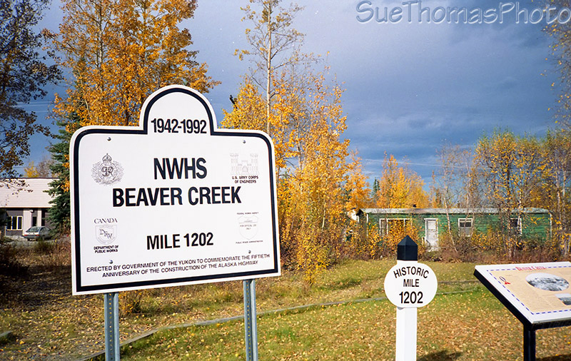
Beaver Creek - historical mile 1202
My hometown is the most westerly community in Canada. It is also where construction crews made the final connection of the Alaska Highway on October 28, 1942.
Beaver Creek - September 1993
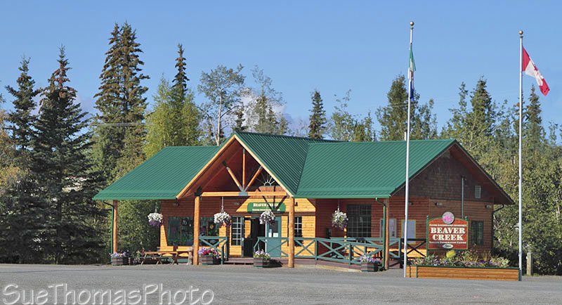
Tourist Information Centre in Beaver Creek - August 2010

The history of Beaver Creek - sign in Beaver Creek - September 2017

Aerial view of Beaver Creek - September 1986
The two-room, eight-grade school I attended is the pink building with the blue roof on the right. Canada Customs was located in front of the three white houses lined up on the left, it has moved further north now.

"Main Street" Beaver Creek - view southbound on the Alaska Highway -
December 1998
The Canada Customs port of entry is located a mile north of town, near the Beaver Creek airport.

Northbound through the Canada customs facility north of Beaver Creek
- March 2014
This airfield was cut out of the bush by my Dad in the early 1960s so he could enjoy his love for flying. The airport has since been expanded and is now operated by the Yukon government.

View of Canada Customs and Stalberg Airfield from Red Hill, just north of Beaver
Creek - June 2008
The community dedicated the airport to my dad, Jack Stalberg, and erected a monument in his honour. In 2016, Jack Stalberg was awarded Yukon's Polaris Award at the Yukon Transportation Museum, acknowledging his work constructing the airport in the 1960s.

Monument at the airport near Beaver Creek, dedicated to my
father Jack Stalberg - June 2008

Text on the monument, dedicating the airport to my Dad,
Jack Stalberg - June 2008

View west of the Alaska Highway between Beaver Creek and the border
- August 2010
View west of Alaska Highway between Beaver Creek and the Alaska Border - June
2008
Yukon/Alaska Border - historical milepost 1221
The signs at the Yukon/Alaska border have changed over the years, from rustic to more grand. I liked the sign shown below and think it unfortunate that it is gone now.

Sign at the Yukon/Alaska border - September 1986

Sign at the Yukon/Alaska border - September 1986
In 2010 the signs had changed.
Signs as travellers cross into Yukon at the
border - August 2010

Doesn't look too much different in March 2014

And vintage photo at the border looking into Yukon - mid 1950s with
our family car
Going the other way, into Alaska, the signs have changed over the
years too.
This rustic sign is no longer there.
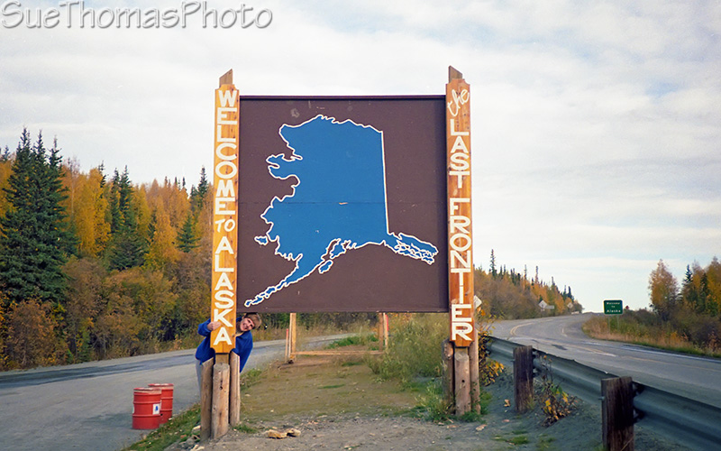
Sign at the Yukon/Alaska border - September 1993

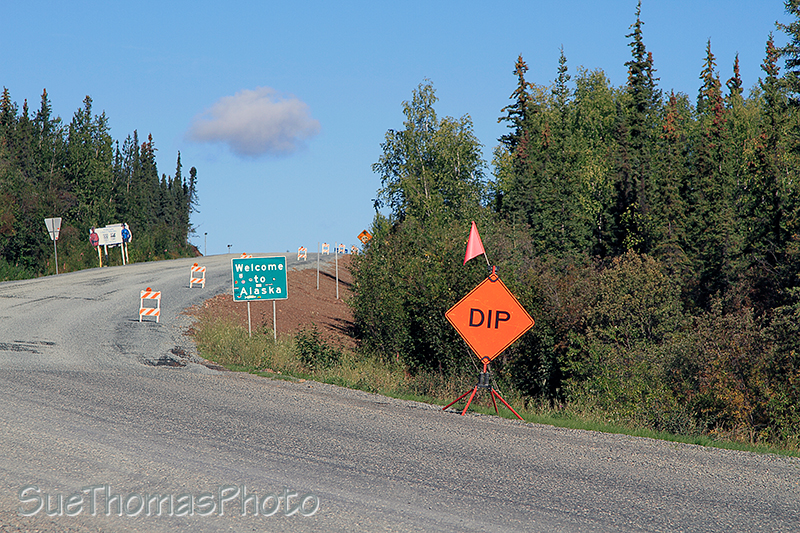
On the Alaska Highway ready to enter Alaska - August 2010

Welcome to Alaska - March 2014
In 2010, these temporary signs also greeted visitors to Alaska -
August 2010

Southbound at Port Alcan - customs building -
September 2012
In 2010 we camped at the recreation site/campground at Deadman Lake. The location is beautiful. The campsites are rustic and not well-suited to RVs longer than 40'.
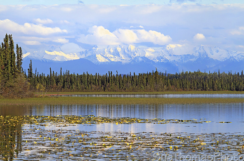
View from Deadman Lake campground towards the Wrangell Mountains -
August 2010
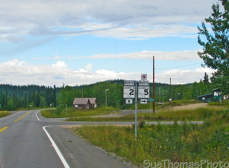
Junction of the Taylor Highway which leads to Dawson City in the
Yukon - August 2010

Tetlin Junction - March 2014

Tanana River approaching Tok - March 2014
Tok is Mile 1313 on the Alaska Highway. Possibly not the place for superstitious people to live!

Driving into Tok northbound - March 2014
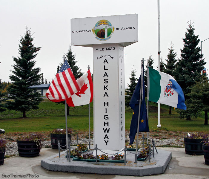
The END of the Alaska Highway at Delta Junction, ALASKA - September 2010
Delta Junction, Alaska - Historical Mile 1422 - is officially the end of the Alaska Highway. The asphalt continues towards Fairbanks as the Richardson Highway. Fairbanks had its own sign in 1986 - this sign might not be there now.

Sign at Fairbanks, Alaska - September 1986