
ALASKA HIGHWAY
Dawson Creek, BC
to Delta, Alaska
YUKON
Map with
Hwy links
Kluane Lake area
Campbell Hwy
Dempster Hwy
Dawson City
Klondike Hwy-North
Klondike Hwy-South
Haines Road
Nahanni Range Rd
Silver Trail
South Canol Road
Top of the World
Hwy
BEARS
Grizzly
/ Black
WILDLIFE
BIRDS
NORTHERN LIGHTS
ALASKA
Taylor Hwy
Denali National Park
McCarthy Road
Richardson Hwy
and more
BRITISH COLUMBIA
Cassiar Highway
Liard Hot
Springs
PLAN YOUR TRIP
Planning Links
Campgrounds/POIs
YUKON sights
2020
2019
2017
2016
2015
2014
2013
2012
2011
RV BLOGS
Vancouver Island
to Yukon & Alaska
2010 Aug & Sept
2009 September
2008 June
2007 September
2001 December
2000 August
1998 December
1997 September
1993 September
Alaska Highway - Kluane Lake to Beaver Creek, Yukon
I have other pages with more images of this section of the Alaska Highway:
- June 2008
- August 2010
- July 2011
- September 2012
- August 2013
- March 2014
- September 2014
- August 2016
- September 2017
Kluane Lake northward
Approaching Destruction Bay community northbound

Kluane Lake viewed southbound on the Alaska Highway, north of Burwash Landing -
September 2013

Kluane River seen from the rest area on the Alaska Highway -
September 2013
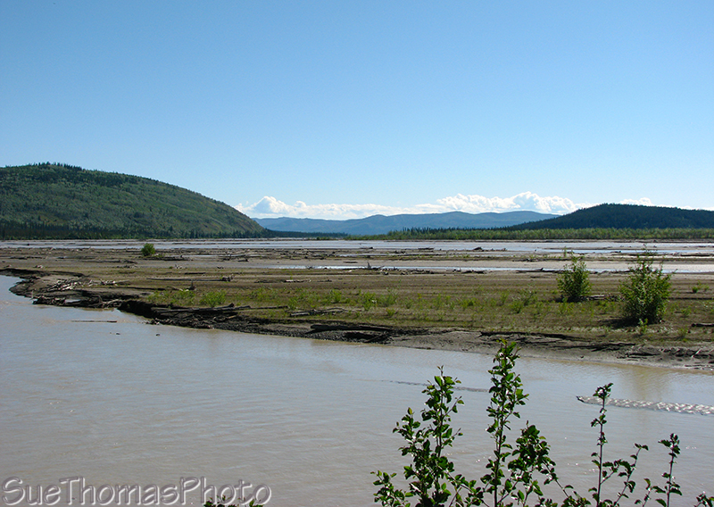
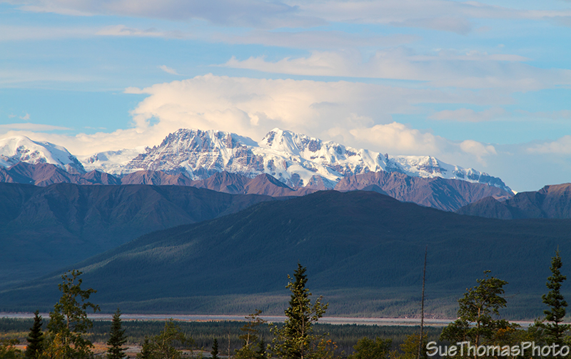 Saint Claire Peak towering over the Donjek River below -
September 2013
Saint Claire Peak towering over the Donjek River below -
September 2013
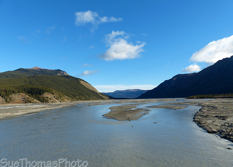
Looking east up the Donjek River from the Alaska Highway -
September 2014

Looking west up the Donjek River -
March 2014
The summer of 2008, the new Donjek River Bridge was open and the old bridge remained in place to the west. In 2010 the old bridge and its approaches were gone.

Southbound at the Donjek River bridges - June 2008
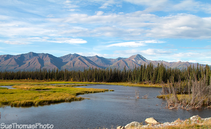
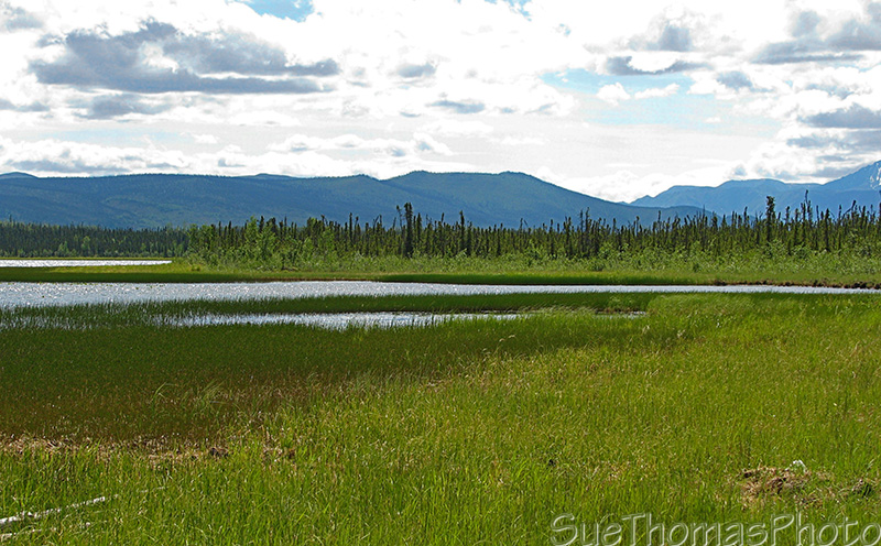
Wetlands north of the Donjek River Bridge, looking westward from the
highway - September 2013
Approaching Pickhandle Lake rest area northbound -
September 2017
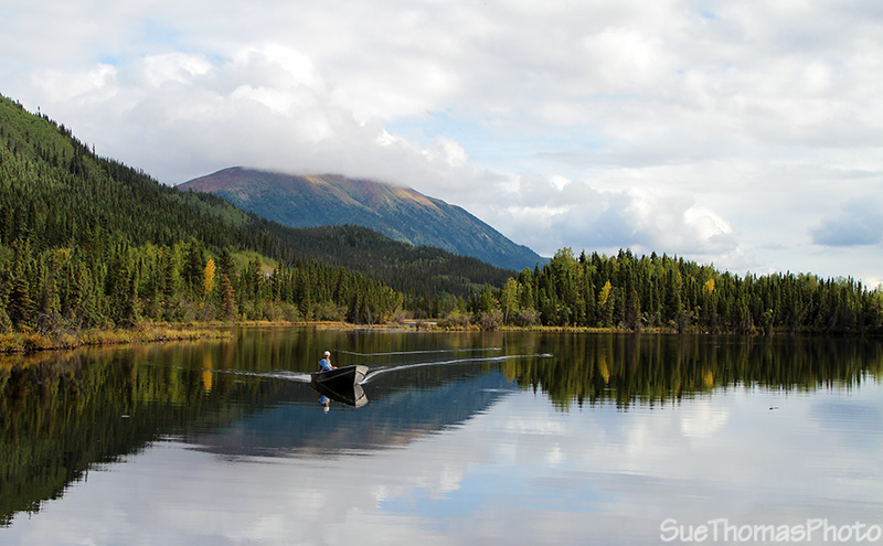
Fishing on Pickhandle Lake -
September 2013
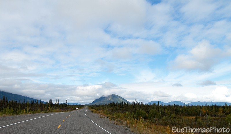
Looking northward along the Alaska Highway near the Koidern River
- September 2013
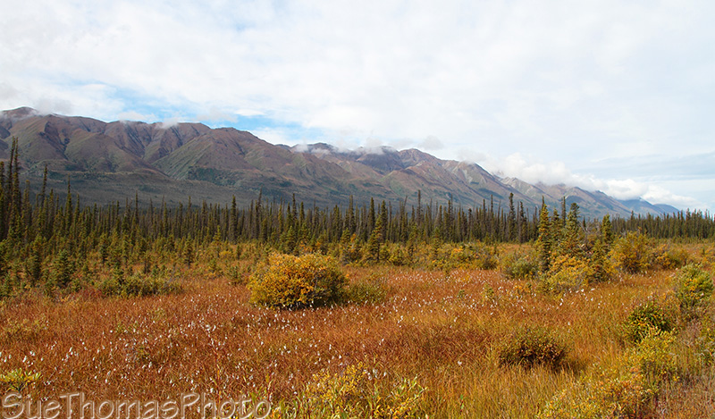
Fall colours along the Alaska Highway - September 2013
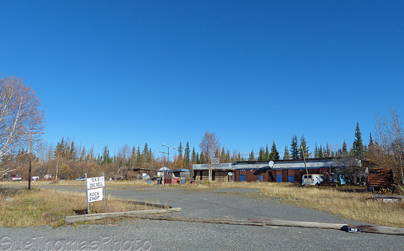
One of the historical lodges along the Alaska Highway, Koidern Lodge -
September 2014

North of Koidern River, heading northbound -
September 2014

Two young bulls trotting into the bush - June 2008

Looking east along the White River -
September 2014

Same view of the White River as shown above - March 2014

More rough Alaska Highway - August 2010

Same section of road as the above image, but in
March 2014

This section of highway is usually rough and was being studied -
September 2014
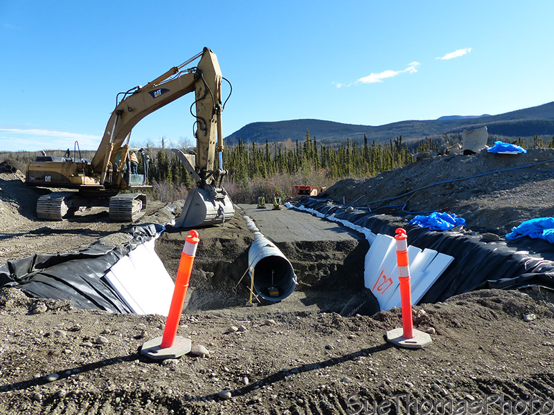
Work for one culvert in melting permafrost! - September
2014

Small lake at the Snag Junction campground -
September 2013
Snag Lake seen from the Alaska Highway - June 2008

Kayaking on Snag Lake (Enger Lake) -
September 2016

Looking west from the Alaska Highway towards the Wrangell Mountains
- August 2010
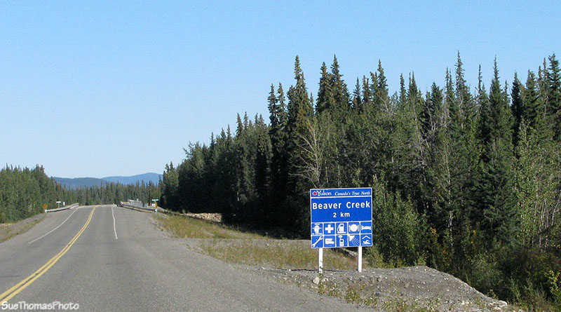
Approaching the Beaver Creek bridge -
August 2010

My hometown is the most westerly community in Canada
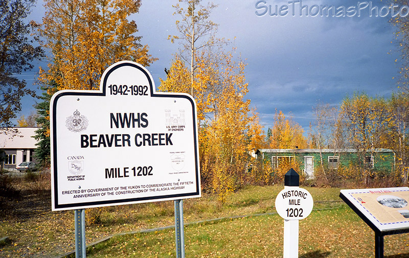
50th anniversary of the Alaska Highway construction
 Beaver Creek - March 2014
See the next page for pictures of Beaver Creek and on to Delta Junction AK
Snag - access road at km 1911
Snag, Yukon was settled during the Klondike Gold Rush. Later it was the site of a military airfield, established as part of the Northwest Staging Route that closed in 1968.
In 1947, Snag had 15-20 airport personnel — meteorologists, radio operators, aircraft maintenance men. My Dad, Jack Stalberg joined them in 1952. There is not much to see in Snag now because the site has been remediated/reclaimed. The road is narrow and twisty and required a 4x4 in 2008 due to high water levels.
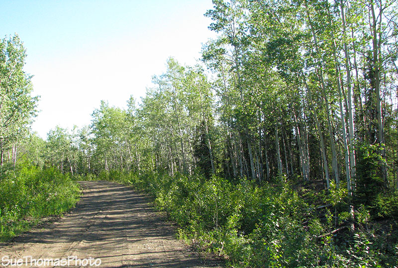
Road into Snag - June 2008

View from the road into Snag, looking west towards the Kluane Range - June
2008
Snag Creek joining the White River at the end of the road, past Snag - June 2008

Truck amongst fireweed at the abandoned community of Snag - September 1993
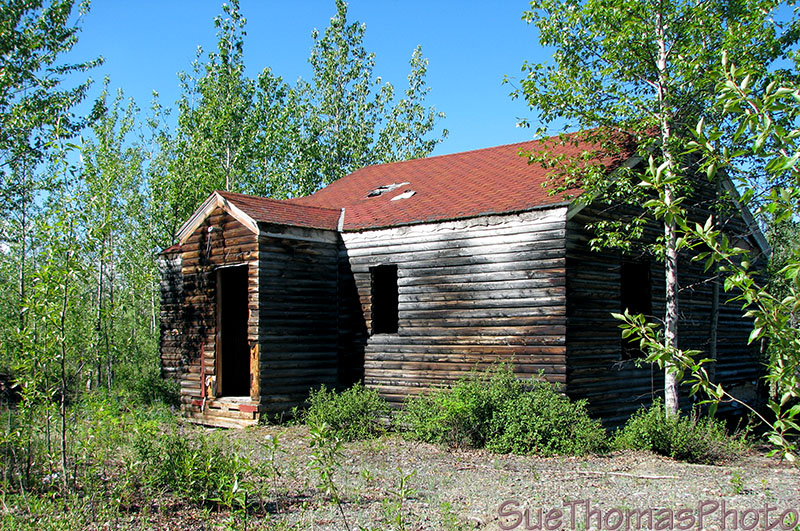
The only remaining building at Snag - June 2008
