
ALASKA HIGHWAY
Dawson Creek, BC
to Delta, Alaska
YUKON
Map with
Hwy links
Kluane Lake area
Campbell Hwy
Dempster Hwy
Dawson City
Klondike Hwy-North
Klondike Hwy-South
Haines Road
Nahanni Range Rd
Silver Trail
South Canol Road
Top of the World
Hwy
BEARS
Grizzly
/ Black
WILDLIFE
BIRDS
NORTHERN LIGHTS
ALASKA
Taylor Hwy
Denali National Park
McCarthy Road
Richardson Hwy
and more
BRITISH COLUMBIA
Cassiar Highway
Liard Hot
Springs
PLAN YOUR TRIP
Planning Links
Campgrounds/POIs
YUKON sights
2020
2019
2017
2016
2015
2014
2013
2012
2011
RV BLOGS
Vancouver Island
to Yukon & Alaska
2010 Aug & Sept
2009 September
2008 June
2007 September
2001 December
2000 August
1998 December
1997 September
1993 September
Alaska Highway - Whitehorse to Haines Junction, Yukon
|
Page contents:
More photos of this portion of the Alaska Highway are on these pages:
|
 |
A few miles south of Whitehorse is the Wolf Creek Yukon government campground.
It is a pleasant place to camp and there is good hiking in the area.

View from hiking trail near Wolf Creek Yukon government campground - September 1995

View of Yukon River from hiking trail near Wolf Creek Yukon gov't campground - September 1995
Whitehorse - km 1425 (historical mile 918)
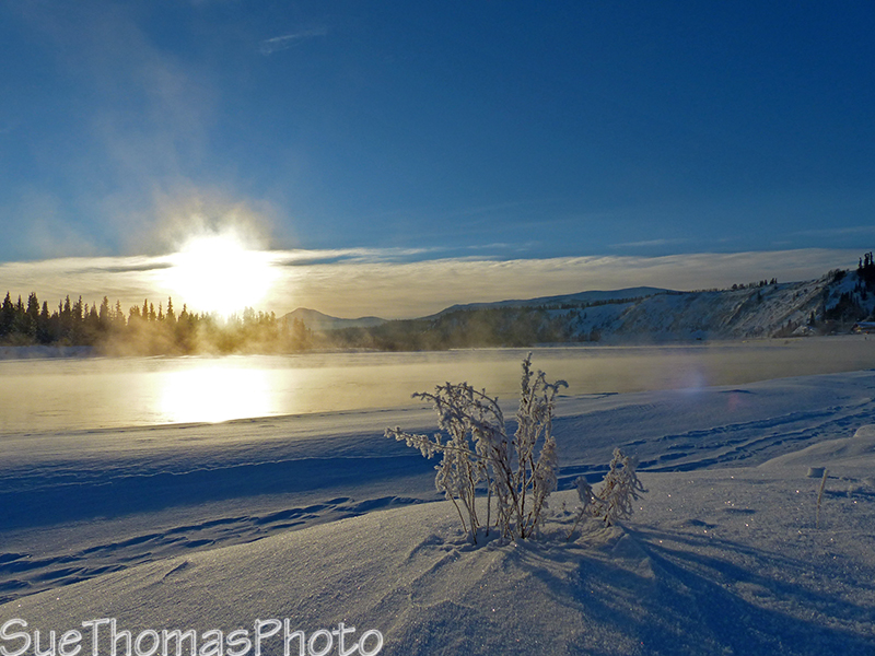
Walking along the
Yukon River near downtown Whitehorse -
January 2014

Historic
S.S. Klondike paddle wheeler in Whitehorse - September 1995

S.S. Klondike paddle wheeler in Whitehorse - January 2014

Driving towards downtown on the Robert Service Blvd
beside the Yukon River - August 2010

Downtown Whitehorse, looking northward - August 2017
The Millennium Trail is a paved hiking/biking trail south of downtown Whitehorse along the Yukon River. There's a popular spot for playboating in the river.

Playboating in the Yukon River in Whitehorse - September 2010
The Yukon Wildlife Preserve it just a bit northwest of town and
worth visiting.
See
images of the wildlife on my page from
12 July 2012
Alaska Highway between Whitehorse and Haines Junction
Heading north on the Alaska Highway from Whitehorse, you can go west towards Haines Junction or turn north on the Klondike Highway and go to Dawson City.

As you leave Whitehorse northbound, the Klondike Hwy is the first junction
- Sept 2015
This junction was reconstructed in 2020 and the highway has better
turning lanes now.
Just a few miles outside the Whitehorse city limits, heading towards
Haines Junction - Sept 2015
Alaska Highway northbound through the Ibex Valley west/north of Whitehorse
- August 2009

View from the Alaska Highway of the
Takhini Salt Flats area in the Ibex Valley-
August 2009

Hike into the Takhini Salt Flats beside the Alaska Highway, near km
1466 - June 2013
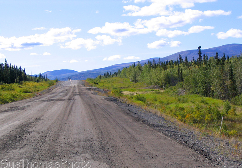
Photo showing
Alaska Highway being upgraded about 50 km west of Whitehorse -
August 2009
The Takhini Elk Herd is often by the
highway
in this area. Stay alert during all seasons.
See more of my elk photos on my other
page dedicated to elk.

Photo of the
Takhini Elk herd crossing the Alaska Highway -
January 2014
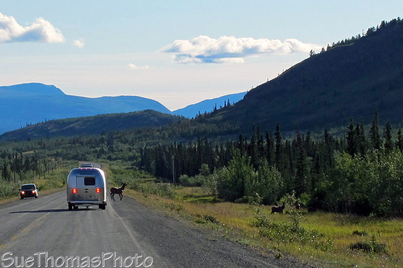
RVer stopping to avoid elk crossing the Alaska Highway in the Ibex
Valley - August 2011

Bull Elk on the Alaska Highway - October 2013
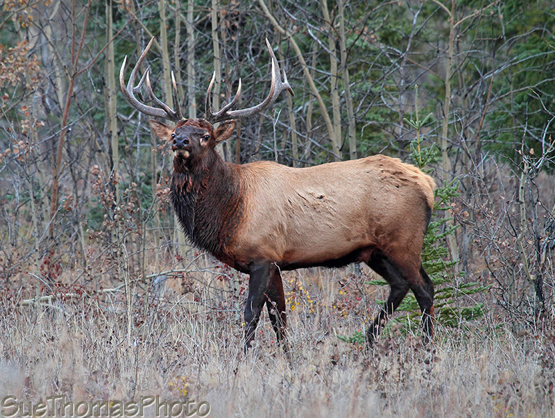
Bull elk during the bugling season - October 2013

km 1470, looking east towards Whitehorse - March 2013
Kusawa Lake Yukon Government Campground - turn off Alaska Hwy at km 1489
The Milepost guide had indicated the 24 km (15 mile) access road to Kusawa Lake is narrow
and winding and "not recommended for large RVs or trailers". We had no
problems towing our fifth wheel to the campground and joined many other
travel trailers and fifth wheels of similar size.
The road to Kusawa Lake has been improved and is easier to drive now.
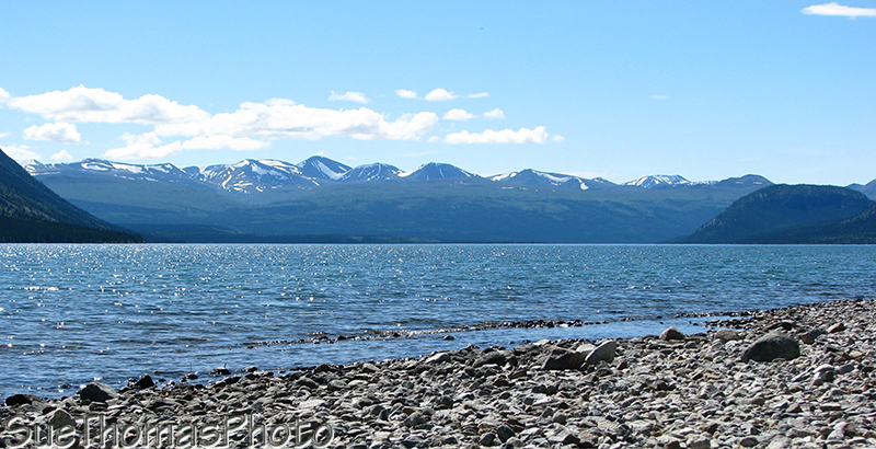
View of
Kusawa Lake from the beach by our campsite -
June 2008
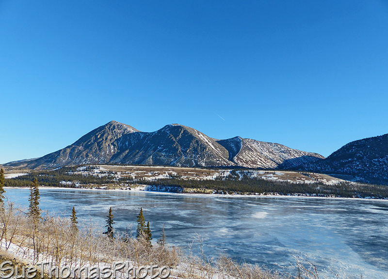
An ice covered
Kusawa Lake flowing into the Takhini River - January 2016
Back on the Alaska Highway heading towards Haines Junction.
These elk were on the Alaska Highway near Mendenhall in November
2019
Northwest of Mendenhall Subdivision there is a turn-off to the historical village of Champagne.

Information signs at the village of Champagne near the Alaska
Highway.- June 2013

Northbound on the Alaska Highway, approaching km 1530 - April 2016
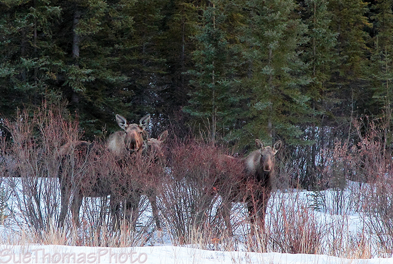
Cow moose with two calves beside the Alaska Highway- March 2013

Sign marking Otter Falls Cutoff Lodge 2 km ahead -
May 2014
Aishihik Road and Otter Falls - km 1546
At km 1546 you can turn north on the
Aishihik Road and drive a gravel road 28 km to Otter
Falls. For images of Aishihik Road, a 120 km rough gravel road to the
abandoned Aishihik airfield, visit
19 October 2013 page or
my page from 7 October 2012.
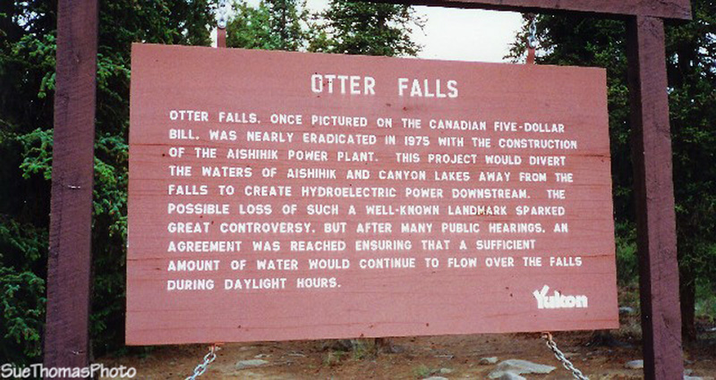
Sign at Otter Falls on the Aishihik Road
(historical mile 996) - June 1996

Otter Falls - June 1996

Otter Falls - October 2012
See more of the Aishihik Road and Otter Falls area on my page
19 October 2013
Back to the Alaska Highway northbound towards Haines Junction.

Canyon Creek Bridge, this is a replica of the original bridge - June 2013

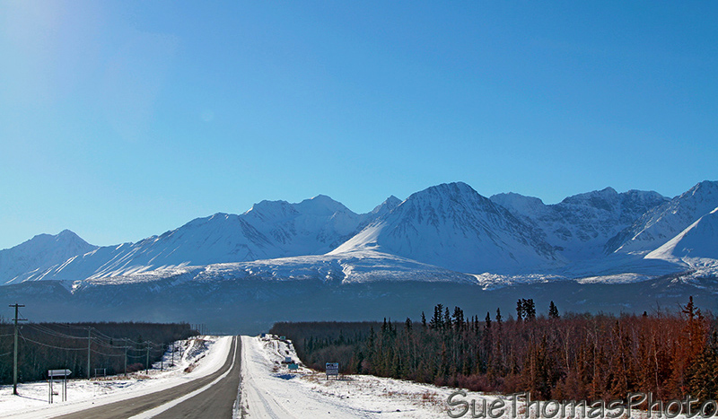
Northbound on the Alaska Highway, not too far from Haines Junction -
May 2013

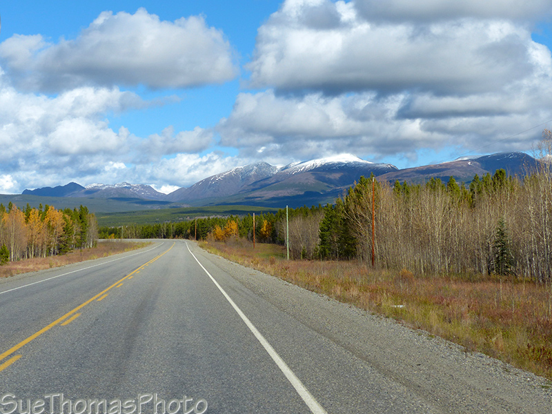
Photo of sunrise on the Kluane Ranges, near Haines Junction -
March 2014

Same view from the same rest area in the fall -
September 2013

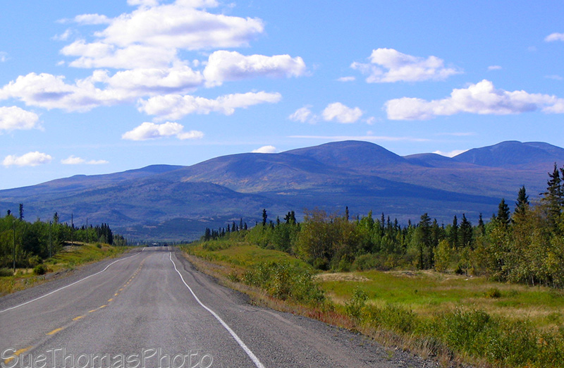
Approaching Haines Junction - June 2013
Almost the same view as above, approaching Haines Junction in winter
- February 2014
If you turn around to look behind you, Paint
Mountain fills the view.
Paint Mountain is actually north of Haines Junction - the AK Hwy
heads north from the Junction and then turns easterly heading
towards Whitehorse.

Photo of
Paint Mountain, north of Haines Junction while southbound on the AK
Hwy - March 2014
Do not miss this the right turn in Haines Junction to continue north on the Alaska Highway!

Turn right to continue north on the Alaska Highway -
June 2013