
ALASKA HIGHWAY
Dawson Creek, BC
to Delta, Alaska
YUKON
Map with
Hwy links
Kluane Lake area
Campbell Hwy
Dempster Hwy
Dawson City
Klondike Hwy-North
Klondike Hwy-South
Haines Road
Nahanni Range Rd
Silver Trail
South Canol Road
Top of the World
Hwy
BEARS
Grizzly
/ Black
WILDLIFE
BIRDS
NORTHERN LIGHTS
ALASKA
Taylor Hwy
Denali National Park
McCarthy Road
Richardson Hwy
and more
BRITISH COLUMBIA
Cassiar Highway
Liard Hot
Springs
PLAN YOUR TRIP
Planning Links
Campgrounds/POIs
YUKON sights
2020
2019
2017
2016
2015
2014
2013
2012
2011
RV BLOGS
Vancouver Island
to Yukon & Alaska
2010 Aug & Sept
2009 September
2008 June
2007 September
2001 December
2000 August
1998 December
1997 September
1993 September
Alaska Highway, Haines Junction to Kluane Lake, Yukon
- Along the Alaska Highway
- Hiking on Sheep Mountain
- Soldier's Summit at Sheep Mountain
- Congdon Creek Yukon Government Campground
Also see the pages dedicated to Kluane Lake and Silver City.
Other pages with this section of the Alaska Highway:
- March 2011
- March 2012
- June 2012
- November 2013
- February 2014
- March 2014
- August 2014
- November 2014
- February 2015
- April 2015
- May 2015
Along the Alaska Highway
The Haines Junction area features mountains. In Haines Junction be sure to turn right to continue north on the Alaska Highway. Otherwise, you'll be heading south to Haines on the Haines Road.
The landscape continues to be wonderful north of Haines Junction.
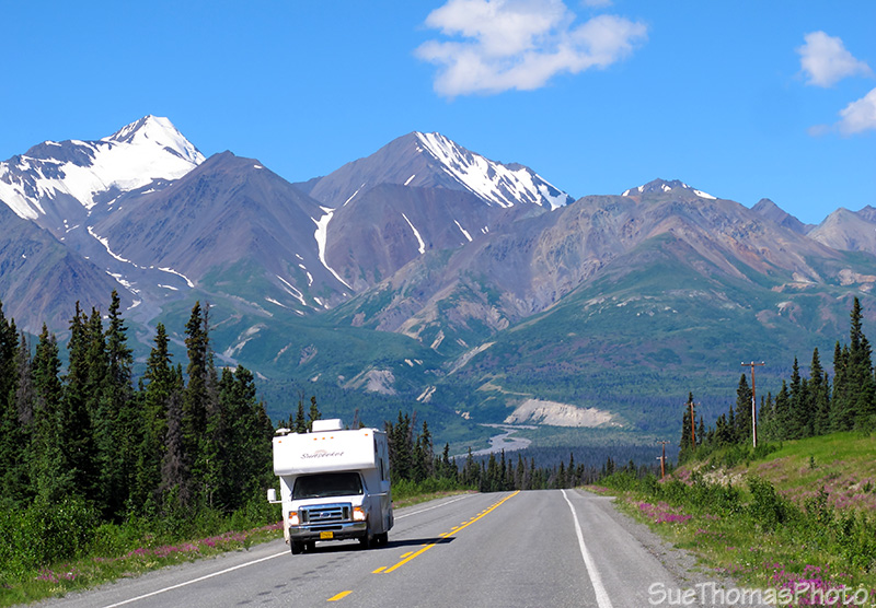
Heading north on the Alaska Highway from Haines Junction -
June 2013
The hills above are spectacular in winter too.

View northward at km 1584, just north of Haines Junction -
March
2011

View travelling south towards Haines Junction -
June 2012
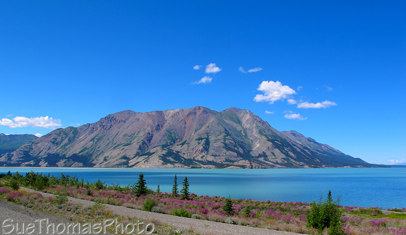
Kluane Lake is one of our favourite areas. On sunny days it is
spectacular.
On cloudy days the mountain ranges can be hidden and the distant views
are limited.
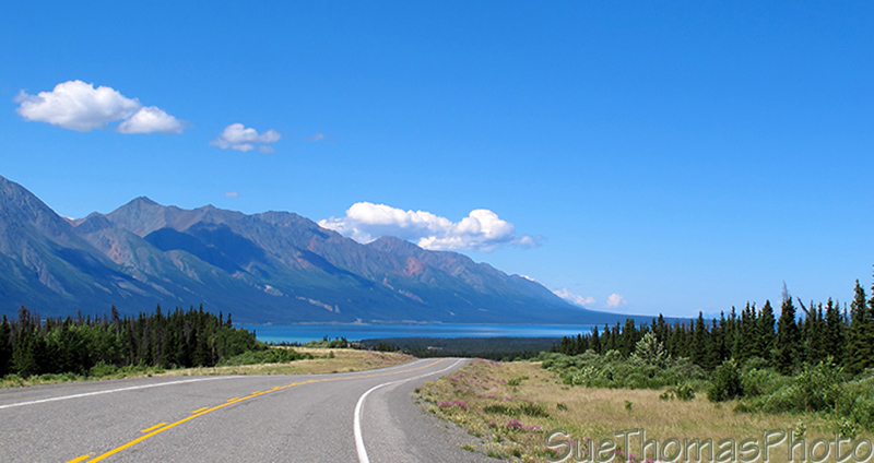
View of Kluane Lake northbound on the Alaska Highway -
June 2013

Kluane Lake, same view as above with ice on the lake -
March 2014

Looking west towards the Kluane Ranges, south
of Kluane Lake - June 2012
Kluane Lake Viewpoint, km 1645 looking north towards
Kluane Lake - September 2013
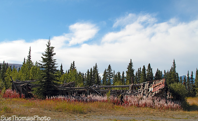
At km 1636 (historical mile 1053) there is a road to an
unmaintained historical site, Silver City.
This early 1900s trading post & roadhouse included
a North West Mounted Police barracks.
When I was a kid we often
stopped to look at the ruins on our way home from Whitehorse.

Front view of Jack Hayden's homestead -
June 2008
Front view of Hayden homestead -
September 2013
See this page for more of my pictures of Silver City.

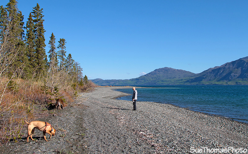
Taking the dogs for a walk along the shore of Kluane Lake - July
2011
Back on the Alaska Highway, continuing northward.
Leaving Silver City headed north to Kluane Lake -
August 2013

Kluane Lake - November 2014
Kluane Lake and Sheep Mountain - June 2013

Dust storms are becoming common alongside Sheep Mountain -
May 2015
Dust storms are becoming common because the lake level is lowering due to a change in the Slims River. The melt from a glacier now flows out to the coast rather than to Kluane Lake.

Another view of Sheep Mountain in fall colours -
September 2014
On the south side of Kluane Lake, there are
many areas to stop and enjoy the sights.
I love Sheep Mountain; as a child
I spent many hours looking for
sheep on the hillsides.

Approaching Sheep Mountain northbound -
August 2014
Sheep Mountain view before crossing Slim's River bridge - May 2019
The Slim's River bridge was rebuilt in 2009/2010.
No overhead structure on the Slim's River bridge now -
June 2013

Slim's River in Kluane National Park -
July 2013

Parked at the visitor centre at Sheep Mountain, looking west along
the Slim's River - Sept 2009

Dall Sheep (white dots) on Sheep Mountain - September 2013
More white dots (Dall Sheep) on Sheep Mountain - August 2019

Dall Sheep with fall colours on Sheep Mountain -
September 2014
Dall Sheep munching on Sheep Mountain - November 30, 2019

Alaska Highway and Slims River Flats seen from near Soldier's Summit -
June 2012
Slim's River flats view from Soldier's Summit - August 2019
View from Soldier's Summit - July 2013

View from Soldier's Summit showing lowered water level in Kluane
Lake- June 2017
See more images of Soldier's Summit below.

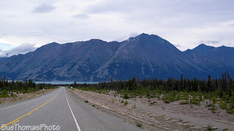
Alaska Highway alongside Kluane Lake -
June 2012
Sheep Mountain, there's a reason it is called that!
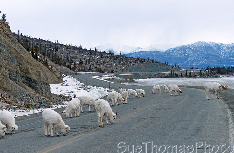
Keep your eyes open for Dall Sheep just around the next bend
See more images of these sheep at
22 March 2014, my drive to Anchorage AK.
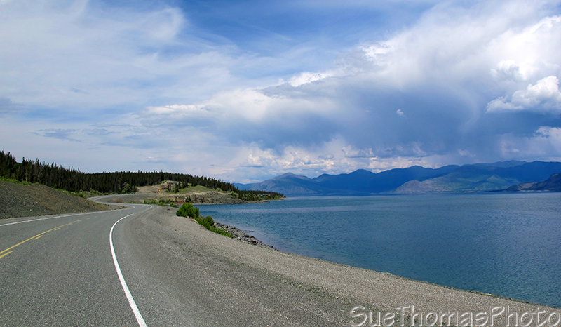
Driving northward along the shores of Kluane Lake -
June 2012

Walking between Kluane Lake and the Alaska Highway -
September 2014

Fishing Kluane Lake in May 2015
Hiking Sheep Mountain at Kluane Lake
I had wanted to hike Sheep Mountain as a kid. Every time my family drove by I imagined being on it. FINALLY, in 1993 I hiked Sheep Mountain! In 2011 we again hiked along Sheep Creek.

Looking west from Sheep Mountain -September 1993

On west side of Sheep Mountain looking west - September 2011

Looking back towards Kluane Lake - September 2011
The zoom lens was required and I was a bit out-of-breath so it was a challenge to hold the camera steady! The image is also cropped a great deal.

Dall sheep seen from Sheep Creek hike on Sheep Mountain -
September
2011

Stunning views with fall colours - September 2011

Looking up the west side of Sheep Mountain -
September 1993

Hiking back down Sheep Creek trail in Kluane National Park -
September 2011
Soldier's Summit - km 1651 (historical milepost 1061)
Soldier's Summit is where the official opening ceremony for the Alcan Military Highway was held in November 1942. In 1992 a trail to the ceremony site was improved for the 50th anniversary ceremony. It is a short uphill hike, starting at a good parking area along Kluane Lake. In 2017 the trail was improved again for the 75th anniversary.

Trail up to Soldier's Summit - July 2013

Plaque at Soldier's Summit - August 2014

Soldier's Summit - September 2009

View from the old highway alignment near Soldier's Summit -
June 2012

A historical survey marker near the shores of Kluane lake - May 2015
Congdon Creek Yukon Government campground - km 1666

2 km to Congdon Creek northbound -
September 2014
Congdon Creek tops the list of our favourite stops. Some of the campsites are by the lakeshore.

Congdon Creek campground -
June 2008
I have many memories of a rough lake with whitecaps moving quickly along the surface. It amazed me that on two separate trips the lake was absolutely calm and mirror flat. Beautiful!

Kayaking on Kluane Lake - August 2014

Rowing on Kluane Lake - July 2015

Looking south over Kluane Lake from Congdon Creek Yukon government campground -
July
2011
Looking northward on Kluane Lake from the Congdon Creek
campground - June 2013

No tenting at Congdon Creek in 2013 due to a grizzly in the
area - June 2013
There is now a specific tenting area with an electrical fence to
keep the bears out.

In August 2010 we met this brown bear just north of the Congdon Creek campground.
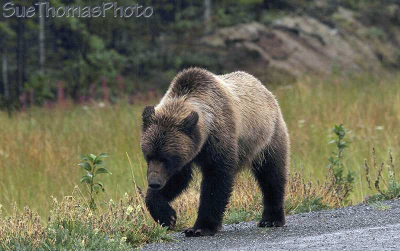
Brown bear on the Alaska Highway near Destruction Bay on Kluane Lake
- August 2010

Approaching Destruction Bay northbound -
September 2014